
Related
The occupation authorities ravage lands and uproot trees in Al-Khader town/ Bethlehem governorate
Violation: Ravaging 5 dunums of lands, and uprooting olive and vine stocks.
Location: Khallet Dahr Al-Ein – Al-Khader town – Bethlehem governorate.
Date: October – 11-2018.
Perpetrator: The Israeli occupation army.
Victims: Farmer Ibrahim Musa family.
Description:
October 11, the occupation bulldozers carried out ravaging 5 dunums of agricultural lands and uprooted olives and vine stocks, the targeted land is close to bypass 60and between “Neve Daniyyel” and “Elazar” settlements.
Noteworthy, the occupation targets lands in the area aiming to connect “Neve Daniyyel” and “Elazar” settlements, then connect them to “Efrat” to implant “The greater Jerusalem” scheme.
Farmers of the land are continuously present cultivating their lands to protect them from colonial expansion, but that did not stop the Israeli illegal colonists from taking over wide areas of land.
Iyad from Al-Khader municibality said: “The Israeli assaults are increasing recently as the occupation is yearning for taking over Al-Khader lands, we try to stay in the area summer and winter to protect it from colonists”..
|
|
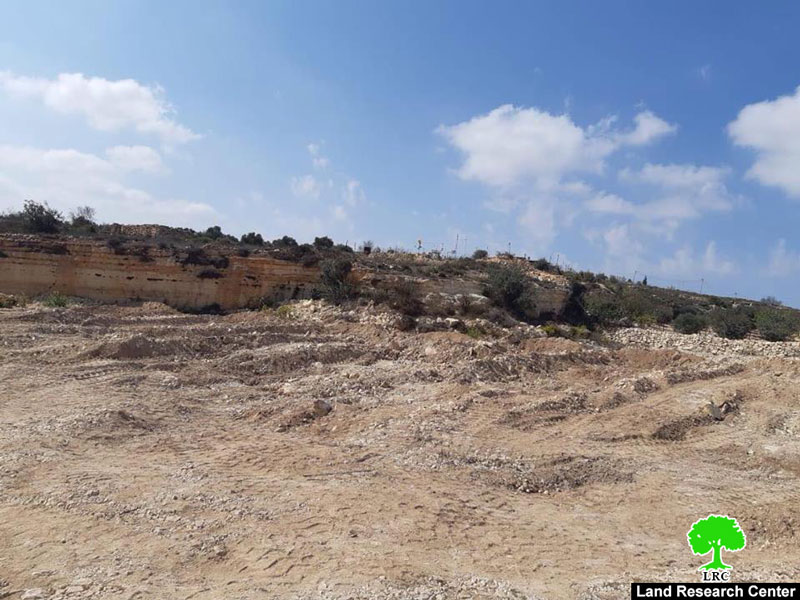

Land ravaging
Noteworthy, In the United Nations declaration on farmers and other workers in rural areas rights, in session of September 2018 confirmedthat Human rights are universal and inalienable; indivisible; interdependent and interrelated, all peoples may, for their own ends, freely dispose of their natural wealth and resources.
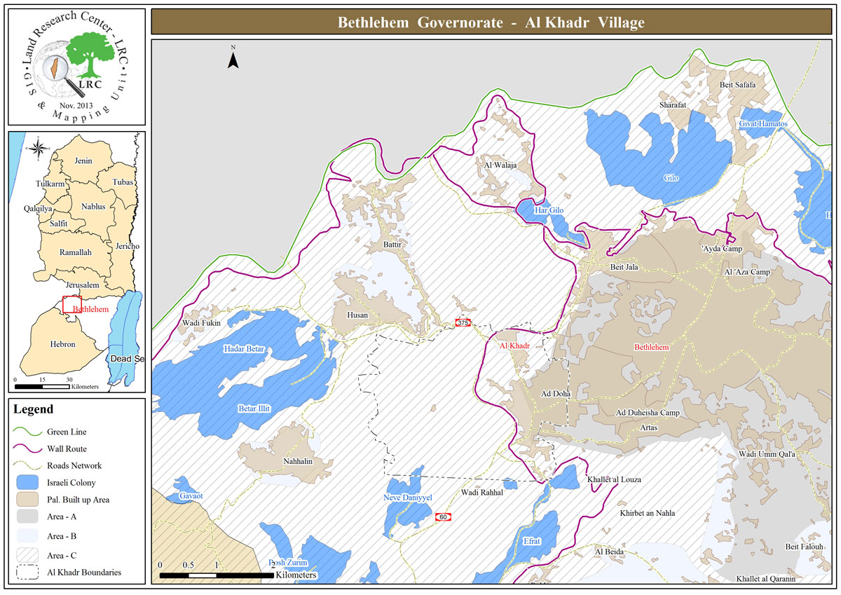
About Al-Khader village[1]:
Al-Khader village is located 4 km from the western side of Bethlehem, it is bordered by Beit Jala and Batir from the north, Hussan and Nahaleen villages from the west, Aldoha, Wadi Rahhal, Beit Jala villages from the east, and Wadi Al-Nees from the south. Its population is 11960 people in 2017. Its gross area is 8,279 donums; 184 of them are the construction area.
The Israeli colonies have despoils 29 donums from the village's lands; two are colonies existed upon a part of the lands. The first one " Efrat" was constructed in 1979 A.D; they have usurped 5.8 donums, and its population 7037 colonists. The second one " Nafy Danial" eas constructed on 1982A.D; they have usurped 23 donums, and its population is 1073 colonists. A part of which is established upon the village's lands.
The bypass roads number 60 and 375 also despoiled more than 487 donums. In addition to establishing the apartheid upon its lands which causes the demolishing of 280 donums and isolating of 5638 donums behind it. The length of this apartheid existing upon the village's land is 2,805 meters.
The village's lands are classified in accordance with Oslo concord into areas( A,B ,C). Area A composes 10% , Area B 6%, Area C is the greatest area and it is under the total occupation domination, and it composes 84% from the total area. The areas are clarified in donums as following:
Area A (808) donums
AreaB (475) donums
Area C(6,996) donums .
[1] GIS-LRC
