
Related
Serving 4 Halt of Construction military orders in Shoshala Al Khader / Bethlahem
 Violation: serving Halt of construction orders.
Location: Shoshala – Al-Khader/ Bethlehem governorate.
Date: November 04, 2018
Perpetrators: The Israel occupation Civil Administration and Army.
Victims: 4 families from Shoshala
Description:
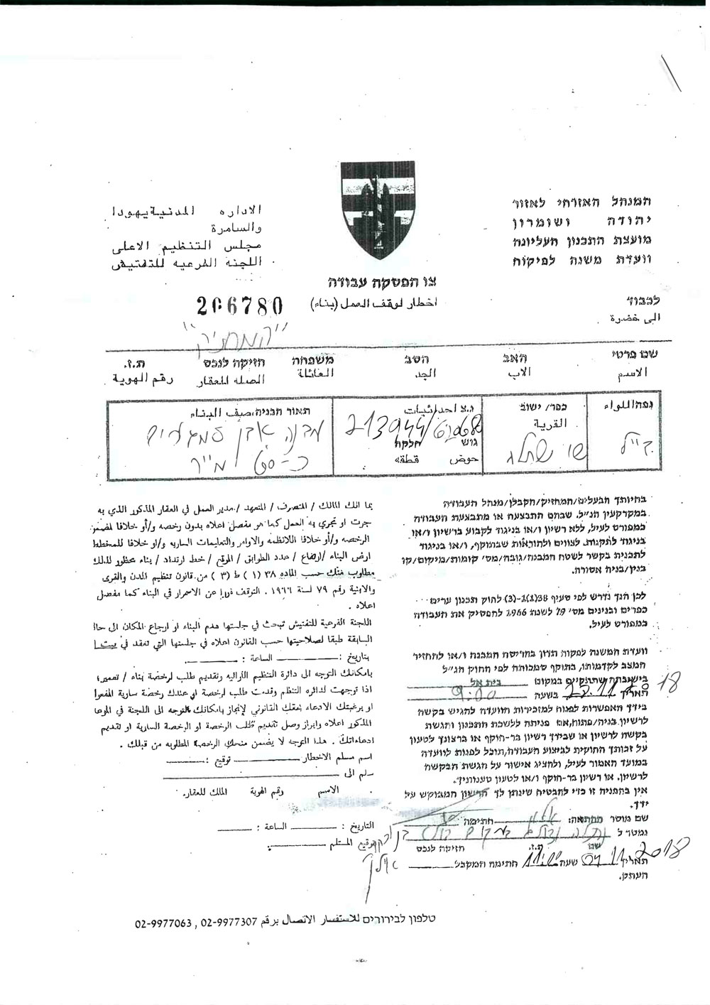
Israeli Occupation Authorities served on November 04, 2018 Halt of Construction orders targeting residences in Shoshala – Al Khader,on the claim of “unlicensed construction”.
November 28, 2018 was set as the hearing session of the Inspection Sub-Committee in the Israeli Court of Beit El to consider whether to demolish the notified structures or restore their previous status.
Iyad from Al-Khader municipality told LRC observer:
“Affected citizens are preparing legal files to apply to the Israeli court, hoping to protect their homes”
The following table provides information about the victims:
Name | Number of family members | Minors | Area m2 | Status of the building | Order’s number |
Habbas Salah | 5 | 2 | 20 | inhabited | 206783 |
Sarhan Salah | 6 | 1 | 50 | inhabited | 206782 |
Ali Salah | 6 | 1 | 50 | inhabited | 206781 |
Musa Salah | 5 | 1 | 60 | inhabited | 206780 |
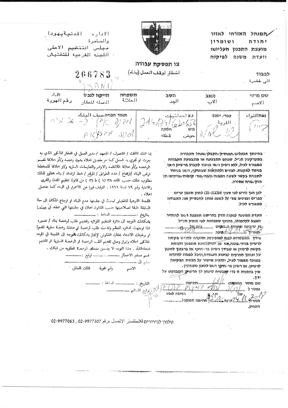
The Order targeting Habbas Salah's Home
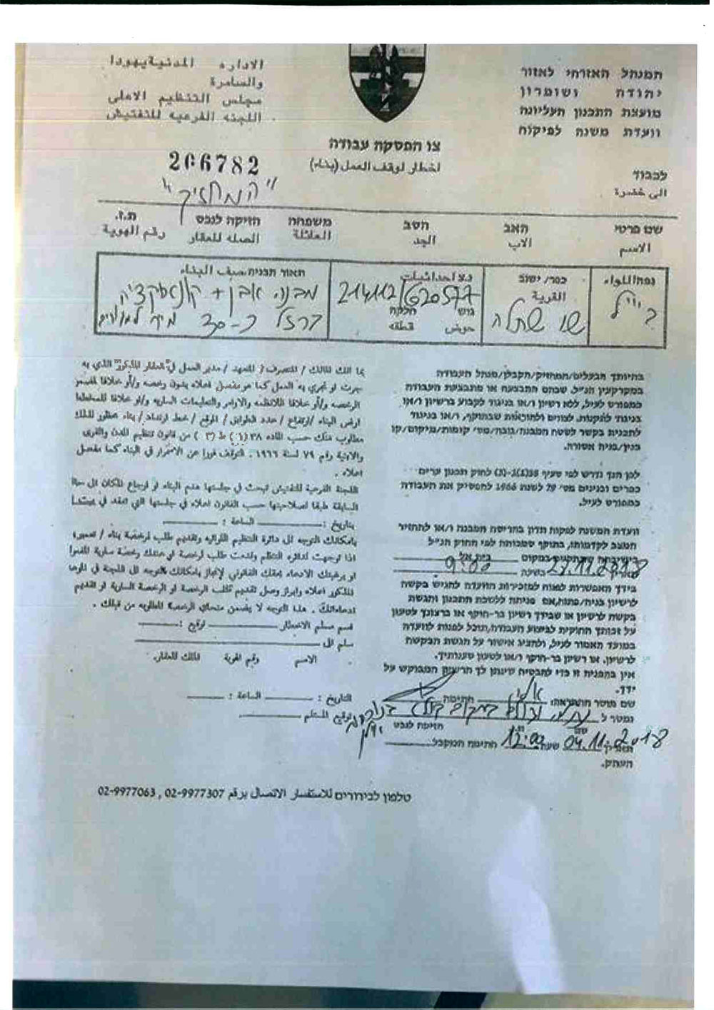
The Order targeting Sarhan Salah's Home
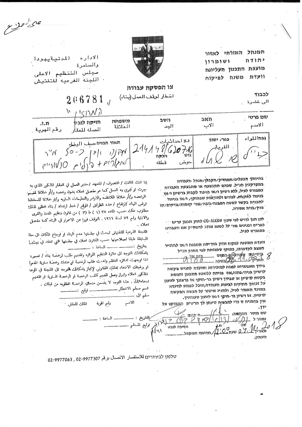
The Order targeting Ali Salah's Home
The Order targeting Musa Salah's Home
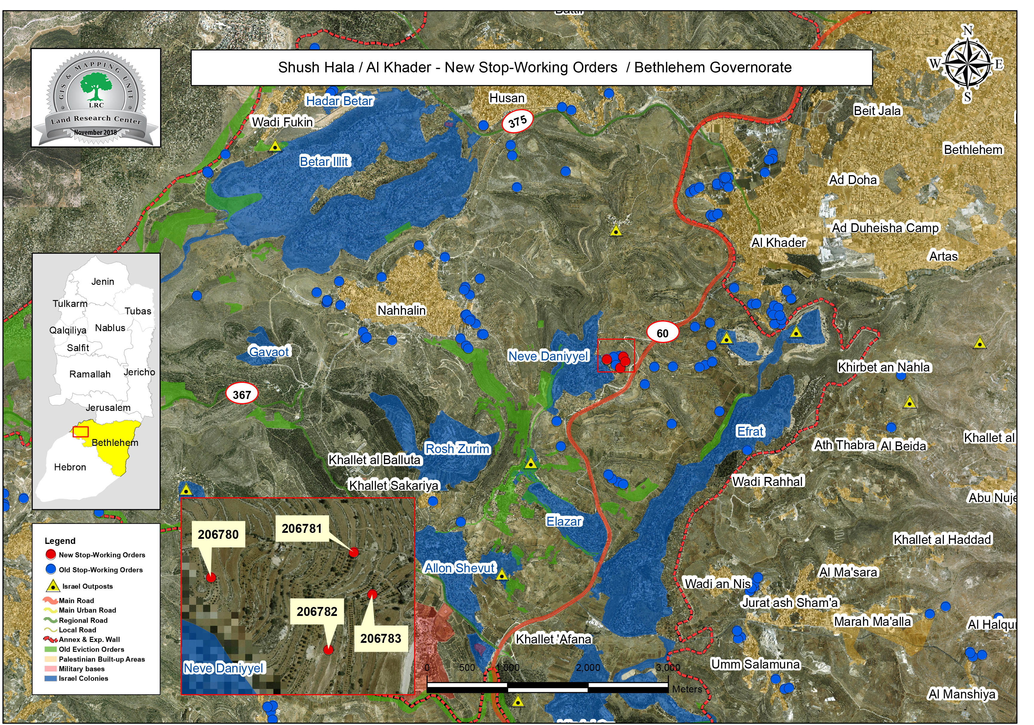
It is noteworthy that Shoshala is targeted by Israeli assaults due to its location on a mountain hill. In addition to that, Shoshala town is surrounded by Israeli settlements that the occupation aims to annex with a road, this plan is only a part of their scheme (the Greater Jerusalem).
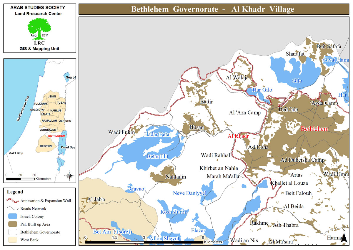
About Al-Khader village:[1]
Al-Khader village is located 4 km from the western side of Bethlehem, it is bordered by Beit Jala and Batir from the north, Hussan and Nahaleen villages from the west, Aldoha, Wadi Rahhal, Beit Jala villages from the east, and Wadi Al-Nees from the south. Its population is 9774 people in 2007. Its gross area is 8,279 donums; 184 of them are the construction area.
The Israeli colonies have despoils 29 donums from the village's lands; two are colonies existed upon a part of the lands. The first one " Efrat" was constructed in 1979 A.D; they have usurped 5.8 donums, and its population 7037 colonists. The second one " Nafy Danial" eas constructed on 1982A.D; they have usurped 23 donums, and its population is 1073 colonists. A part of which is established upon the village's lands.
The bypass roads number 60 and 375 also despoiled more than 487 donums. In addition to establishing the apartheid upon its lands which causes the demolishing of 280 donums and isolating of 5638 donums behind it. The length of this apartheid existing upon the village's land is 2,805 meters.
The village's lands are classified in accordance with Oslo concord into areas( A,B ,C). Area A composes 10% , Area B 6%, Area C is the greatest area and it is under the total occupation domination, and it composes 84% from the total area. The areas are clarified in donums as following:
Area A (808) donums.
AreaB (475) donums.
Area C(6,996) donums .
[1] GIS-LRC
