
Related
Settlers of “Rahalim†sabotage 80 trees in As-Sawiya village / Nablus governorate
Violation: Sabotaging olive trees.
Location : As-Sawiya village – Nablus governorate.
Date: Settlers of “Rehelim”.
Victims: Hamd Jazi.
Description:
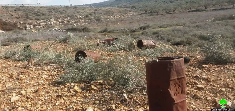
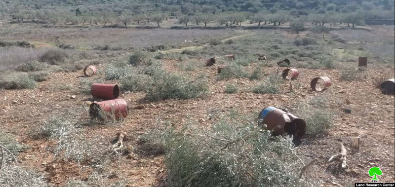
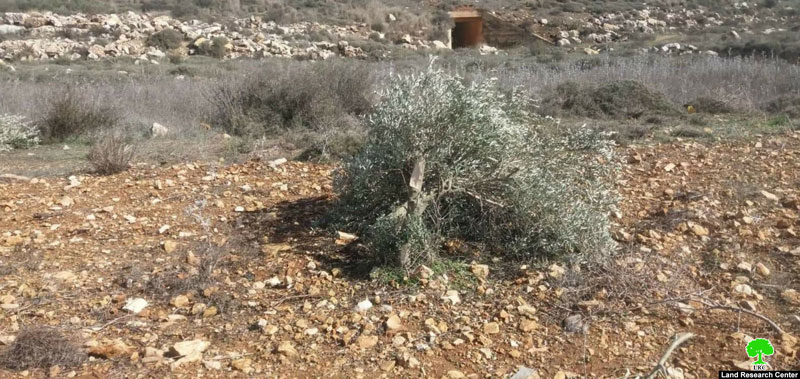
Wednesday , January 8th 2020 , about 11:00 am , settlers of “Rehelim” were seen sabotaging olive trees from an olive grove in Dar Kamuna location southwest As-Sawiya.
Affected farmer Hamd Jazi (52) told LRC reporter:
“One of the passing drivers told us that he saw settlers cutting and sabotaging olive trees in our olive grove in “Dar Kammuna” area , when I got to the olive grove , I found out that settlers already sabotaged most of the trees , and ran to “Rehelim” settlement only 500 m away from our plot.”
Reportedly, 8 settlers attacked the olive grove with sharp tools , the attack left 80 olive trees aging 7 years old completely destroyed.
Mr.Hamd Salih also told LRC reporter: “ in 2013, settlers of “Rehelim” uprooted number of olive saplings from the same olive grove , I cultivated them once again, and now they came back after 7 years and sabotaged them, but i will never give up, and I will plant olive saplings all over again” .
|
|
|
|
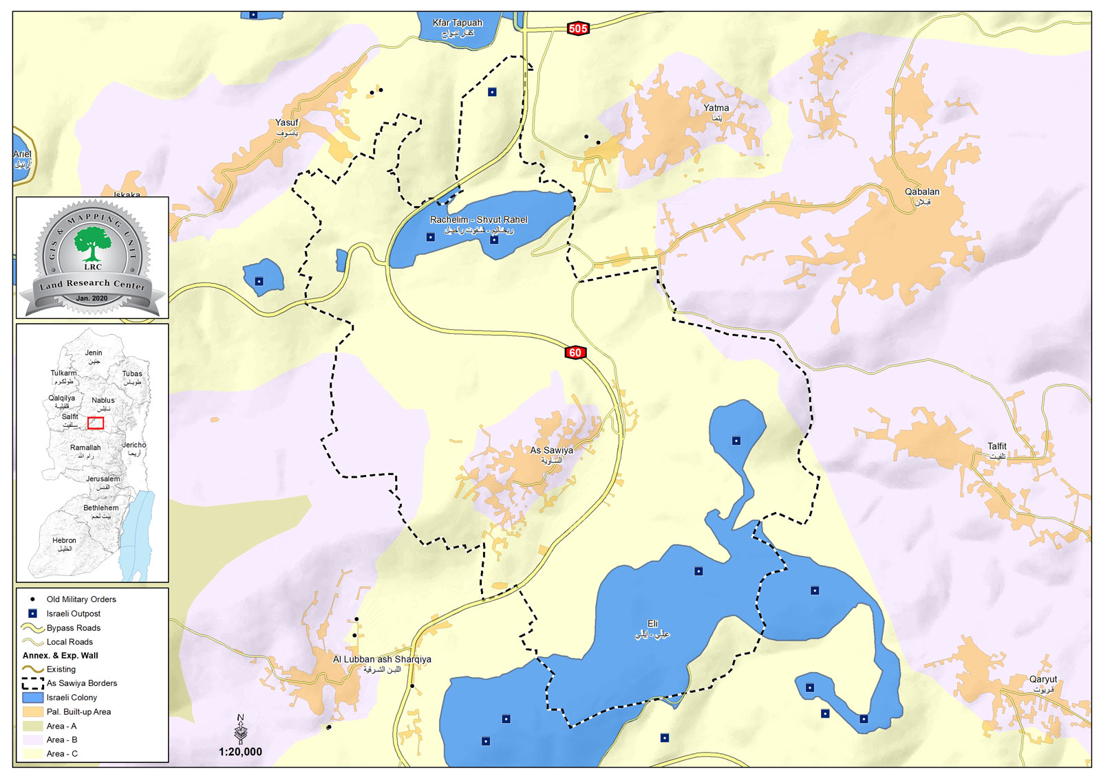
As-Sawiya village:
20 km south Nablus city , As-Sawiya is surrounded by Yatma and Yasouf (north) , Al-Lubban Ash-Sharqi (west) , Talfit and Qablan (east) and Al-Lubban Ash-Sharqi and “Eli” Israeli illegal settlement (south).
As-Sawiya has a population of (2761) people according to 2017 census.
As-Sawiya has a total area of 10,733 dunums , of which 310 dunums are a built up area for the village.
The Israeli occupation confiscate (2662) dunums of its lands for the following purposes:
Israeli settlement took over (2022) dunums for:
| Settlement name | Establishment year | Area of controlled lands | population | Total area of the settlement |
| Eli | 1984 | 1543 | 4191 | 3360 |
| Rehalim | 1991 | 479 | 812 | 547 |
Bypass 60 devoured 640 dunums.
- Oslo accords divided the town’s lands as the following:
- B area: (1459) dunums.
- C area : (9274) dunums.