
Related
Settlers cut down 60 trees in Al-Khader / Bethlehem governorate
Israeli Violations in the time of Corona
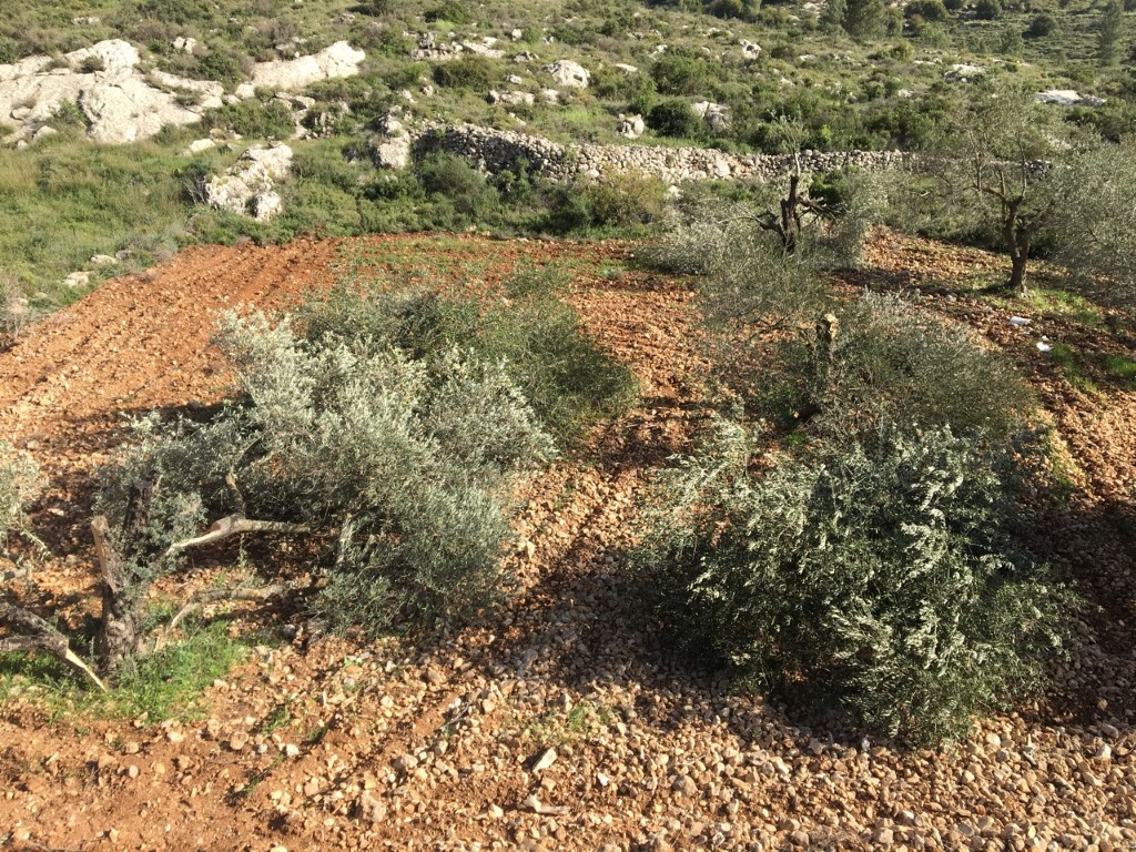
Violation: Cutting olives and vine trees.
Date: March 26th 2020.
Location: Al-Khader town / Bethlehem governorate.
Perpetrators: Settlers of “Gush ‘Etzion”.
Victims: family of Hisham Sbaih.
Description:
Thursday, March 26th 2020 a group of settlers from “Gush ‘Etzion” settlement cluster stormed a plot belong to citizen Hisham Sbaih , and cut down 60 trees (40 vine and 20 olives).
Settlers take advantage of the Corona lockdown, and that some farmers are not capable to reach their lands to conduct vandalism in Palestinian lands.
People of Al-Khader depend mainly on agriculture as a source of income, in order to harm those most, settlers vandalize and cut down their trees.
Farmlands remained the only escape for people of Al-Khader during the lockdown, and a source of income that gives a hand during such difficult times.
Al-Khader is hotspot for settlers’ violence represented in ravaging lands, uprooting trees, closure of agricultural roads, and pollution in Sewage water and attacking farmers.
About Al-Khader village:[1]
Al-Khader village is located 4 km from the western side of Bethlehem, it is bordered by Beit Jala and Batir from the north, Hussan and Nahaleen villages from the west, Aldoha, Wadi Rahhal, Beit Jala villages from the east, and Wadi Al-Nees from the south. Its population is 11960 people in 2017. Its gross area is 8,279 donums; 184 of them are the construction area.
The Israeli colonies have despoils 29 donums from the village's lands; two are colonies existed upon a part of the lands. The first one " Efrat" was constructed in 1979 A.D; they have usurped 5.8 donums, and its population 7037 colonists. The second one " Nafy Danial" eas constructed on 1982A.D; they have usurped 23 donums, and its population is 1073 colonists. A part of which is established upon the village's lands.
The bypass roads number 60 and 375 also despoiled more than 487 donums. In addition to establishing the apartheid upon its lands which causes the demolishing of 280 donums and isolating of 5638 donums behind it. The length of this apartheid existing upon the village's land is 2,805 meters.
The village's lands are classified in accordance with Oslo concord into areas( A,B ,C). Area A composes 10% , Area B 6%, Area C is the greatest area and it is under the total occupation domination, and it composes 84% from the total area. The areas are clarified in donums as following:
- Area A (808) donums
- AreaB (475) donums
- Area C(6,996) donums
[1] GIS-LRC

The contents of this document is the sole responsibility of LRC and can under no circumstances be regarded as reflecting the position of the European Union