
Related
Halt of Work notice targets an under construction house belongs to Al-Muhsiri family in Umm Ar-Rukba / Bethlehem governorate
Violation: 96 hours removal notice.
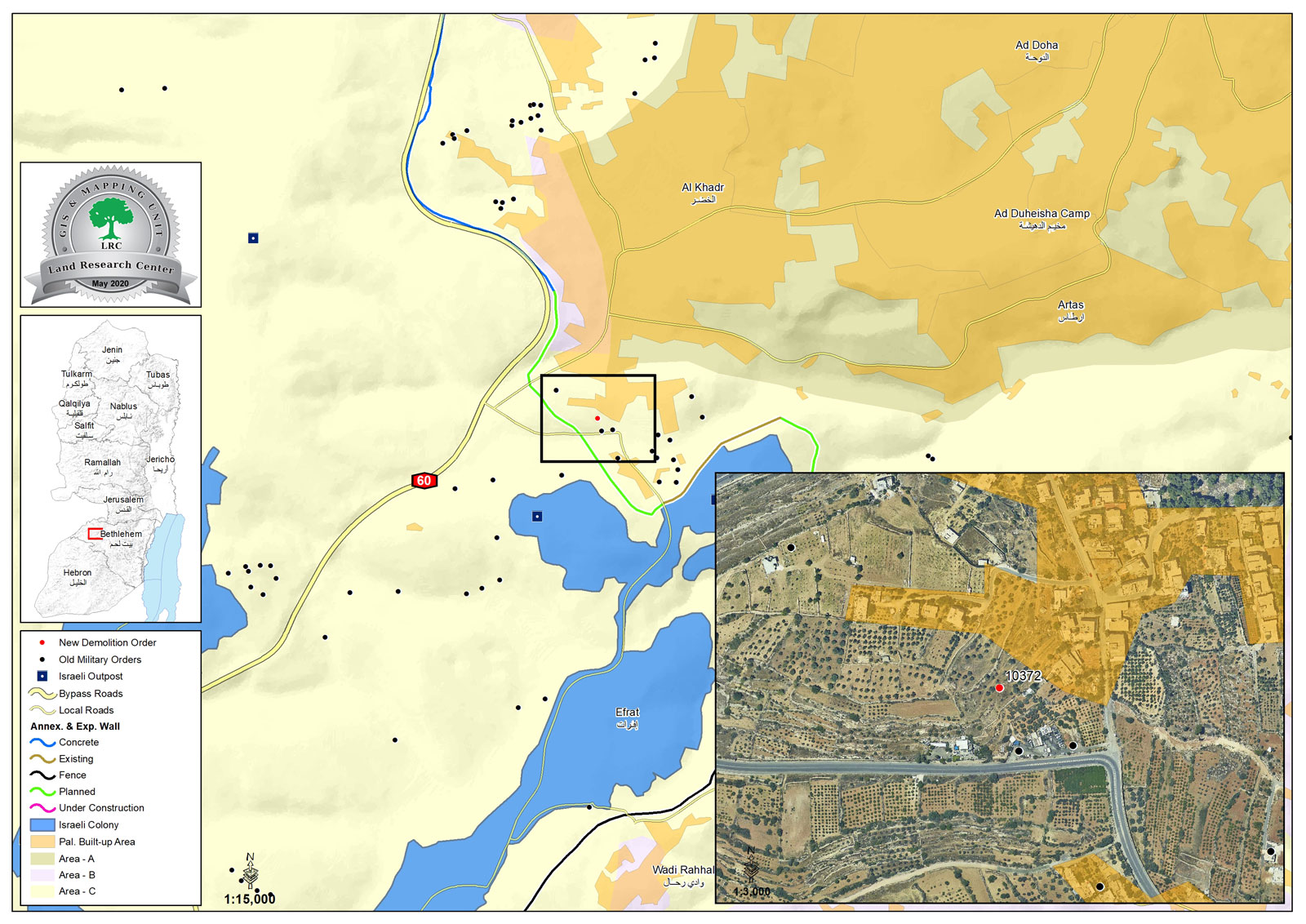
Location: Umm Ar-Rukba – Al-Khader town / Bethlehem governorate.
Date: April 21st 2020.
Perpetrators: The Israeli Occupation Civil Adminitsration protected by the occupation forces.
Victims: Salih Al-Muhsiri , Mustafa Salah.
Description:
A vehicle related to the Israeli Civil Administration protected by occupation forces raided Umm Ar-Rukba area in Tuesday April 21st 2020, and gave citizen Mahmoud Al-Muhsiri a removal order within 96 hours on house foundations, on the pretext of building without licenses , they also confiscated several hand tools (angle grinder , cable and other things) belong to citizen Mustafa ‘Umran.
The notice is entitled “Removal of a new building”, and numbered (10372), under which the occupation authorities will implement the demolition in 96 hours.
Iyad Issa from Legal Aid Unit in Al-Khader municipality told LRC:
“The Israeli Occupation has been heavily targeting people of Al-Khader with “removal within 96 hours notices”, depriving people of the least of their rights, to submit a petition.”
Noteworthy, Salih set up foundations to build a house for his family, on 1 dunum plot.
The Occupation intensified halt of work and demolition notices in Umm Ar-Rukba, while Giv’at Hatamar settlement is expanding freely on the village lands, and for the sake of settlers’ security , Palestinians aren’t allowed to build or even use their own lands in the area.
The Occupation takes advantage of the Corona lockdown, and closure in most legal aid and human rights institutions to carry out demolition operations and notify structures.
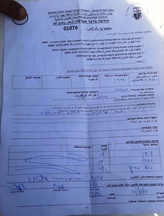
Photo 1: confiscation notice for the hand tools

Notice number (10372) to remove a building within 96 hours
About Al-Khader village:[1]
Al-Khader village is located 4 km from the western side of Bethlehem, it is bordered by Beit Jala and Batir from the north, Hussan and Nahaleen villages from the west, Aldoha, Wadi Rahhal, Beit Jala villages from the east, and Wadi Al-Nees from the south. Its population is 11960 people in 2017. Its gross area is 8,279 donums; 184 of them are the construction area.
The Israeli colonies have despoils 29 donums from the village's lands; two are colonies existed upon a part of the lands. The first one " Efrat" was constructed in 1979 A.D; they have usurped 5.8 donums, and its population 7037 colonists. The second one " Nafy Danial" eas constructed on 1982A.D; they have usurped 23 donums, and its population is 1073 colonists. A part of which is established upon the village's lands.
The bypass roads number 60 and 375 also despoiled more than 487 donums. In addition to establishing the apartheid upon its lands which causes the demolishing of 280 donums and isolating of 5638 donums behind it. The length of this apartheid existing upon the village's land is 2,805 meters.
The village's lands are classified in accordance with Oslo concord into areas( A,B ,C). Area A composes 10% , Area B 6%, Area C is the greatest area and it is under the total occupation domination, and it composes 84% from the total area. The areas are clarified in donums as following:
- Area A (808) donums.
- AreaB (475) donums.
- Area C(6,996) donums.
[1] GIS-LRC

The contents of this document are the sole responsibility of LRC and can under no circumstances be regarded as reflecting the position of the European Union