
Related
New Outpost in Kafr Malik village in Ramallah governorate
Violation: Demolishing a new outpost.
Location: Kafr Malik village / Ramallah Governorate.
Date: October 12th 2020.
Perpetrators: Israeli Illegal Settlers.
Victim: Al-Ka’abneh Bedouin community.
Description:
A group of settlers established a new outpost on Kafr Malik lands in Ramallah governorate, after taking over five dunums of Palestinians’ lands southeast Al-Ka’a’bneh Bedouin community in Ein Samiya.
The new outpost is 150 m to the north of Kokhav HaShahar settlement on lands classified as state lands in an area known of “At-Tabeel”.
The new outpost is similar to a farm consisting of tents and a barracks, settlers try to devour vast areas of lands and impose realities on the ground that affects the lives of Palestinians living in the area.
|
|
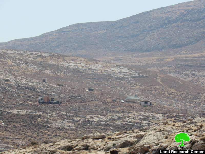
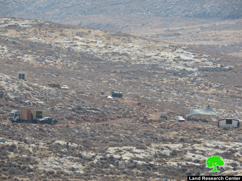
Two years ago a group of settlers established a new outpost to the south of Kokhav HaShahar settlement, on confiscated lands from Kafr Malik and Deir Jarir villages, the outpost is growing quickly.
Al-Ka’abneh Bedouin council head in Ein Samiya area Mohammed Al-Ka’abneh told LRC:
“The new outpost constitutes a real danger on Peoples lives, Arab Al-Ka’abneh community (18 families) depend mainly on cattle breeding for living. On the other side, the new outposts’ residents also raise cattle, and now they are trying to take over postures in the area.”
During the last three years, several new outposts (with features similar to farms) were establishes around the Palestinian suburbs. This is a new way to take over Palestinian agricultural lands and postures or closing them off to Palestinian farmers.
About Kafr Malik:[1]
15 km northeast Ramallah city, Kafr Malik is surrounded by Khirbet Abu Falah and Al-Mughayyir village (north), Al-Mazra’a Ash-Sharqiya (west) , Al-Mughayyir and Al-Auja (east) and Deir Jarir village (south).
Kafr Malik is populated (2946) people in 2017 census.
Kafr Malik has a total area of 51,891 , of which 911 dunums are a built up area.
The occupation devoured 1645 dunums for the following purposes:
Kokhav Hashaher devoured 380 dunums , established in 1977 and inhabited by 1367 settlers.
Bypass 458 ate up more than 726 dunums.
Israeli military camps ate up 539 dunums.
Oslo conventions divided the land as the following :
- B area: 6,574 dunums.
- C area: 45,317 dunums.
[1] GIS-LRC

This document was prepared with EU funding
The Contents of this document are the responsibility of LRC and do not reflect the positions of the European Union