
Related
Halt of work notices for houses and agricultural facilities in Kobar / Ramallah governorate
Violation: Halt of work notices.
Location: Kobar town / Ramallah governorate.
Date: October 28th 2020.
Perpetrator: The Israeli Occupation civil administration.
Victims: 11 Palestinian families.
Description:
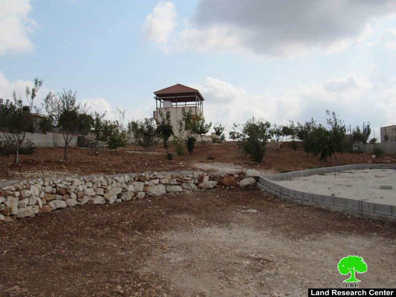
Wednesday, Oct 28th 2020, the Israeli Occupation forces accompanied by the inspection officer of the building and organization subcommittee at the Israeli Civil Administration raided Kobar northwest Ramallah; the inspection officer hanged the notices on the walls of the targeted structures.
The notices Targeted structures southwest the village , 1 km away from a confiscated land where “Halmish” was built in Natural blocks (6), (5) , (8) most of them are agricultural lands.
According to the military notices, the occupation set Nov 18th 2020 as the date of the subcommittee session in Beil El military court to decide the fate of the structure.
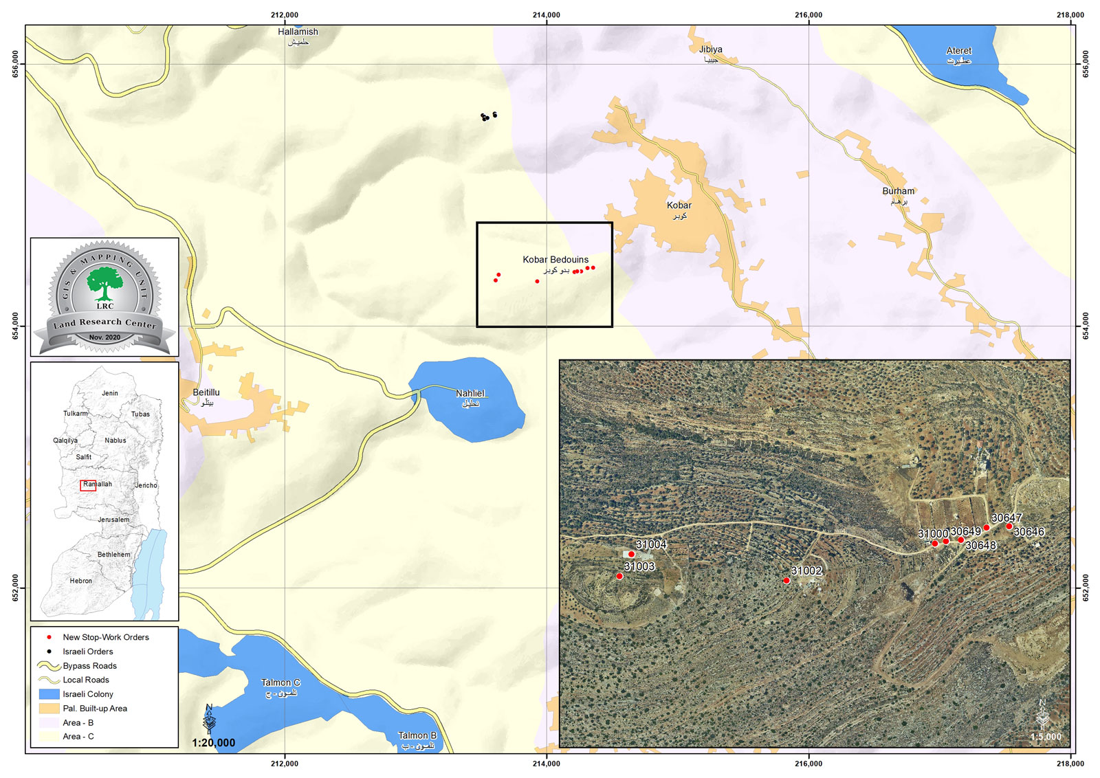
The map illustrates the targets of the military orders
The following table shows more information about the damages:
Affected citizen | Family members | children | Military order number | The targeted facility | Photo number |
Iyad Abu Qura’a | 11 | 9 |
| 1 | |
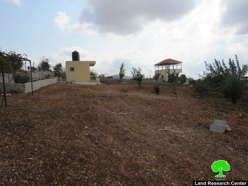
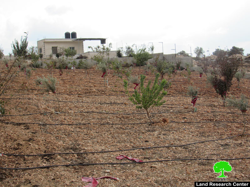
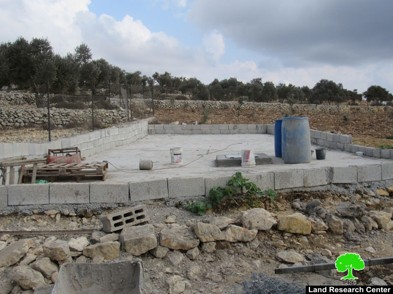
Muntaser Yousif | 3 | - | Under construction agricultural structure built of bricks and a baton ceiling with a total area of 70 m2 | 2 | |
Mohammed Yousif | 7 | 3 | Agricultural structure built of bricks and a baton ceiling (50 m2) | 3 | |
Nabeel Al-‘Abed | 7 | 3 | Plot surrounded by a baton wall with a total area of 1 dunums , and an agricultural structure built of bricks and a Baton ceiling (45m2) | 4 | |
Jalal Yousif | 6 | - | Agricultural structure built of bricks and a baton ceiling (20 m2) | 5 | |
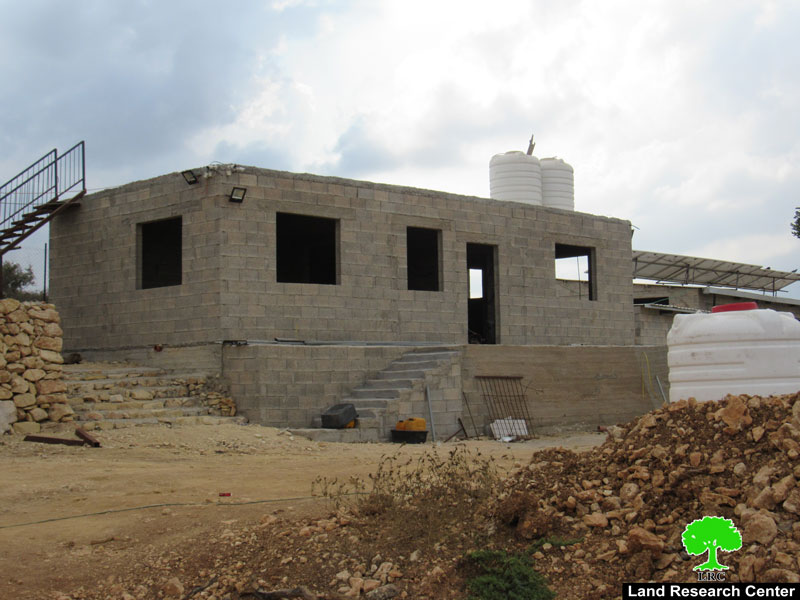
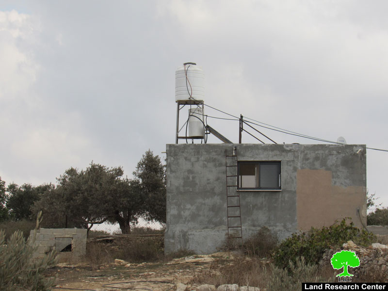
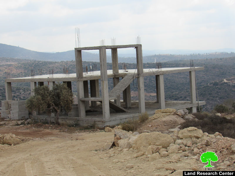
‘Ali Yousif | 3 | 1 | Under construction house consists of a floor and a basement (250 m2) | 6 | |
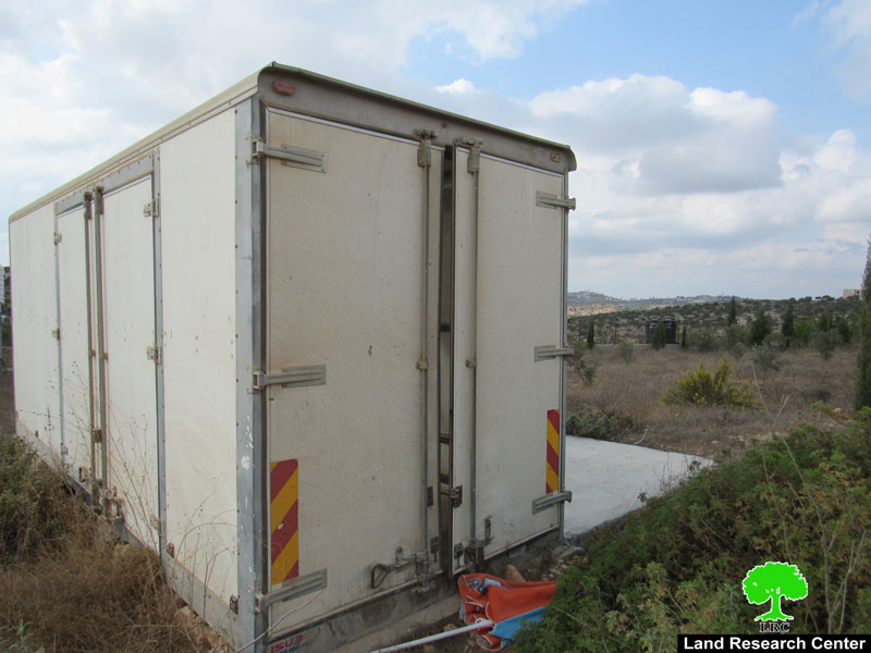
Marwam Abu Farha | 8 | 1 | Agricultural land with a total area of 800 m2 surrounded by a baton floor and a caravan (16 m2) | 7 | |
Sami An-Natsha | 7 | 4 | Agricultural land with a total area of 1200 m2 , a cistern with a storage capacity of (60 m3) , an agricultural structure (60 m2) and a roof (45 m2) | 8 | |
‘Adnan Al-Haj | 6 | 4 | N/A | Cistern with a storage capacity of 60 m3 | 9 |
‘Arafat Mahmoud | 8 | 2 | N/A | Cistern with a storage capacity of 60 m3 , and a caravan 16 m2 | 10 |
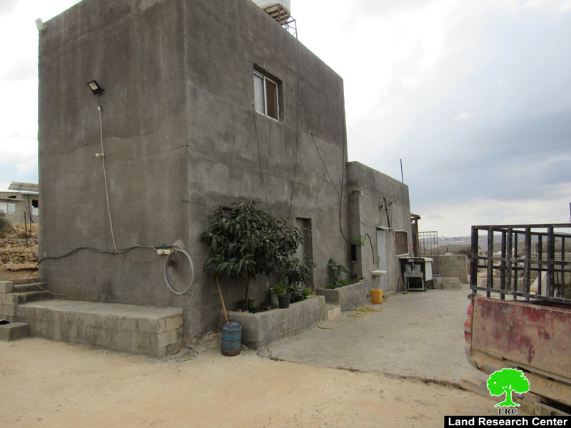
Zakariya Barakat | 4 | 2 | N/A | House that has a total area of 150 m2 | 11 |
Photo 1 |
Photo 2 |
Photo 3 |
photo 4 |
photo 5 |
photo 6 |
photo 7 |
photo 8 |
photo 9 |
Reportedly, during 2019 the inspection officer in the Israeli occupation civil administration targeted (6) houses at the village on the pretext of building without licenses. Noteworthy, during the last five years, the occupation demolished five houses at the village.
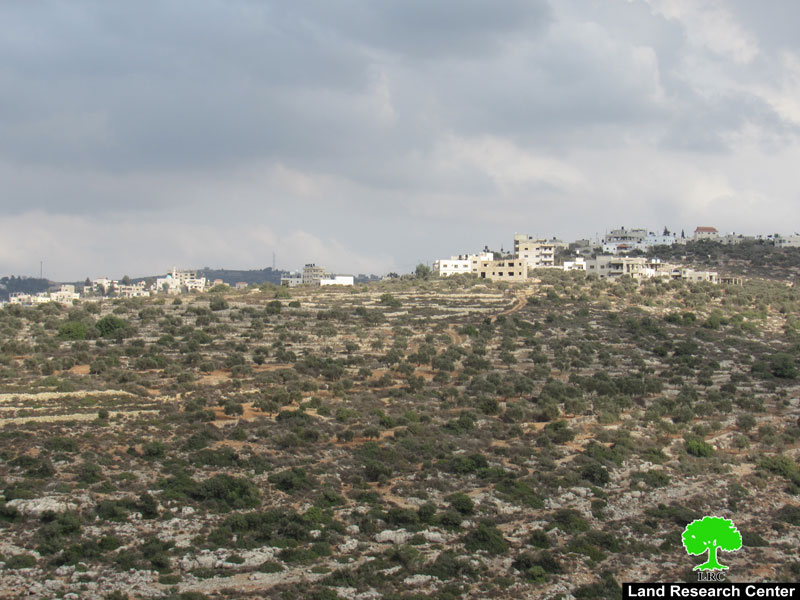
About Kubar village:[1]
15 km North West Ramallah, Kubar is surrounded by Jibya , Burham and Umm Safa (north), Beitillu and Deir Nitham (west), Birzeit (east) and Al-Mazra’a Al-Qebaliya and Abu Shkhaidem (south).
Kubar has a population of (4,320) people in 2017 census, and an area of 9,905 dunums, of which 711 dunums are the town’s built up area.
Oslo conventions:
B area : 5,549 dunums.
C area: 4,356 dunums.
Kubar village
[1] GIS-LRC

This report is part of SPLHR project activities
This report was made with EU funding, The contents of this document do not reflect positions and views of the EU