
Related
New Outpost to be constructed and road closure on Sinjil / Ramallah governorate
Israeli Violations in the Time of Corona
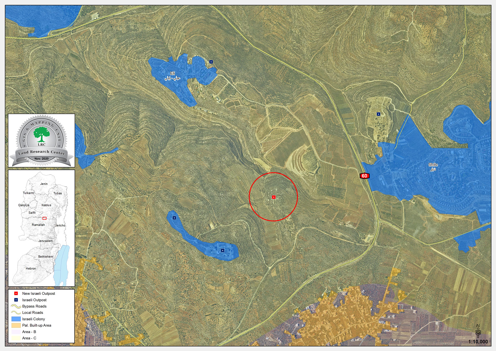
Violation: Constructing a new outpost and closing an agricultural road.
Location: sinjil town / Ramallah governorate.
Date: September 2nd 2020.
Perpetrators: The Israeli Occupation forces and colonists.
Victims: Sinjil farmers.
Description:
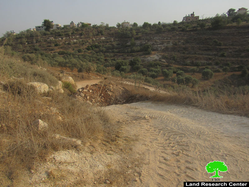
A group of colonists belong to “Sons of the hills” gang established a random outpost northeast Sinjil , the outpost overviews bypass 60 and located only 400 m away from Eli colony.
|
|
|
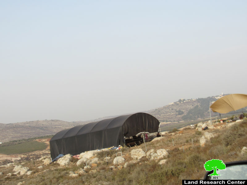
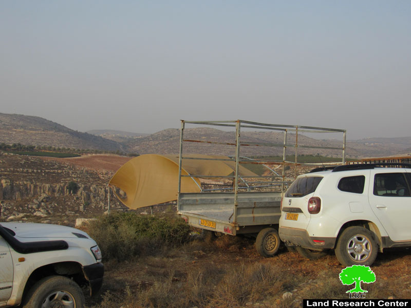
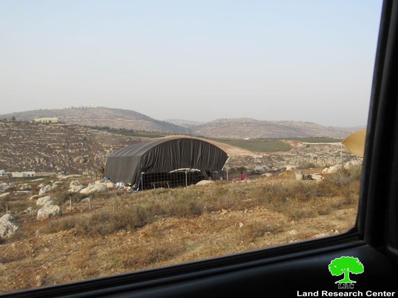
Photos 1-3: The new outpost
Land Research Center field worker was at the location with Sinjil village council head Mu’taz Tafasha , the plot apparently belongs to heirs of Ahmed Al-Ghafri , and located in natural plot (6) of Al-Mugharibat area , and piece (27) of Wad Al-Mughassil lands , the targeted plot has a total area of 2 dunums , the occupation had declared it as a state property.
Photo 4: ownership deeds for the plot where the outpost is built
Reportedly, the outpost composes of two tents (one of them is used as a residence, and the other is a barn), under the protection of the occupation forces.
One of the Heirs, Yousif Al-Ghafri told LRC:
“The targeted land belongs to our family and we have an ownership deed as a prove, the plot has a total area of 36 dunums usually cultivated with wheat and grain, in 2016 the occupation started
hindering any developmental projects at the area , it also banned Palestinians access to the area , and despite everything we are steadfast at the land.”
Wednesday, August 26th 2020, a group of colonist established a random outpost in ‘Abawein village lands , in Be’ar Yassin location and on lands classified B according to Oslo accords , colonists reportedly set up three tents at the location , people of the village managed to get them to leave the area, and they went to Sinjil to set up the tents on a new place.
Closing off an agricultural road:
Wednesday evening , September 2nd, the occupation forces closed off an Agricultural road to the north of Sinjil in an area known of Wad Uzraiel , the targeted road is 3 km long , and serves 400 dunums of olive groves and farms in Sinjil and the nearby village of ‘Abawein.
.
|
|
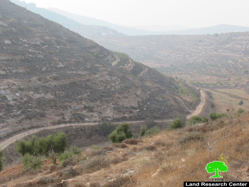
Photos 5+6 : The targeted agricultural road
Sinjil village council head Mu’taz Tafesh told LRC: “Three years ago the village council rehabilitated agricultural roads at the area that provide access to about 400 dunums , Ma’ale Levona colony is nearby the location , the occupation is trying to impose control over the area , and farmers are finding it very hard to access their farmlands.
About Sinjil:
20 kilometer north of Ramallah, Sinjil is surrounded by Al Labn Ash Sharqia (north), ‘Abween and Jaljilia (west), Qaryut and Turmus’ayya (east), and Al Mazr’a Ash sharqia (south).
Sinjil has a total population of 5742 people according to statistics conducted in 2017. It has a total area of 14028of which 888 are a built-up area of the village.
The Israeli occupation devoured 551 dunums of the lands of the village for two colonies. The first one is Maale Levona which was built in 1983 and confiscated 298 dunums of the village, and inhabited by 497 colonists. The second is Eli which was built in 1984 and devoured 253 dunums, and inhabited by 2058 colonists.
Moreover, bypass number ’60 took over 246 dunums of the village lands.
According to Oslo Accords, 14% of Sinjil is under Area A (PA has full civil and security control) while 30% is under Area B (PA is in charge of civil matters with Israel responsible for security). However, most of the village lands (56%) is under Area C (Israel maintains full security and administrative control). Here are the area in dunums:
Area A (1980) dunums
Area B (4140) dunums
Area C (7908) dunums
[1] GIS-LRC

This report was prepared with EU funding
The Contents of this document do not reflect position sand views of the European Union