
Related
The Israeli Occupation Demolishes retaining Walls in Ni’lin / Ramallah
Violation: Demolishing retaining walls on the pretext of building without licenses.
Location: Ni’lin / Ramallah governorate.
Date: September 23rd 2020.
Perpetrator: The Israeli Occupation Civil Administration and army.
Victims: Citizen Hussain Al-Khawaja.
Description:
Wednesday, The Israeli Occupation Civil Administration raided Ni’lin village west Ramallah and carried out a demolition operation for retaining walls, on the pretext of building without licensing.
Reportedly, the targeted plot is 1 dunums , and surrounded by a cement wall 100 * 2.5 and belong to citizen Hussain Khawaja from Ni’lin..
|
|
|
|
|
|
|
|
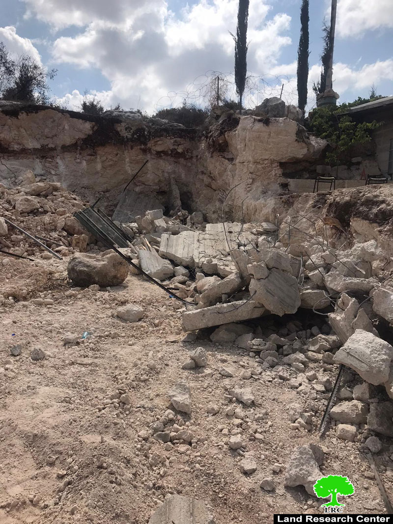
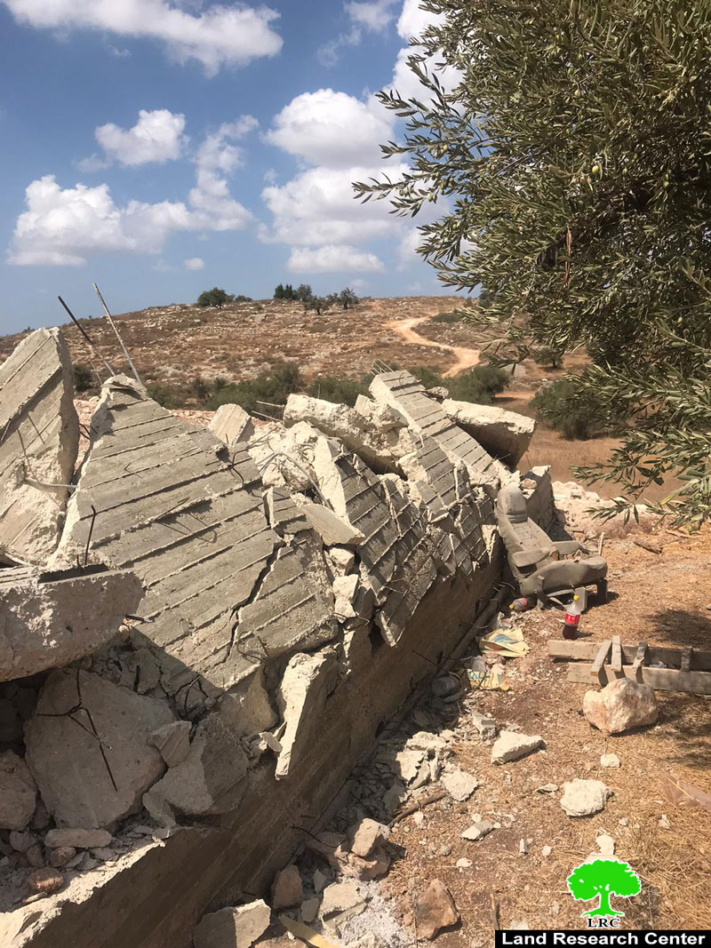
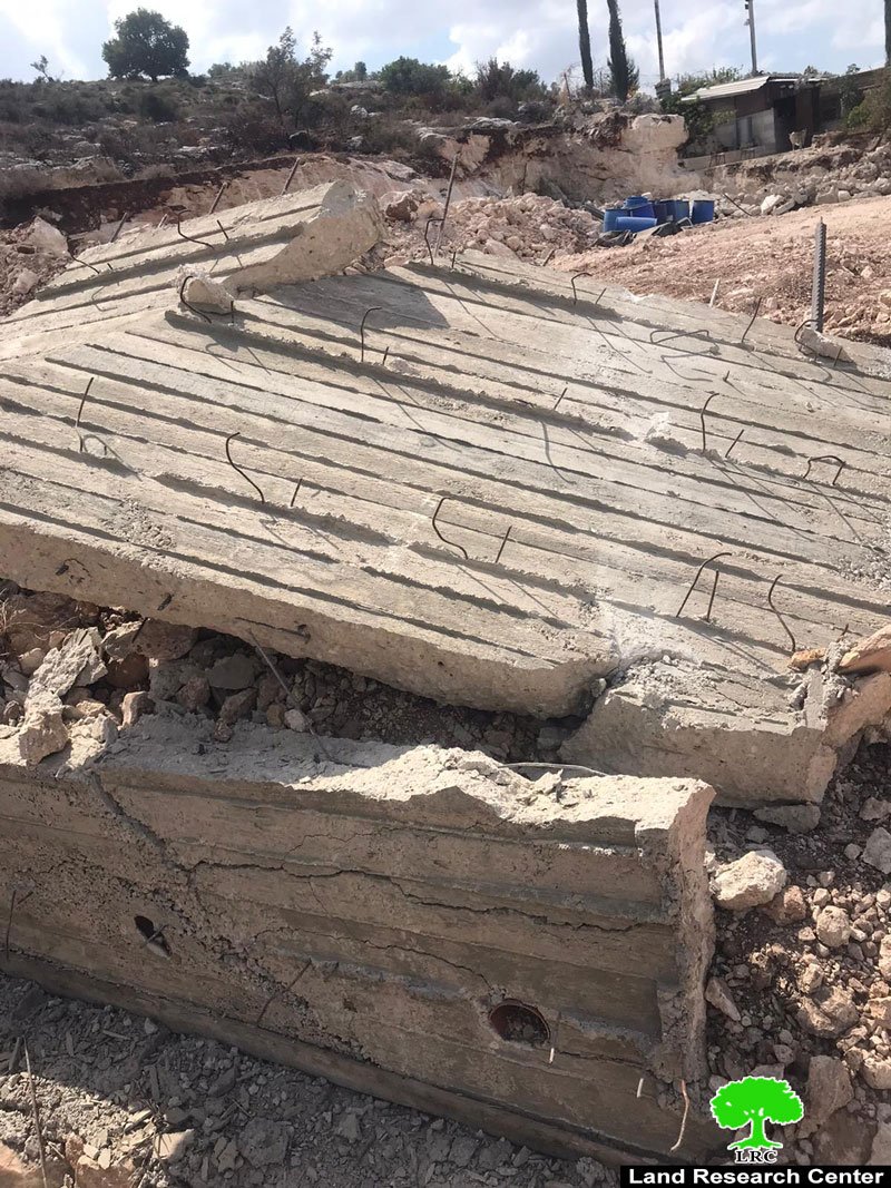
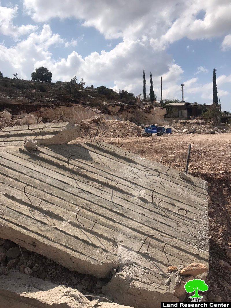
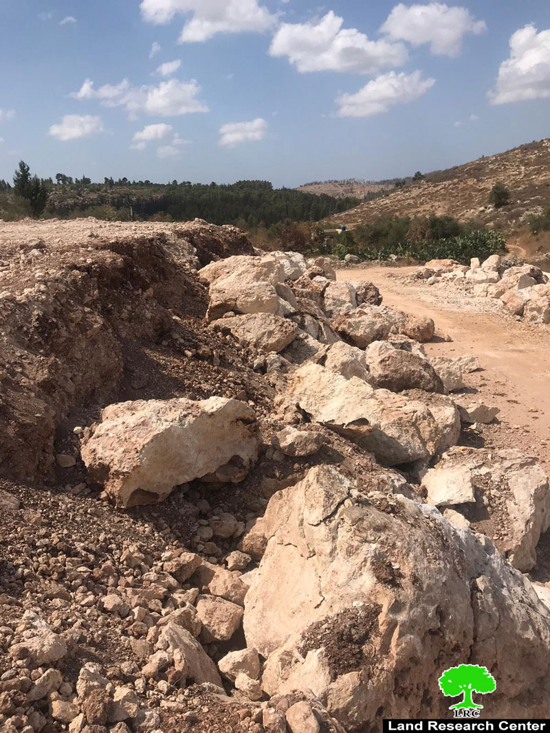
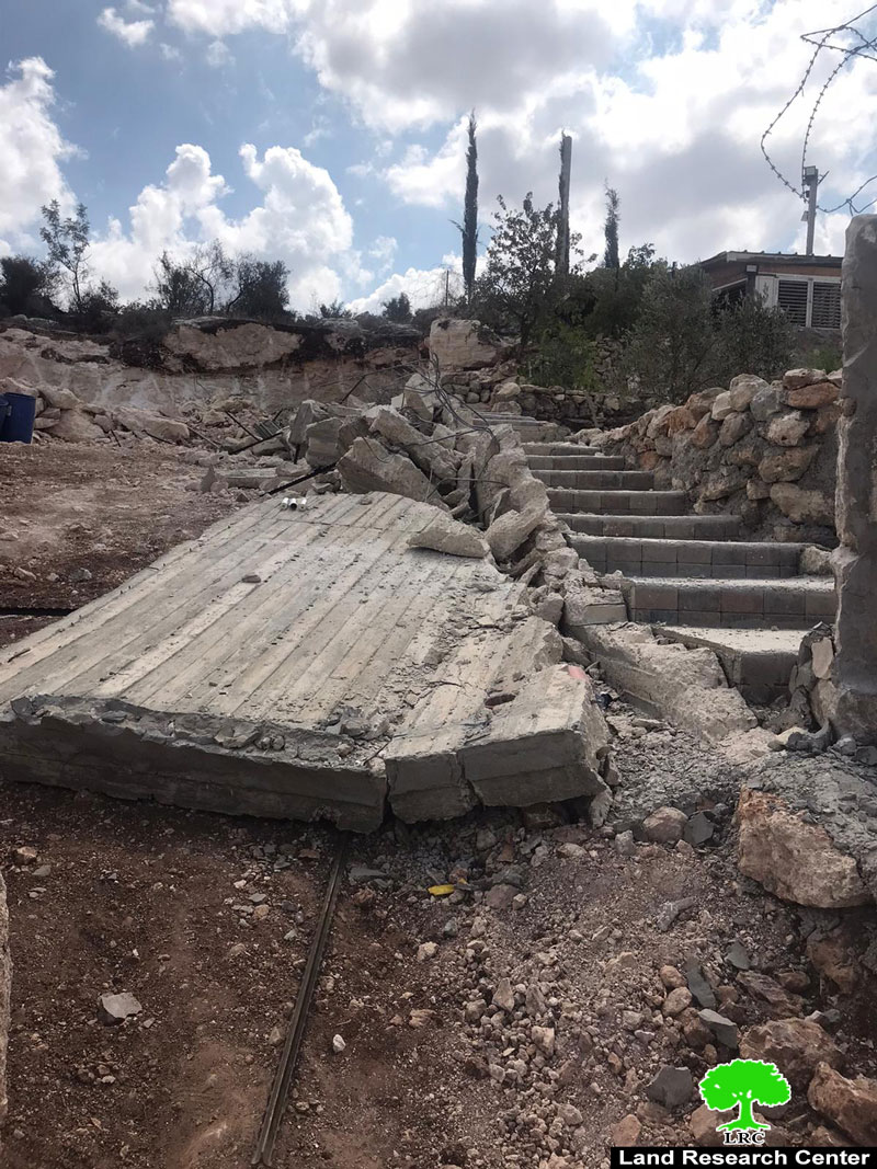
The remains after the demolition in Khawaja’s plot
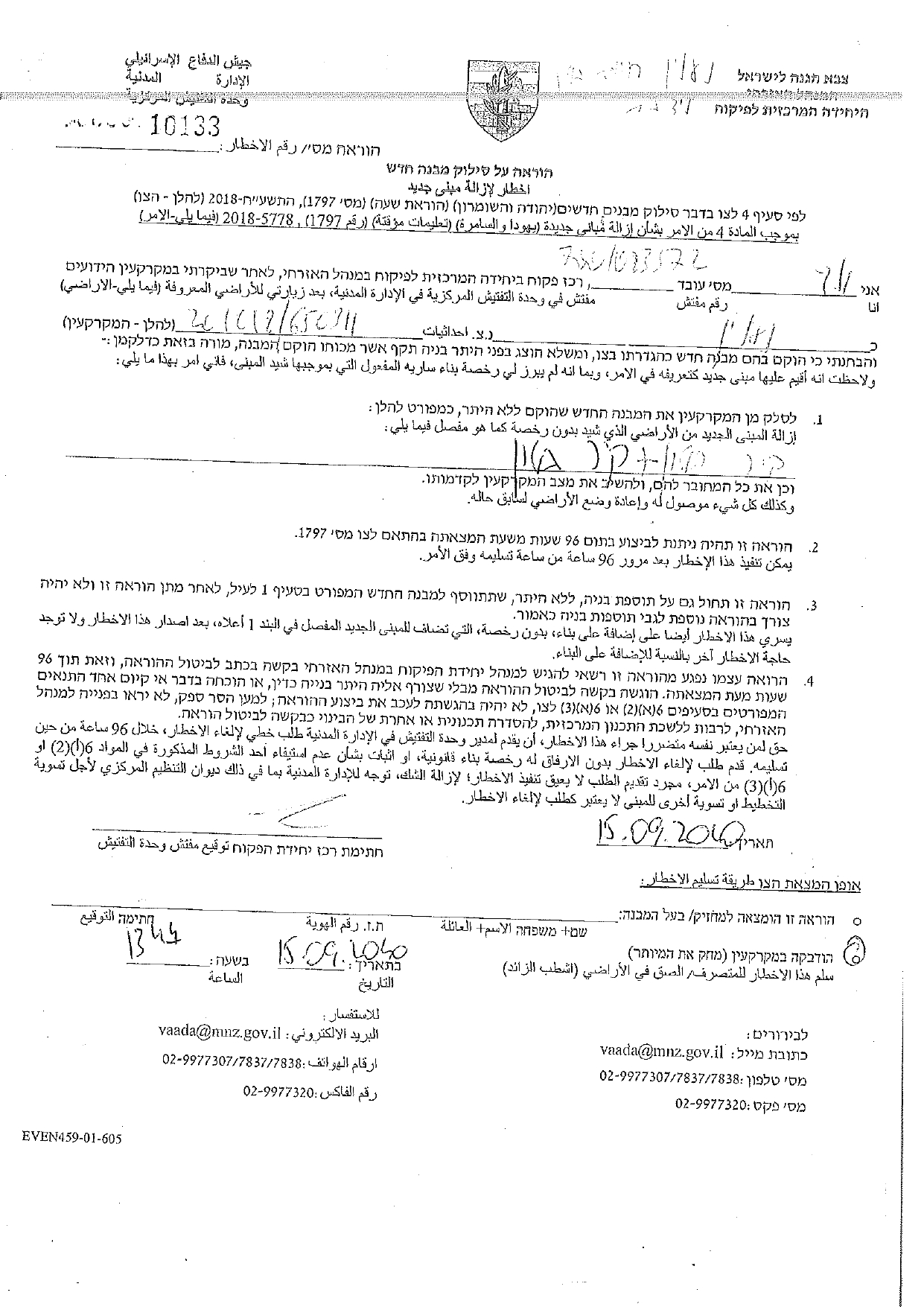
The Owner received a notice in September 15th 2020 numbered 10133 entitled “Removing a new building” , and gave the owner only 96 hours before removing the wall.
The notice was issued under military order (1797) which allows the civil administration to demolish structures built in the last 60 days.
Hussain Khawaja told LRC:
“I support a family of 5, 3 of them are children, and I own a plot situated to the West of Ni’lin, last summer we built a retaining wall (100m) around the plot to protect it, I was later given a notice entitled “Removal of a new building” , I filed an objection through Jerusalem Legal Aid and Human Rights Center, but the occupation refused and set the morning of September 23rd to carry out the demolition.”
During this year, the occupation demolished retaining walls in several locations and notified several houses and facilities in Ni’lin.
About Ni’lin:[1]
20 km to the northwest of Ramallah, Ni’lin is edged by the towns of Qibya and Budrus from the north, Al-Midyah town from the southwest, Deir Qidees town from the east and Mod’in and Kiryat Sefer colonies from the south.
Ni’lin is inhabited by 5897 people on a total land area of 15,206 dunums , of which 748 dunums are the village’s built-up area.
The occupation confiscated a total of 3020 dunums for colonial ends, which are detailed as follows:
Hashmona’im colony: it was established in 1985 on confiscated area of 858 dunums from the village. It is now inhabited by 2097 colonists.
Kiryat Sefer: it was established in 1991 on confiscated area of 476 dunums from the village. It is now inhabited by 24,290 colonists.
Mattityahu colony: it was established in 1980 on confiscated area of 657 dunums from the village. It is now inhabited by 1365 colonists.
Colonial bypass road number 446confiscated 408 dunums
The apartheid wallconfiscated 621 dunums for the favor of its construction and isolated 14,083 behind it.
According to Oslo Accords lands classifications, Ni’lin lands are classified as follows:
1,123 dunums are classified as area “B”
14,083 dunums are classified as area “C”
[1] GIS-LRC

This report was created with the financial support of the EU