
Related
Israeli Illegal Colonists Close off vast Areas of Postures East At-Tayba / Ramallah Governorate
Violation: Closure of vast areas of postures.
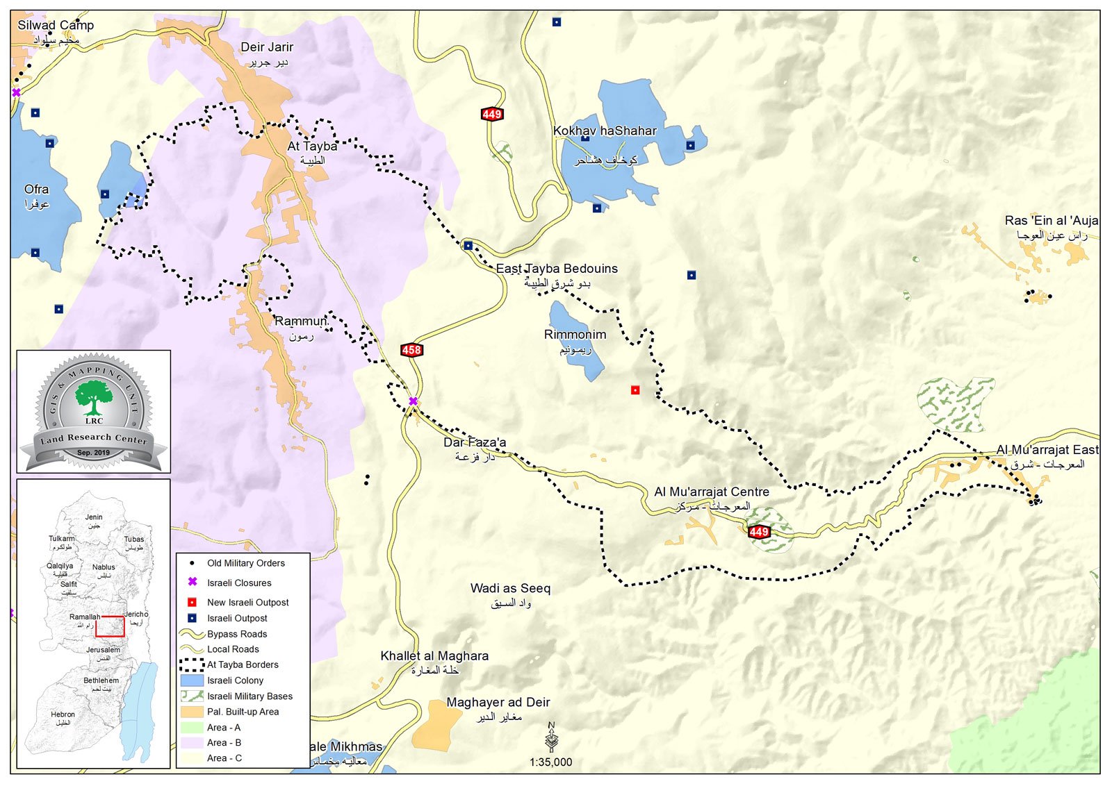
Location: Al-M’uarejat areas – At-Tayba / Ramallah and Al-Bireh governorate.
Date: February 1st 2021.
Perpetrators: a random Israeli outpost.
Victims: Al-Ka’abneh and Al-Mlaihat Bedouin communities in Al-M’uarejat area.
Description:
As Colonization rates accelerate in the West Bank, Israeli colonists with the help of the Israeli Civil Administration and other governmental bodies imposed closure over vast areas in the Jordan Valley.
Reportedly, in early February 2021, a new outpost was reported southeast Rimonim colony on At-Tayiba lands, which closed off vast areas of postures in Al-M’uarejat area.
Abdul Raheem Al-Ka’abneh (47) from Al-M’uarejat Bedouin community:
“Al-M’uarejat area is the home of 45 Bedouin families from Al-Ka’abneh , Al-Mlihat and Az-Zawahra clans, the great majority of these families live out of cattle breeding and we’ve been living here for many years. A while ago, colonists established a random outpost north the Bedouin community and started carrying out continuous assaults against us and our herds. The Israeli so-called Civil Administration supports them through notifying Palestinian structure. Nowadays, however illegal Israeli colonists are closing vast areas of postures on the face of Palestinian land owners.”
Expanding the outpost’s area of control:
Furthermore, the outpost goes under continuous expansions, new residential and agricultural structures were constructed including (three shacks and barns, and two residential structures). Which is a part of the plan to empty the area and take over it for colonial expansion.
|
|
|
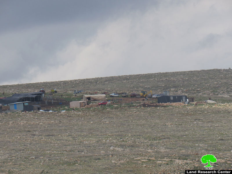
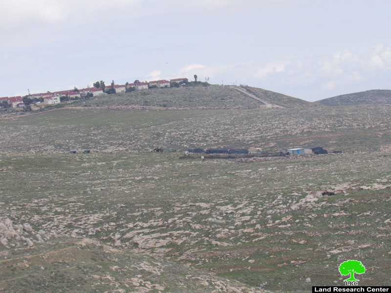
Photo 1+2: the targeted outpost
The Outpost was established late summer of 2019 on At-Tayba town, and about 300 m away southeast Rimonim colony. It is one of the newest Israeli illegal colonies at the Jordan valley that contribute in the gradual annexation of its lands.
At-Taybeh village:[1]
15 km east Ramallah, At-Taybeh is surrounded by Deir Jarir (north) , Silwad (west) , Al-Mu’arejat (east) , and blocked by Kokhav Hashaher and “Rimonim” east on Rammun village lands.
At-Taybeh is inhabited by (1340) people, in 2017 census.
At-Taybeh has a total area of 22,969 dunums, of which 732 dunums are a built up area.
The occupation confiscated (1,738) dunums for the following purposes:
- Israeli settlement took over (354) dunums as the following:
| Settlement name | Establishment year | Area in dunums | Number of settlers 2018 |
| ‘Ofra | 1975 | 25 | 3235 |
| Rimonim | 1977 | 329 | 745 |
- Bypasses 449 and 458 devoured (1,087) dunums.
- Israeli military camps devoured (297) dunums.
Oslo accords divided the area as the following:
- B area : (8,010) dunums.
- C area: (14,959) dunums.
[1] GIS-LRC

This Publication has been produced with the assistance of the EU
The Contents of this publication are the sole responsibility of the individual organization only , and can in no way be taken to reflect the views of the EU