
Related
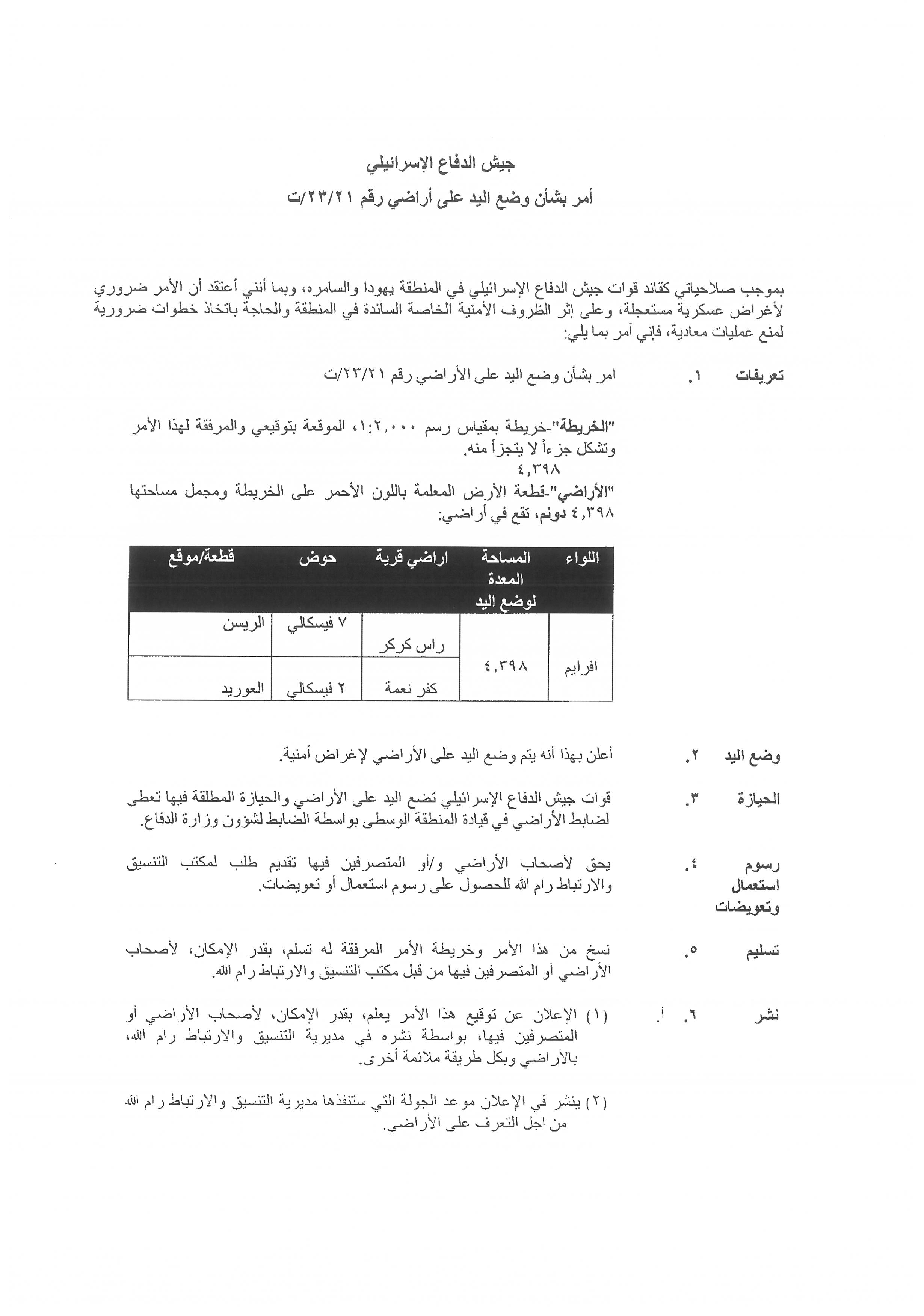
Military Order to Seize Lands in Kufur Ne’ama and Ras Karkar / Ramallah Governorate
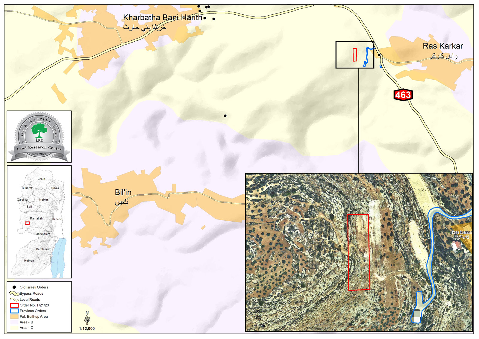
Violation: Confiscation notice for 4.3 dunums.
Location: Kufur Ne’ama and Ras Karkar / Ramallah Governorate.
Date: November 4th 2021.
Perpetrators: West Bank Army commander.
Victims: Sharek Youth Forum, Farmer Dawoud Fkhaitha, Farmer Hassan Zama’reh.
Description:
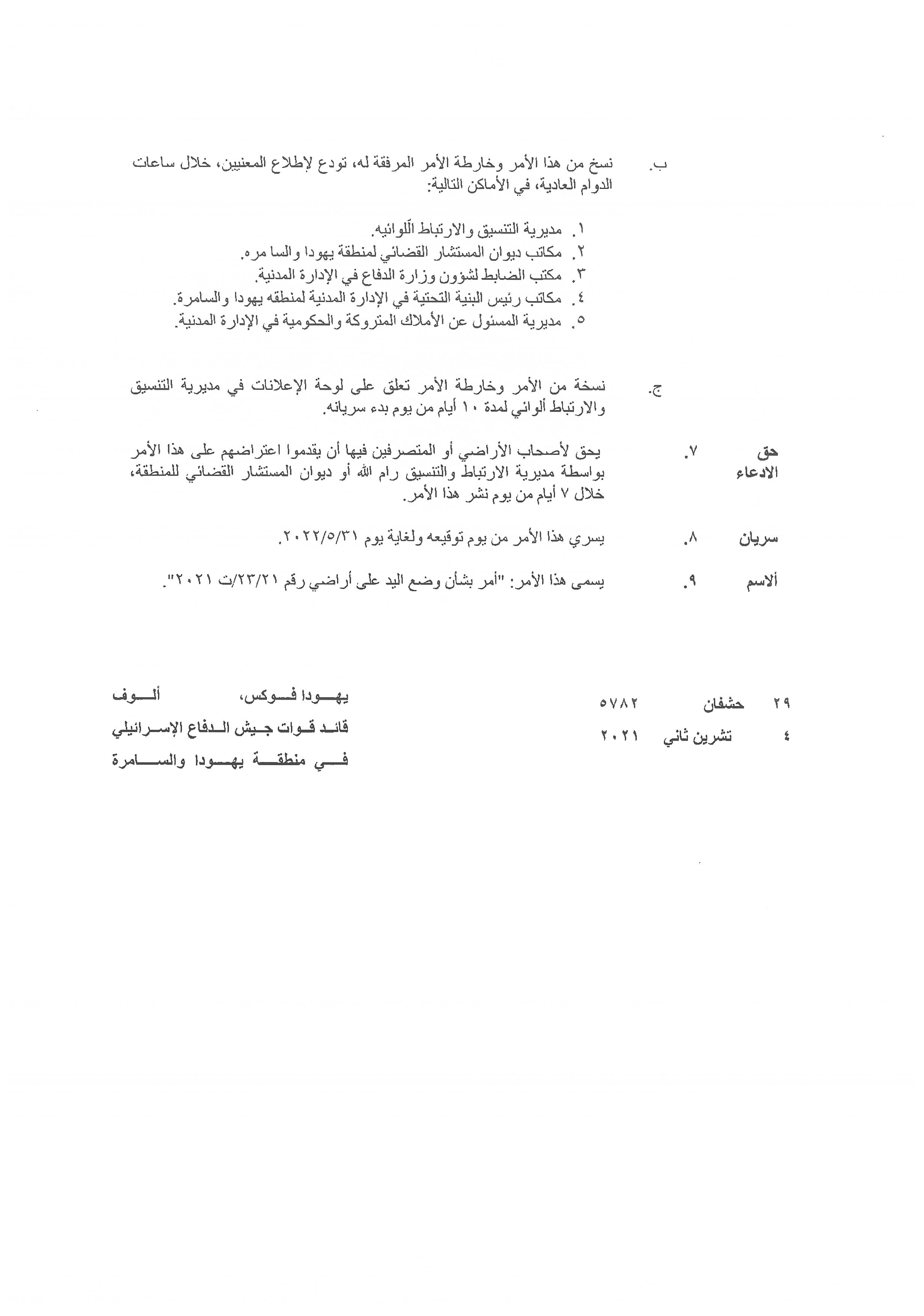
Thursday, November 4th 2021, The Occupation’s West Bank Army Commander “Yehuda Alof” issued military order 21/23/t , in order to lay control over 4.3 dunums in Kufur Nea’ma and Ras Karkar lands north Ramallah.
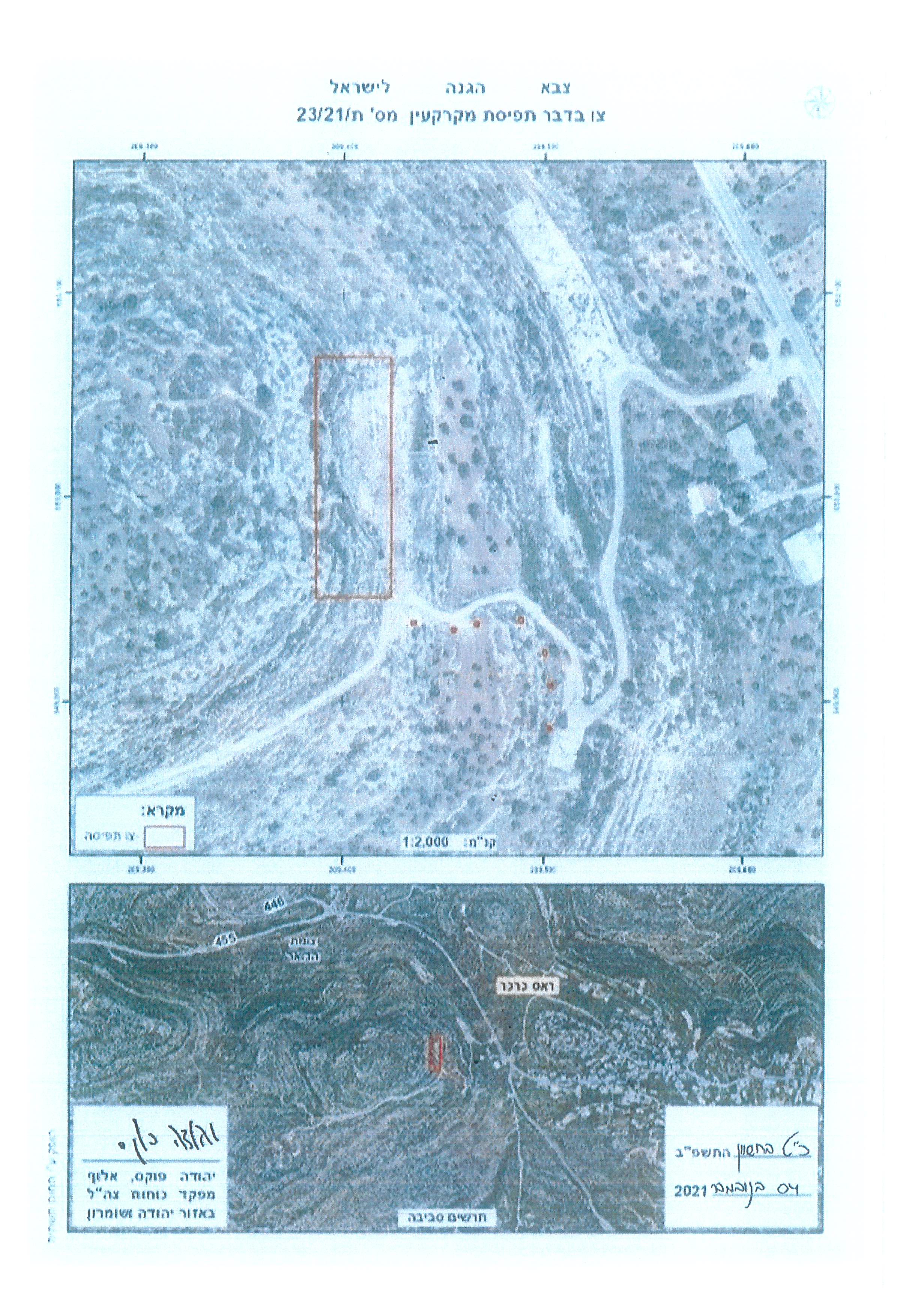
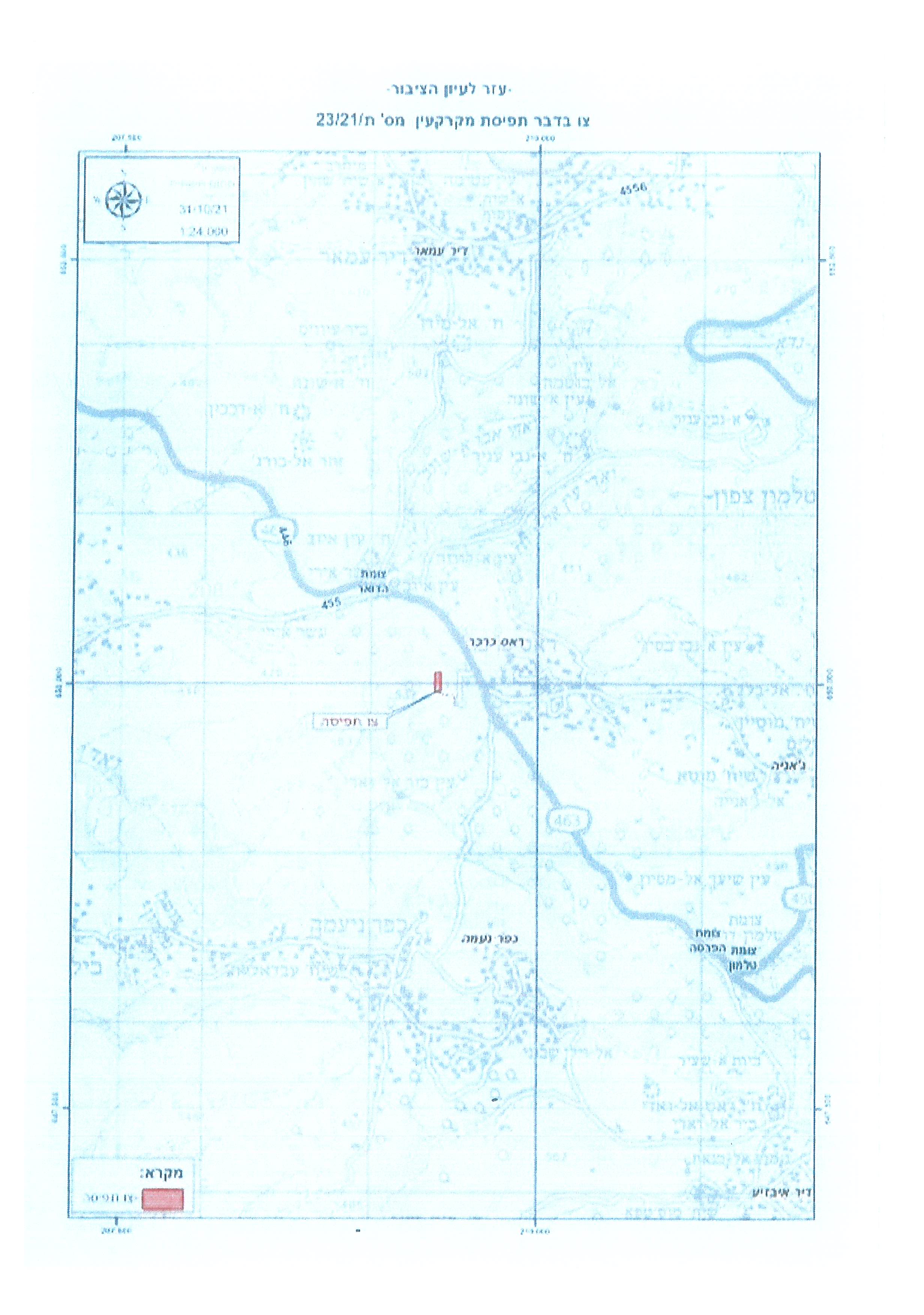
According to the military order, the targeted location is in natural block 7 of Jabal Al-Risan location in Ras Karkar , and natural block 2 on Al-‘Awared location in Kufur Nea’ma village.
The targeted lands are olive groves, that are accessed by a roads network.
On the other hand, Ras Karkar village council head Radi Abu Fkhaitha told LRC:
“The targeted lands are in a strategic location in Kufur Nea’ma village, Ras Karkar , Kharabtha Bani Harith , and is accessed by agricultural roads network used by farmers to access their lands at the mountain , now if the Israeli government lays control over these areas there will be more restrictions and dangers on farmers who want to access any of their lands in Ar-Risan mount.”
The targeted lands in the confiscation notice are only 200 m away from an outpost established in 2018 at the area, it is also possible that the occupation will annex the recently seized lands to expand the colony’s area of control.
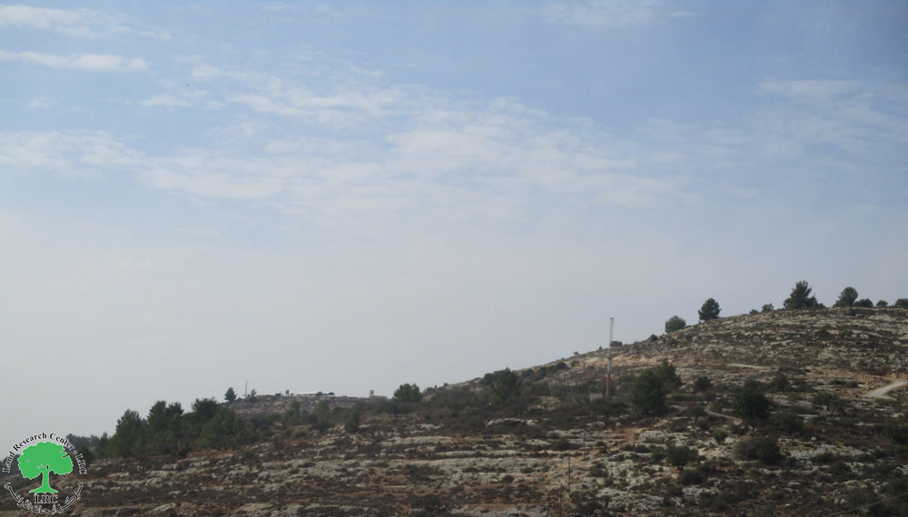
The targeted lands
|
|
|
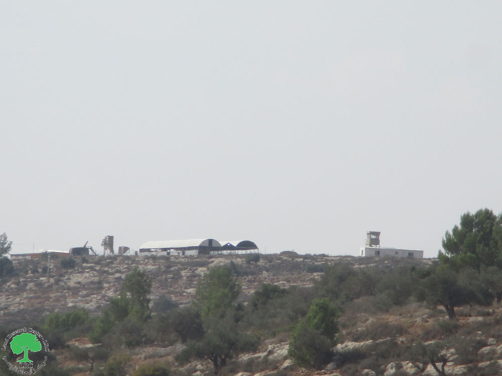
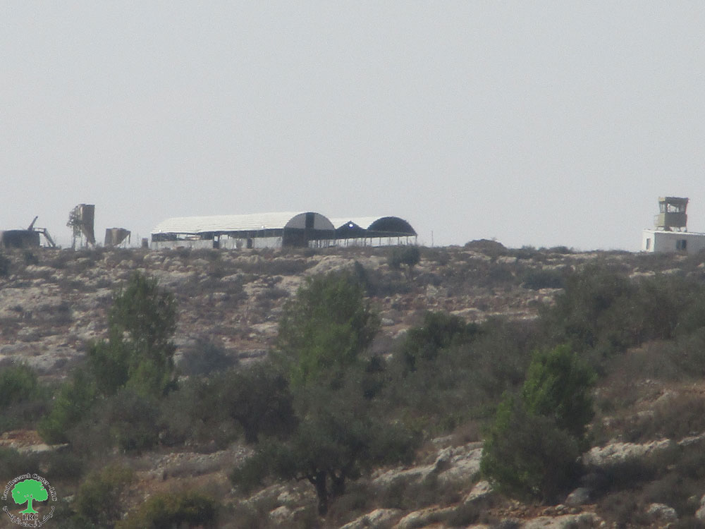
The Israeli outpost at Ar-Risan Mountain and the targeted lands
|
|
|
|
|
|
Kufur Ne’ama village:[1]
12 kilometer west Ramallah, Kufur Ne’ama is surrounded by Ras Karkar and Kharabtha Bani Harith (north), Bal’in (west), Deir Ibzei’a and Aj-Janiya (east) , and Saffa and Beit ‘Or At-tihta (south).
Kufur Ne’ama has a total population of (4,569) people until 2017 census.
Kufur Ne’ama has a total area of 8,190 dunums, of which 1,000 dunums are a built-up area for the village.
Land categorization according to Oslo accords:
- B area : (6,078) dunums.
- C area: (2,112) dunums.
Ras Karkar:[2]
15 kilometer north west of Ramallah, Ras Karkar is about 500 m above sea level, and has a total area of 5,050 dunums, of which 330 dunums are a built up area.
Ras Karkar is surrounded by Deir ‘Ammar (north), Kafr Ni’ma and Deir Ibziq (south), Al Jania (east), Bani Harth (west).
Ras Karkar has a population of 1956 people according to statistics conducted by the Palestinian Central Bureau of Statistics in 2017.
The Israeli occupation devoured more than 32 dunums of the lands of the village for Talmon C colony which was built in 1989. Moreover, bypass number ‘463 took over 295 dunums of the village lands.
According to Oslo Accords, 19% of Ras Karkar is under Area B (PA has full civil and security control) while most of the village lands (81%) is under Area C (Israel maintains full security and administrative control). Here is the area in dunums:
- Area B (940) dunums
- Area C (4110) dunums
[1] GIS-LRC
[2] GIS-LRC

This Publication has been produced with the assistance of the EU
The Contents of this publication are the sole responsibility of the individual organization only , and can in no way be taken to reflect the views of the EU