
Related
Demolition of a Concrete Floor in Ras Karkar village / Ramallah Governorate

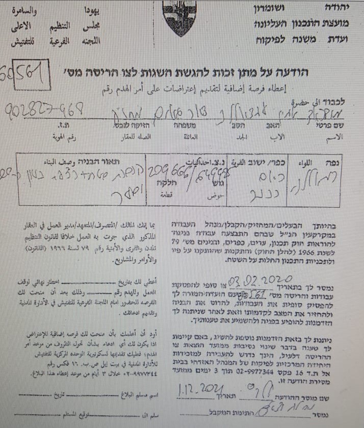
Violation: Notice of Demolition for a Baton Floor.
Location: Ras Karkar village / North Ramallah city.
Date: December 1st 2021.
Perpetrators: The building inspector at the Israeli Civil Administration.
Victims: Citizen Baher Salihiya.
Description:
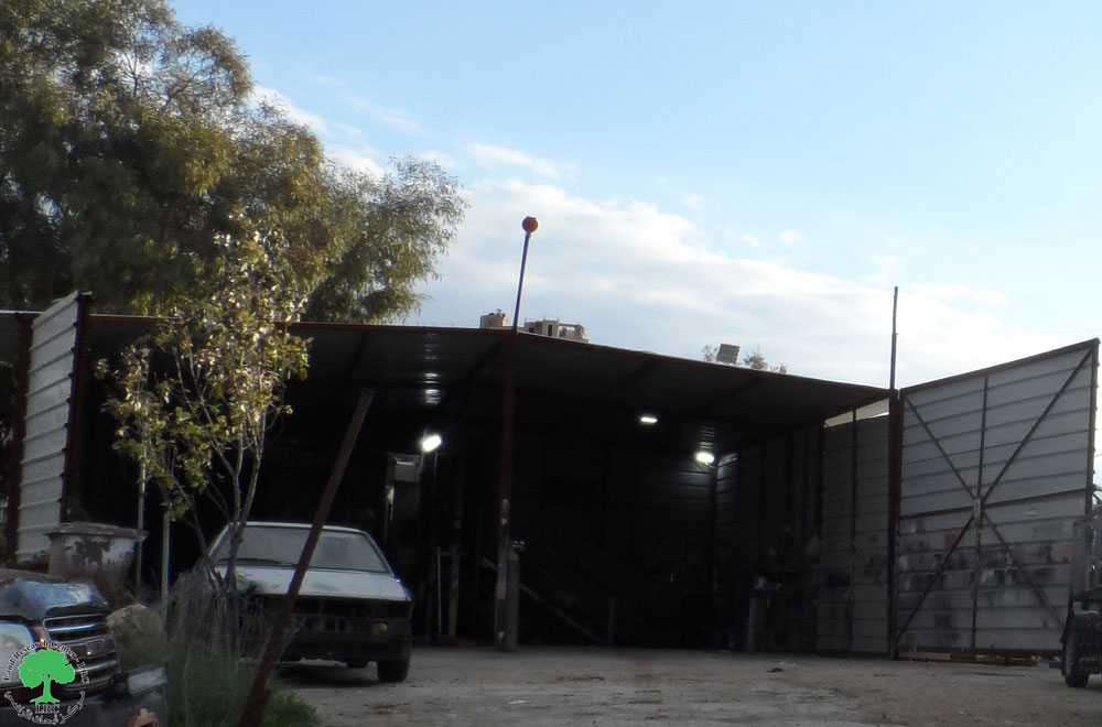
Wednesday morning, December 2021, the building inspector at the Israeli Civil Administration notified a Baton floor with a total area of 26 m2, in front of a shop in Ras Karkar village, belong to citizen Baher As-Salihiya.
According to military order number (60561), the owner was given seven days to object on the military order starting from the issue date, Noting that the owner had previously received a halt of work notice on the same structure in February 3rd 2020, He applied for a license , but the occupation authorities refused and ravaged the floor.
The following table shows more information about the targeted structure:
Affected citizen | Family member | Children | Females | Area (m2) | Military notice number | The targeted facility |
Baher Salhiya | 6 | 2 | 2 | 26 | 60561 | Baton floor |
|
The targeted floor |
Ras Karkar:[1]
15 kilometers north west of Ramallah, Ras Karkar is about 500 m above sea level, and has a total area of 5,050 dunums, of which 330 dunums are a built-up area.
Ras Karkar is surrounded by Deir ‘Ammar (north), Kafr Ni’ma and Deir Ibziq (south), Al Jania (east), Bani Harth (west).
Ras Karkar has a population of 1956 people according to statistics conducted by the Palestinian Central Bureau of Statistics in 2017.
The Israeli occupation devoured more than 32 dunums of the lands of the village for Talmon C colony which was built in 1989. Moreover, bypass number ‘463 took over 295 dunums of the village lands.
According to Oslo Accords, 19% of Ras Karkar is under Area B (PA has full civil and security control) while most of the village lands (81%) is under Area C (Israel maintains full security and administrative control). Here is the area in dunums:
- Area B (940) dunums
- Area C (4110) dunums
[1] GIS-LRC

This Publication has been produced with the assistance of the EU
The Contents of this publication are the sole responsibility of the individual organization only , and can in no way be taken to reflect the views of the EU