Related
Demolition Order for Barghouthi family in Deir Ghassana village / Ramallah governorate

Violation: Demolition Order target a farm on the pretext of building without a license.
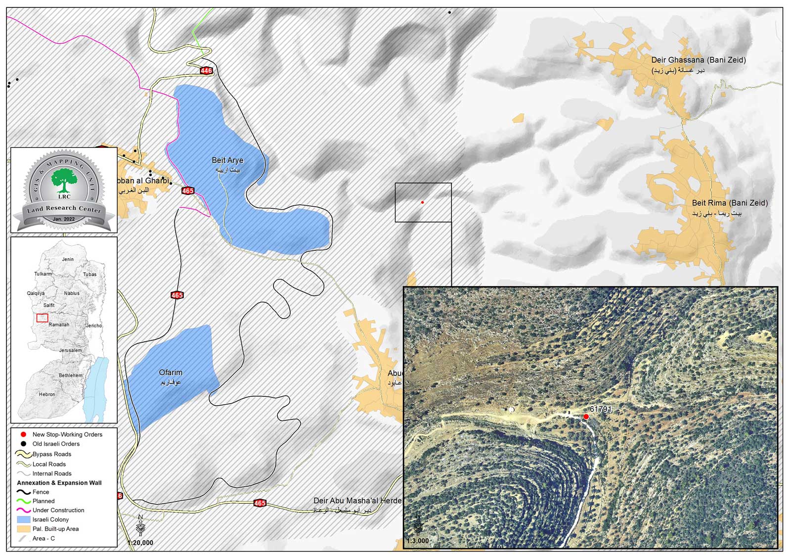
Location: Wad Az-Zarqa – Deir Ghassana / Ramallah governorate.
Date: December 14th 2021.
Perpetrators: The building inspector at the Israeli Civil Administration.
Victims: Farmer Naseef Al-Barghouthi.
Description:
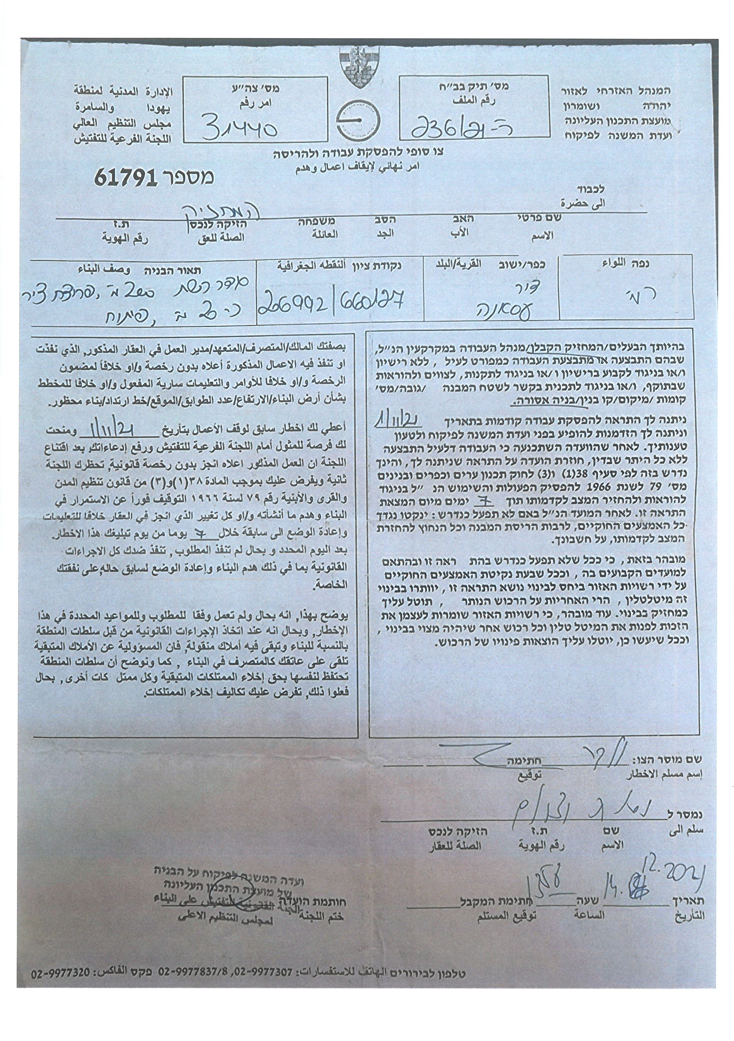
Tuesday, December 14th 2021, the building inspector at the Israeli Civil Administration gave citizen Naseef Al-Barghouthi from Der Ghassana , a final demolition order on his three dunums farm, on the pretext of building without a license.
According to the military order (61791) , the Israeli occupation sat a period of 7 days to return the plot to its previous status. Noteworthy, the owner received a previous halt of work order in November 1st 2021.
Affected farmer Ahmed Al-Barghouthi told LRC:
“In April, I started rehabilitating the plot that I inherited from my father and planting it with Olives and Avocado, only few months later I received a notice from the occupation, which was shocking because I didn’t know what was the reason, and I know that my plot is located away from Israeli colonies . it seems that the only reason is to oppress us.”
The farm belongs to citizen Ahmed Al-Barghouthi , who supports a family of four , among them one child.
The targeted farm

A final demolition orders
Noteworthy, Wad Az-Zarqa area is a hot spot for Israeli violations, mostly represented in hindering and destroying rehabilitation projects and ravaging springs.
Deir Ghassana village:
Deir Ghassan is located within Bani Zayed Al-Gharbiya community, which contains Deir Ghassana and Beit Rima and placed 25 km north west Ramallah, it is surrounded by Bruqin and Kafr Ad-Deek (north) , Al-Lubban Al-Gharbi (Beit Aryeh settlement) (west) , Kafr Ein (east) and Beit Rima (south).
Deir Ghassana has a total population of (1692) people, according to 2017 census.
Bani Zayed Al-Gharbiya community has a total area of 21,978 dunums , of which 394 dunums are a built up area for Deir Ghassana , and 848 dunums are a built up area for Beit Rima.
The Israeli occupation confiscated about 1000 dunums of Deir Ghassana lands for the following purposes:
- Bypass 446 devoured (780 dunums).
- The apartheid wall (siege) , which is 1,526 m, ate up (135) dunums under its route , and isolated 812 dunums.
Oslo accords divided Bani Zayed Al-Gharbiya community as the following:
- A area : (6,407) dunums.
- B area: (8,452) dunums.
- C area : (7,119) dunums.

This Publication has been produced with the assistance of the EU
The Contents of this publication are the sole responsibility of the individual organization only , and can in no way be taken to reflect the views of the EU

