
Related
Initiating the construction of a new colonial road on the lands of the village of Ein Yabroud and the city of Al-Bireh / Ramallah governorate
• Violation: the initiation of a new colonial road.
• Location: the lands of the village of Ein Yabroud and the city of Al-Bireh / Ramallah governorate.
• Date of violation: 05/22/2022.
• The aggressor party: the settlement of "Bethel".
• Affected party: a large number of Palestinian farmers in the area.
• Details of the violation:
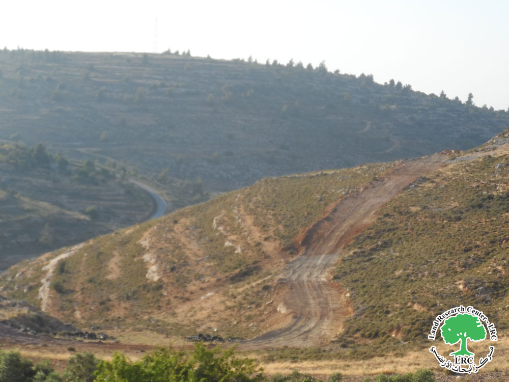
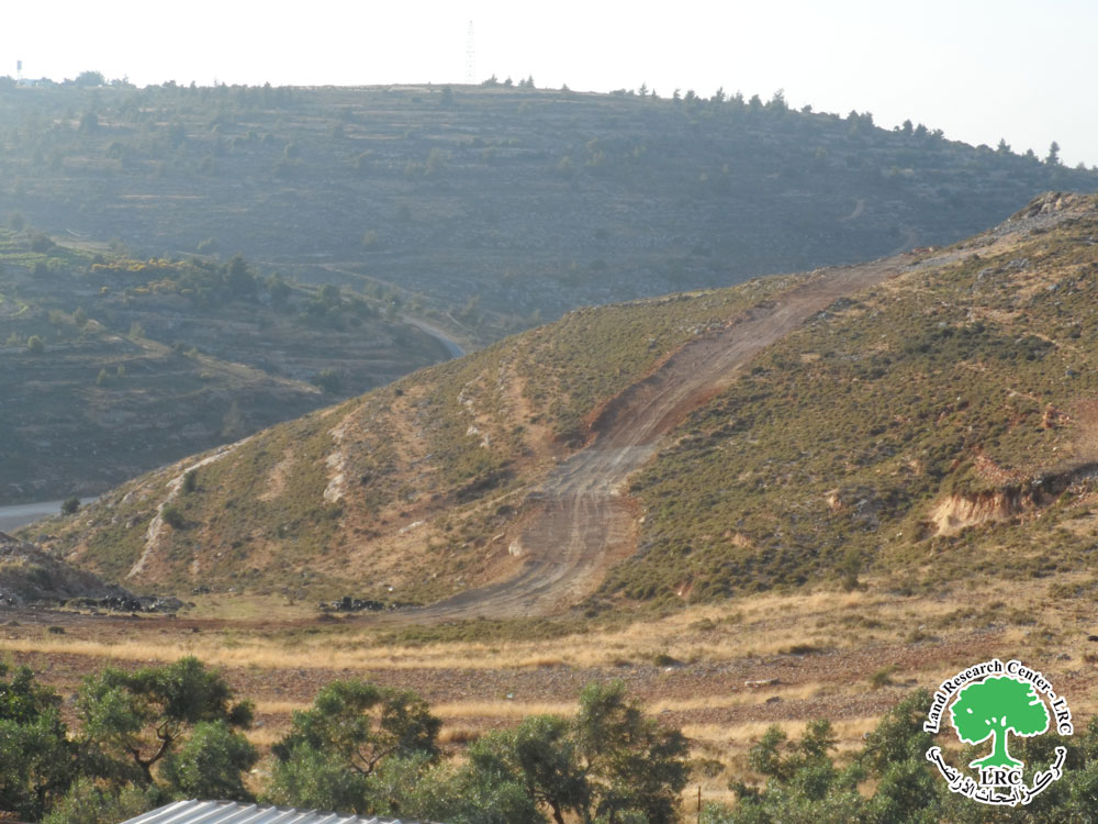
A group of settlers, under the cover of darkness at dawn on Sunday (22/5/2022), and through private civilian bulldozers belonging to them, began building a new colonial road on the lands of the village of Ein Yabroud to the outskirts of the city of Al-Bireh, with the aim of seizing more agricultural lands and facilitating control over it. This is in order to expand the lands under the control of the settlement of "Beth El".
According to the field follow-up at the site of the violation, the settlers, until the date of preparing the report, built and rehabilitated an old agricultural road located to the west of the village of Ein Yabroud within the area known as “Wadi Al-Masyat”, where actually the area is located east of the settlement of “Beit El”, which is considered an area of an agricultural, in terms of the presence of a large number of farms belonging to the settlers there, while the occupation there for many years has prevented Palestinian landowners from exploiting their lands there, even plowing the land has become fraught with dangers in that area.
The length of this road is approximately 1500 meters with a width of (5) meters, linking the farms to the settlement of “Beit El.” In addition, another secondary road was built at the foot of a hill overlooking the farms’ areas with a length of 300 meters, where this road is only 250 meters away from the houses of the village, and it is not excluded that this road will serve the Israeli occupation army by establishing an Israeli occupation army observation point on the outskirts of the road.
It is clear that what the settlers did was without any military notification issued by the occupying army. Rather, the decision to work in this way was made through the regional council of that settlement.
Mr. Muhammad al-Ghoul, deputy head of the village council of Ain Yabroud, told the field researcher of the Land Research Center the following:
“What the settlers did was an attack on private lands owned by the people of the village according to official Turkish Tapu documents, and there is a fear that this road is a prelude to expanding the influence of the organizational structure of the settlement, at the expense of the village lands, and it is also not excluded that the settlers will seek to control more of the lands, especially the lands that will lie behind the settlement, which amounts to 160 dunams.”
|
|
|
|
|
|
|
|
|
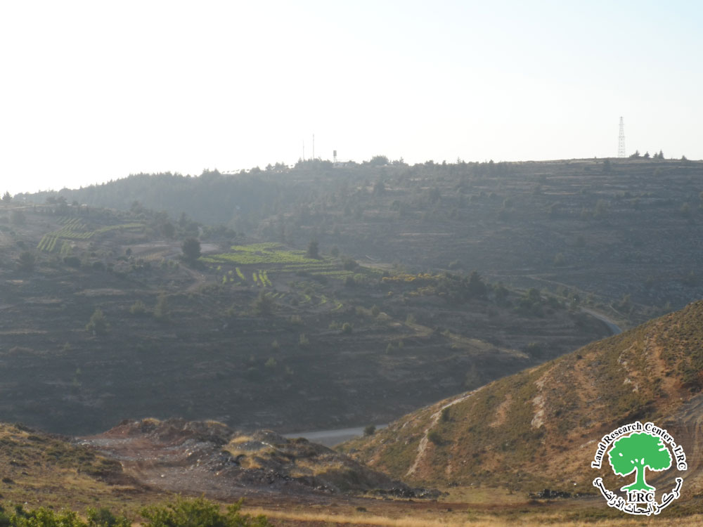


The occupation does not hesitate to seize the agricultural lands surrounding the settlements with the aim of building colonial roads, which are often used for the benefit of any future expansion of the settlement and pave the way for the seizure of lands there in the area for military purposes that ultimately serve the Judaization activity There are many examples of this, as the eastern slopes of the towns of Frossh Beit Dajan and Beit Furik are the greatest evidence of this, as roads were built there by the colonists in favor of linking it to the Itamar settlement in preparation for the annexation of new lands for the expansion plan.
About Ein Yabrud[1]
6 km north east Ramallah, Ein Yabrud is bordered by Silwad (north), Dura Al-Qare’a (west) , At-Taiba and Ramon (east) and Deir Dibwan and Betin (south).
Deir Dibwan is populated (2515) people in 2017 census.
Dei Dibwan has a total area of (11,401) dunums, (1,177) are the town’s built up area.
1: Israeli settlements devoured about (1563) dunums, for the following purposes:
Settlement name
|
Establishment year
|
Confiscated lands in dunums
|
Number of settlers
|
Beit El
|
1977
|
135
|
4627
|
Ofra
|
1975
|
1,428
|
2214
|
Bypass 60 devoured about (283) dunums.
Osslo accords divided the land as the following:
- B area (4,010) dunums.
- C area (7,391) dunums.
[1] GIS-LRC