
Related
"Beit Arieh" settlers flood the western Laban lands with waste water in Ramallah governorate

Violation: pumping wastewater, which led to the destruction of a number of trees.
Location: Al-Batin District - Al-Lubban Al-Gharbi Village / Ramallah and Al-Bireh Governorate.
Violation date: May 26, 2022.
Perpetrators: Beit Arieh settlement.
Affected party: a number of farmers in the village.
Violation details:
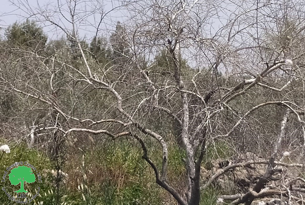
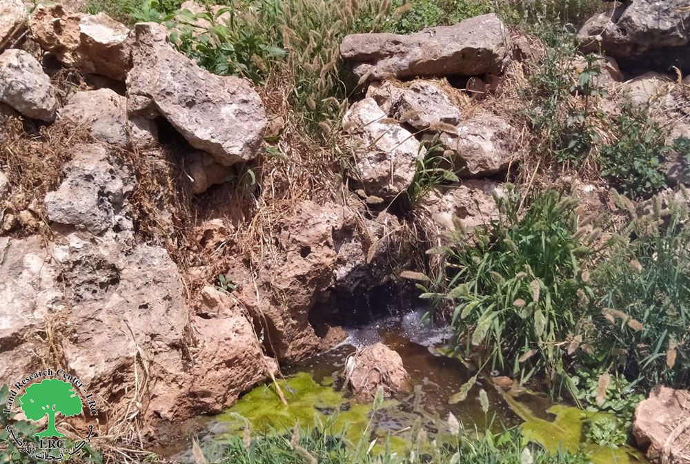
On Thursday morning, May 26, 2022, the Beit Arieh settlement pumped large amounts of untreated wastewater towards the fields planted with olive trees in the Al-Batin area, north of the Al-Lubban Al-Gharbi Village. The area is located near the fence surrounding the settlement.
The wastewater completely destroyed 13 olive trees aged 20 years, in addition to that 24 olive trees were partially damaged, and 25 dunums of agricultural land were badly damaged due to being inundated with waste water.
The victim, Hajj Ahmad Radwan (78 years), told the field researcher at the Land Research Center as follows:
“The pollutants emanating from the wastewater have become a focus of sleeplessness for us, as weeds have spread among the olive fields, and insects and snakes have spread greatly, and this has threatened our lives. The wastewater has also destroyed the olive fruits and we have lost many trees, and this phenomenon we have been suffering from for many years. It got a lot worse recently”.
It should be added that wastewater is considered one of the main challenges facing a large number of farmers, and the settlers deliberately increase the pumping of wastewater towards the agricultural fields, which led to the damage of a large number of trees in the area.
It must be mentioned that the wastewater pumped from the settlement travels a distance of no less than 400 meters between the olive fields until it reaches the edge of the bypass road that connects the Beit Arieh settlement with the occupied lands in 1948 AD, which penetrates the village itself until it passes near a number of residential houses belonging to Al-Lubban Al-Gharbi.
Radwan also added:
“We, a large group of farmers, submitted a large number of complaints to the occupation police, but to no avail. We were addressed by the so-called civil liaison, also to no avail, and we do not know what we will do, knowing that the damages are increasing day by day”.
|
|
|
|
|
|


The settlement of Beit Arieh on the lands of the village of al-Lubban al-Gharbi considered to be one of the real challenges facing the residents of the village, as settlements expansion and the seizure of agricultural lands in the village, in addition to the organizational settlement schemes, which have a negative impact on the natural right to build and expand for the residents of the village.
It is noteworthy that the "Beit Aryeh" settlement - according to the continuous follow-up of the research team at the Land Research Center - witnessed during the past three years the establishment of new residential neighborhoods in it, where those neighborhoods were concentrated on the southern and western side of the colony, which led to the doubling of the size of that colony to twice its current size compared to what it was previously. This gives a clear indication of the occupation's interest in developing the colonial settlements there and creating a reality that prevents the creation of geographical contiguity between the Palestinian residential communities.
Al-Lubban Al-Gharbi village[1]
30 km northwest Ramallah, Al-Lubban Al-Gharbi is surrounded by Deir Ballut (north), Rantees and the greenline (west), Aboud (east) and Bani Zaid (west). Bayt Areh settlement is built on confiscated lands (east), Aboud and Rantis (south), it is also blocked by ‘Ofarim settlement (south).
Al-Lubban Al-Gharbi has a total population of (1566) people in 2017 census.
The village has a total area of 10,779 dunums, of which 280 dudums are a built up area for Al-Lubban Al-Gharbi.
The occupation confiscated (2369) dunums for the following:
Israeli settlements devoured about (1126) dunums as the following:
| Settlement | Establishment year | Area in dunums | Number of settlers for 2018 |
| Beyt Areh | 1981 | 841 | 5,353 |
| ‘Ofarim | 1988 | 285 | NA |
Bypasses 445 and 446 devoured 602 dunums.
- The apartheid wall:
- The existing apartheid walls 6,407 m; it ate up 641 dunums.
- The under-construction segment of the apartheid wall is (4,801) m, it will eat up 480 dunums.
In case the construction was completed, the wall will isolate (2,914) dunums.
According to Oslo accords the village lands are divided as the following:
· B area: 305 dunums.
· C area: 10,474 dunums.
[1] GIS-LRC