
Related
The colonial project of the light rail, and the gnawing of Jerusalem lands in Beit Hanina - occupied Jerusalem
The light rail project implemented by the occupation municipality since 2002 continues to devour more of the residents’ lands throughout the city. Its extension from the south of the city has eaten up lands from the village of Beit Safafa and Sharafat, while in the north it will largely target the lands of Shuafat and Beit Hanina, and other villages that it passes through it and cuts it off, and every time the municipality announcing the expansion of the train track, the and Palestinian landowners residents are notified of the confiscation of their lands and prevented from disposing of it such as building, selling, buying or investing in it, as happened with Mr. Samer Al-Shweiki in May 2022, when his facility was bulldozed under the pretext of the light rail.
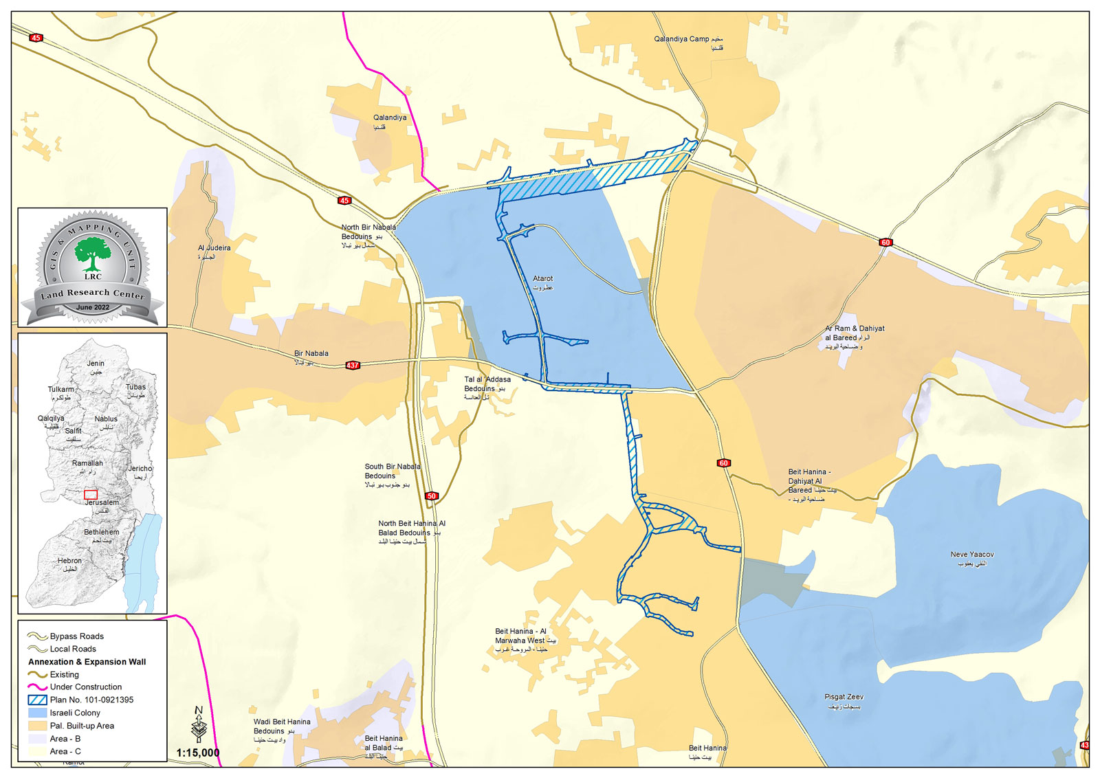
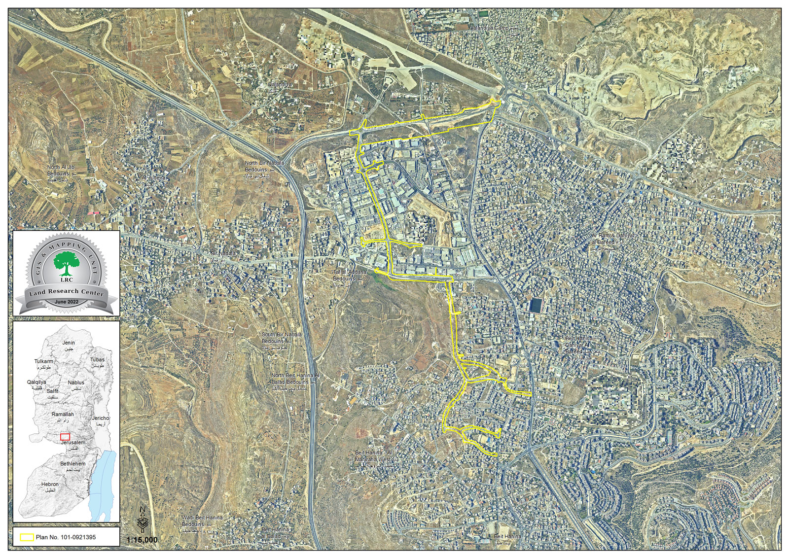
Maps show the extension of the project in the areas of Beit Hanina, Shuafat and Atarot
It is noteworthy that the light train crossing the city of Jerusalem reached a length of about 22, and the last thing that was announced was the extension of the light train line on the lands of Beit Hanina, in order to connect the Atarot industrial area with Jerusalem, and the light train passes from Beit Hanina on the western side and branches inside it from the Jerusalem Road - Ramallah to Abd al-Hamid Shoman Street in the heart of the town, from Dahiyat al-Barid in the north to Atarot, and in Shuafat to the south of Beit Hanina.
|
|
|
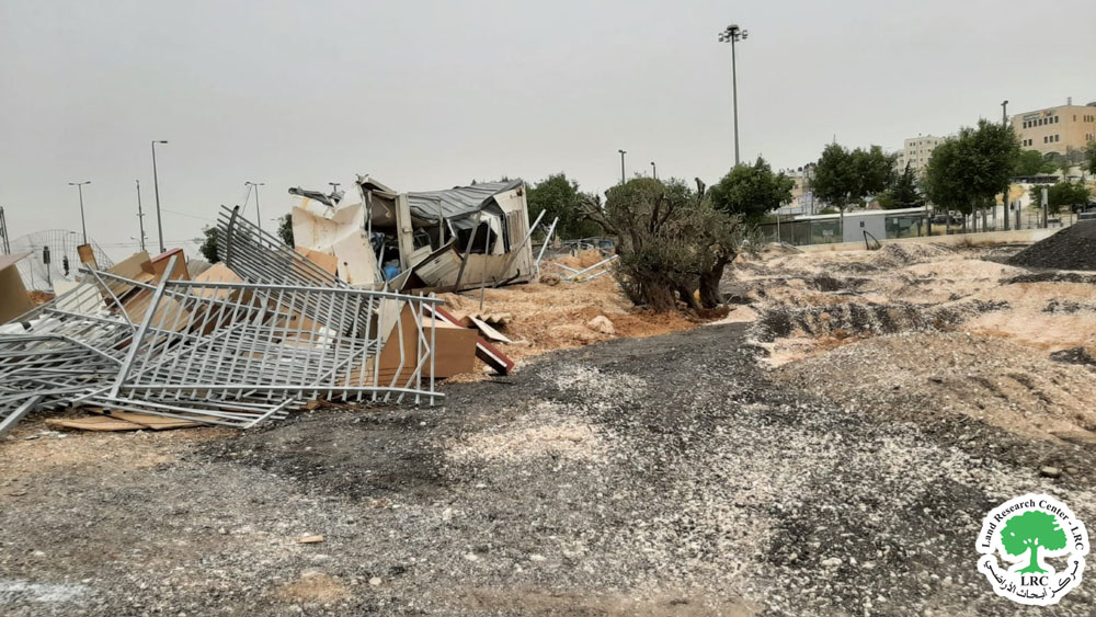
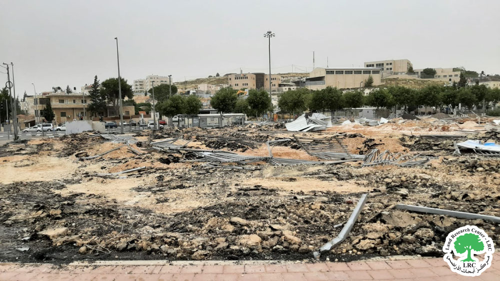
Photos show the demolition of a commercial facility owned by Mr. Samer Al-Shweiki on the pretext of the light rail project
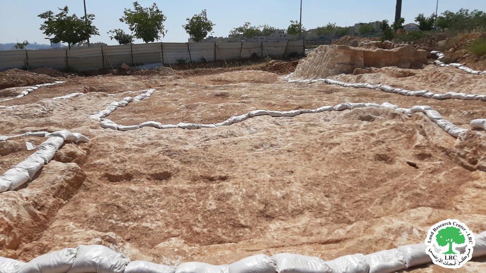
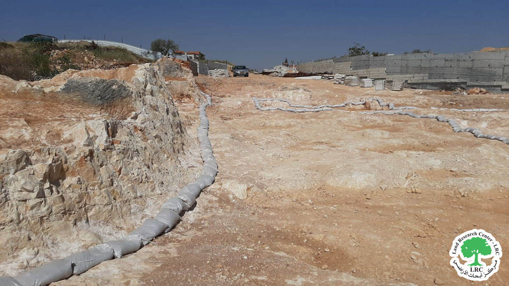
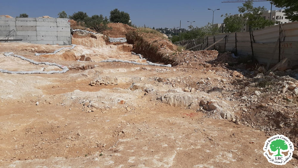
As for the implementation of this project announced in March 2022, a large area of citizens’ lands were confiscated in Beit Hanina, Shuafat, Dahiyat al-Barid, and other neighborhoods crossed by the train. In light of this, an announcement was made for the acquisition of lands amounting to about 82 dunums from (Al-Awd: 30605 Al-Kharayeb, 30606 Addas, 30607 Aqaba, 30610 Al-Koliya until Al-Farir School) and from the lands of Shuafat (the basins 31298, 31301, 31302), thus preventing residents from using these lands are considered lands under the full control of the municipality in order to establish the light rail project.
As for the phenomena that have been repeated over the years through the construction of roads or train tracks in Jerusalem, the emergence of many archaeological sites along these roads. On the one hand, these monuments are discovered and vandalized, and on the other hand, the land on them is confiscated anywhere, as is the case in Beit Hanina these days, in conjunction with the construction of the light rail..
|
|
|
|
|
|
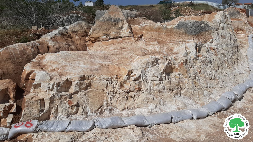
show the archaeological ruins discovered in Shuafat during the excavation of the light rail railroad
Beit Hanina village
The village of Beit Hanina - about 16,284 dunams, with a population in 2007 of more than 27 thousand people - is located to the north of Jerusalem, surrounded to the north by Ram, to the west by Beit Hanina to the west, to the east by the settlement of Bizgat Ze'ev, and to the south by Shuafat. Perched on its lands are the settlements of Bizgat Ze'ev and Al-Nabi Yaakov. There are many demolitions that take place on a regular basis, in addition to threatening many homes in the same area, as is the case with all the villages and neighborhoods of Jerusalem that are subject to displacement and Judaization.
[1] GIS - LRC