
Related
Stop-Work military orders in Nahhalin/ Bethlehem
Violation: Delivering military orders against retaining walls and 2 agricultural roads.
Location: Nahhalin / Bethlehem governorate.
Date: July 10 , 2018.
Perpetrators: The Israeli civil administration.
Victims: Salim Rashad's and Hassan Rashad's families , Nahhalin villagers.
Description:
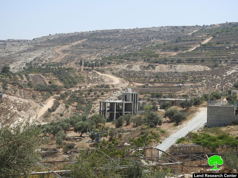
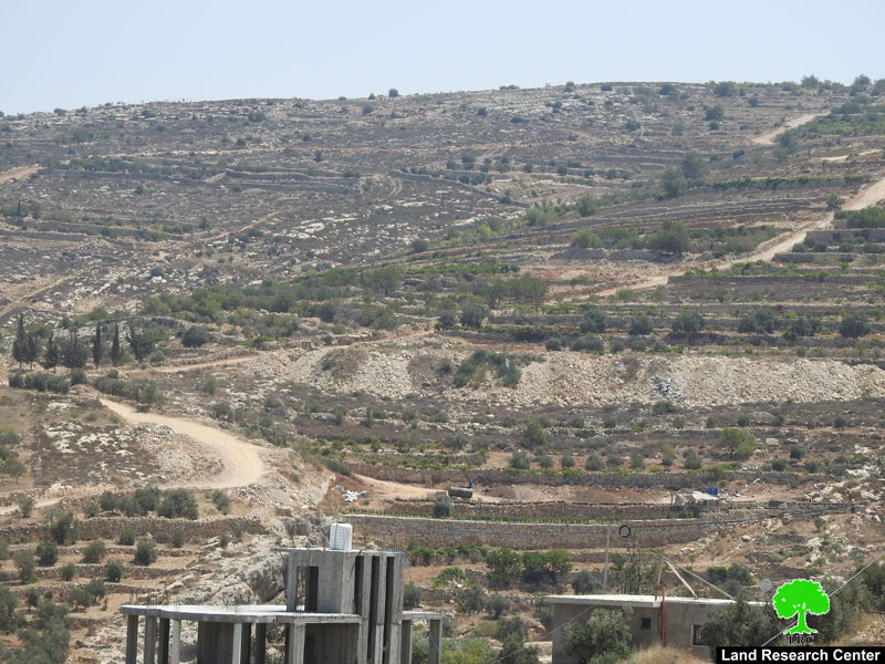
Israeli occupation forces broke into Nahhalin village and delivered a stop-work military order to a retaining wall, and a final order to stop-work on 2 agricultural roads on the pretext of unauthorized constructions.
Mayor of Nahhalin municipality (Sobhi Zidan) told LRC observer:
"The Israeli occupation delivered to military orders to immediately stop-work on 2 agricultural road that help Palestinian farmers to reach their lands"
The first one is named "Wad Salim", it is 1.5 kilometer long , and 6 meter wide
|
|
|
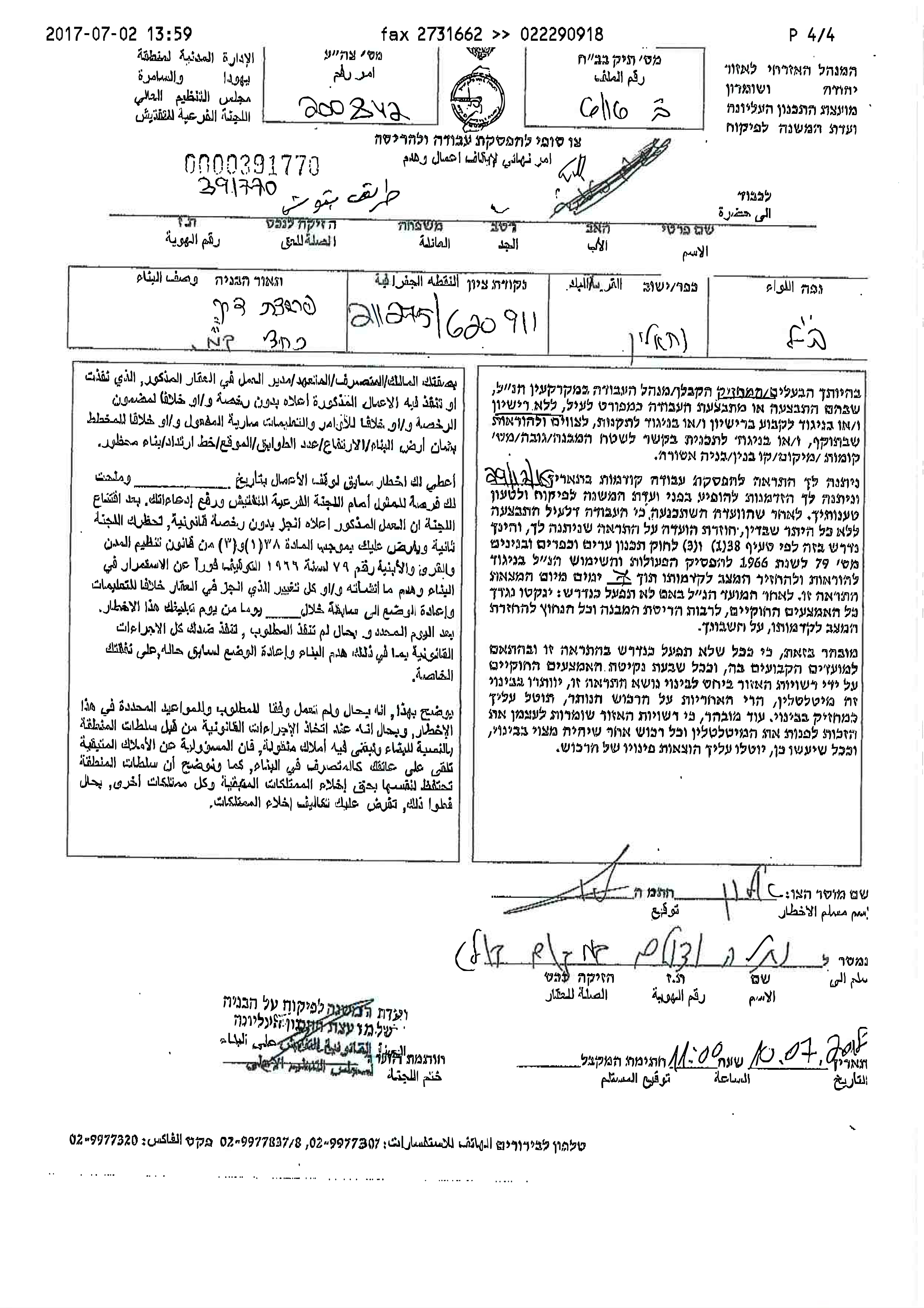
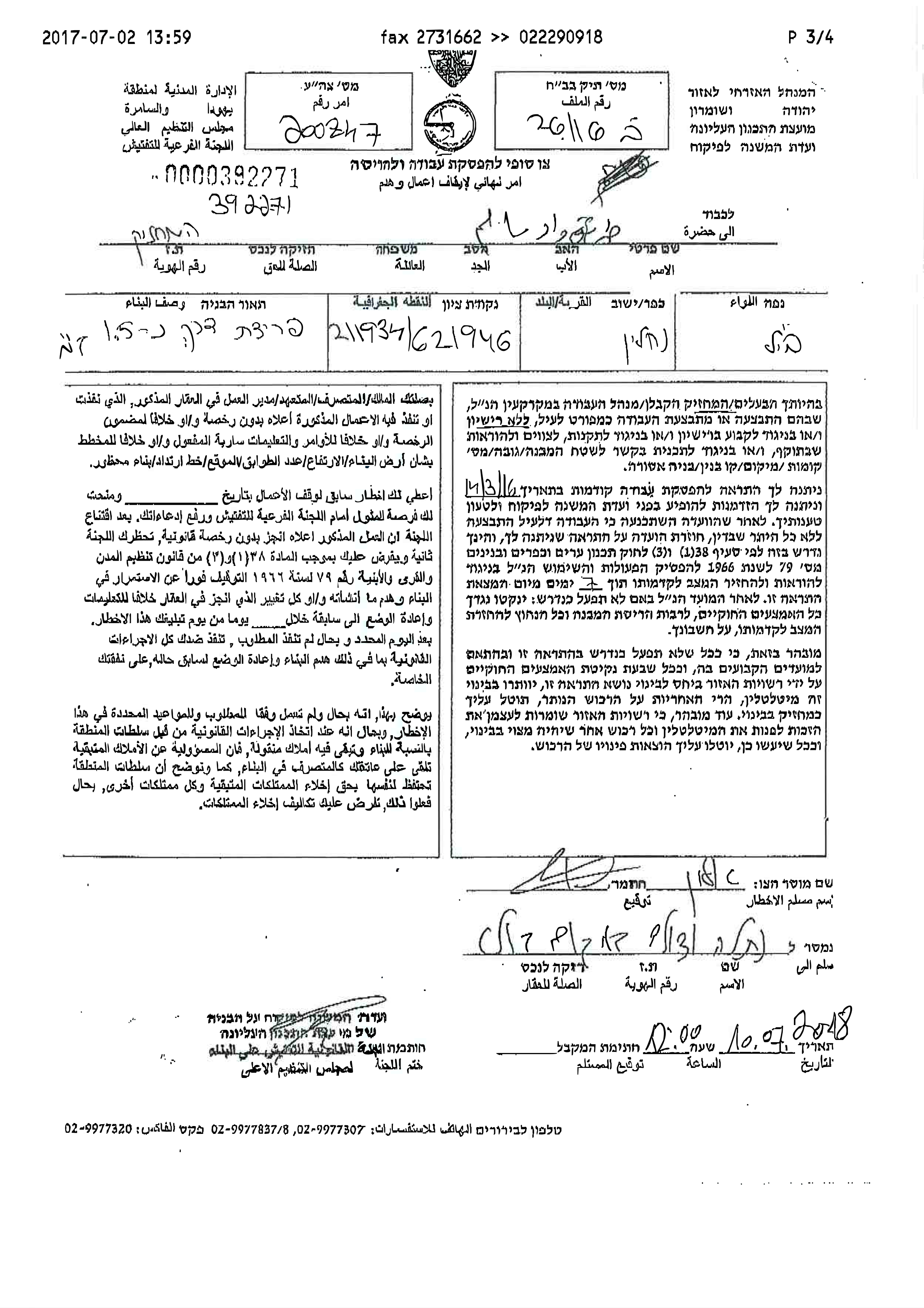 Military order to stop-work and construction of a retaining wall
The second one is named " Baqoush", it is 1.5 kilometer long , and 6 meter wide.
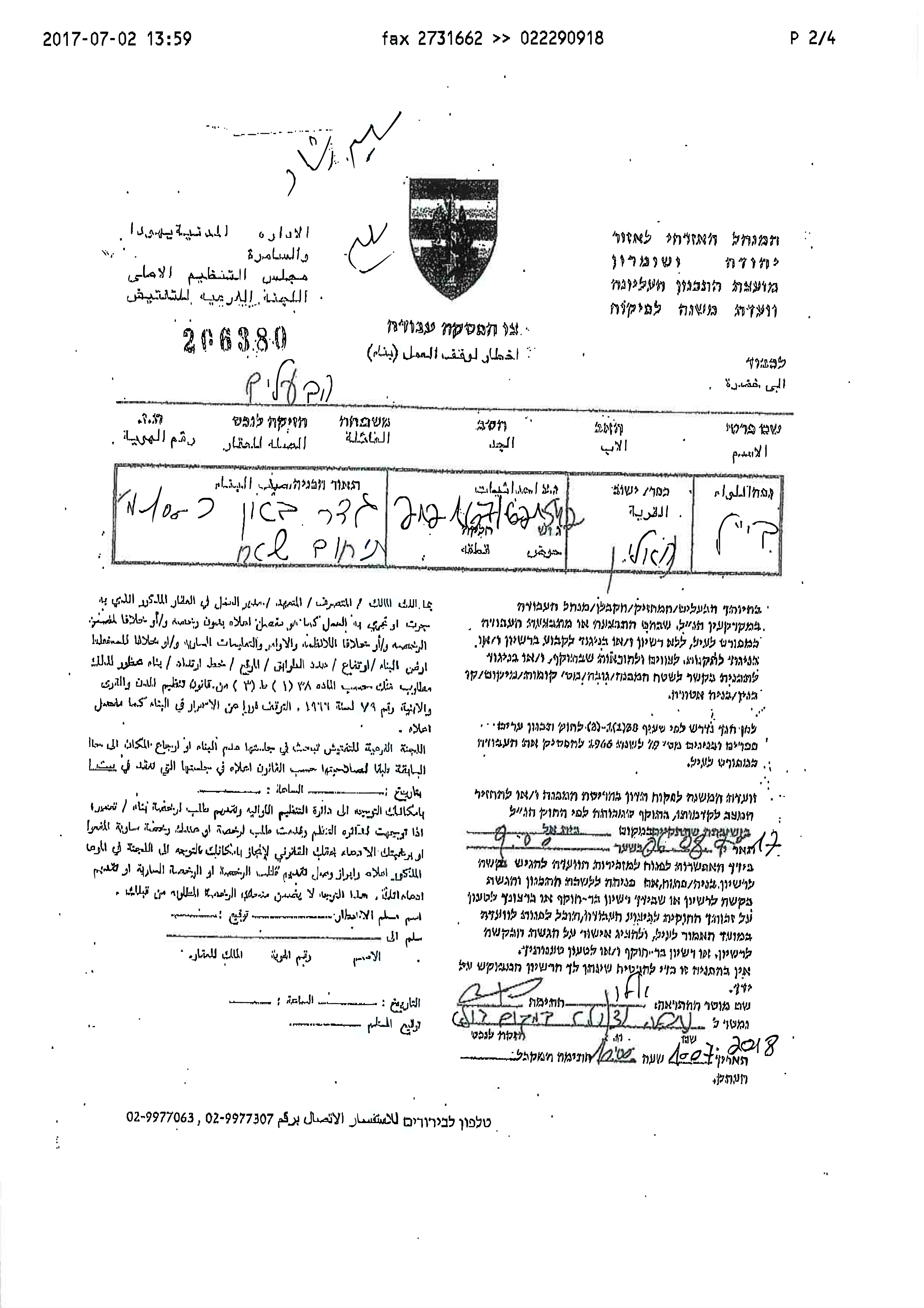
Military order to close "Baqoush" road
Villager Jehad told LRC observer:
"One year ago, Land Research Center opened two agricultural roads, Which facilitated reaching the agricultural area and encouraged farmers to reclaim their lands"
Nahhalin municipality is also working on providing infrastructure projects, to facilitate reaching agricultural lands for farmers, and stop illegal settlements growth.
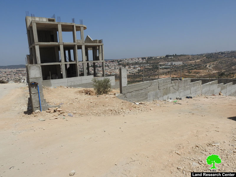
Furthermore, Israeli occupation forces headed to farmer Salim Rashad land who was building a retaining wall and delivered a stop-work military order.
Farmer Salim's mother told LRC observer:
"My son was building a retaining wall around 900 m2 land, The occupation's forces reached the area and tried to confiscate the "cement blender", after they left the place he finished building it manually."
Farmer Salim is attempting to build a home for his family, he has documents to prove that he owns the land and the area is inhabited by Palestinian citizens..
|
|
|
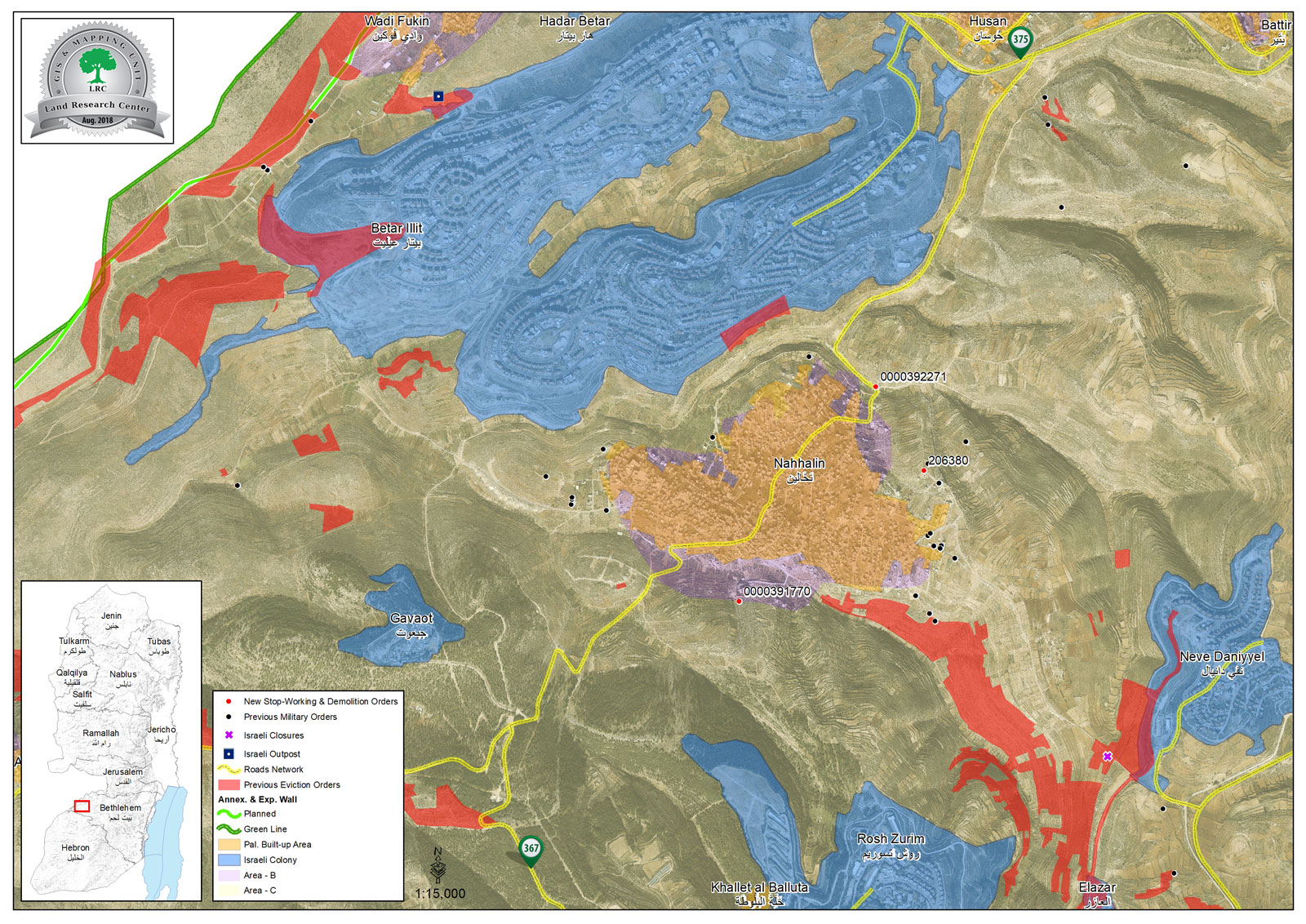
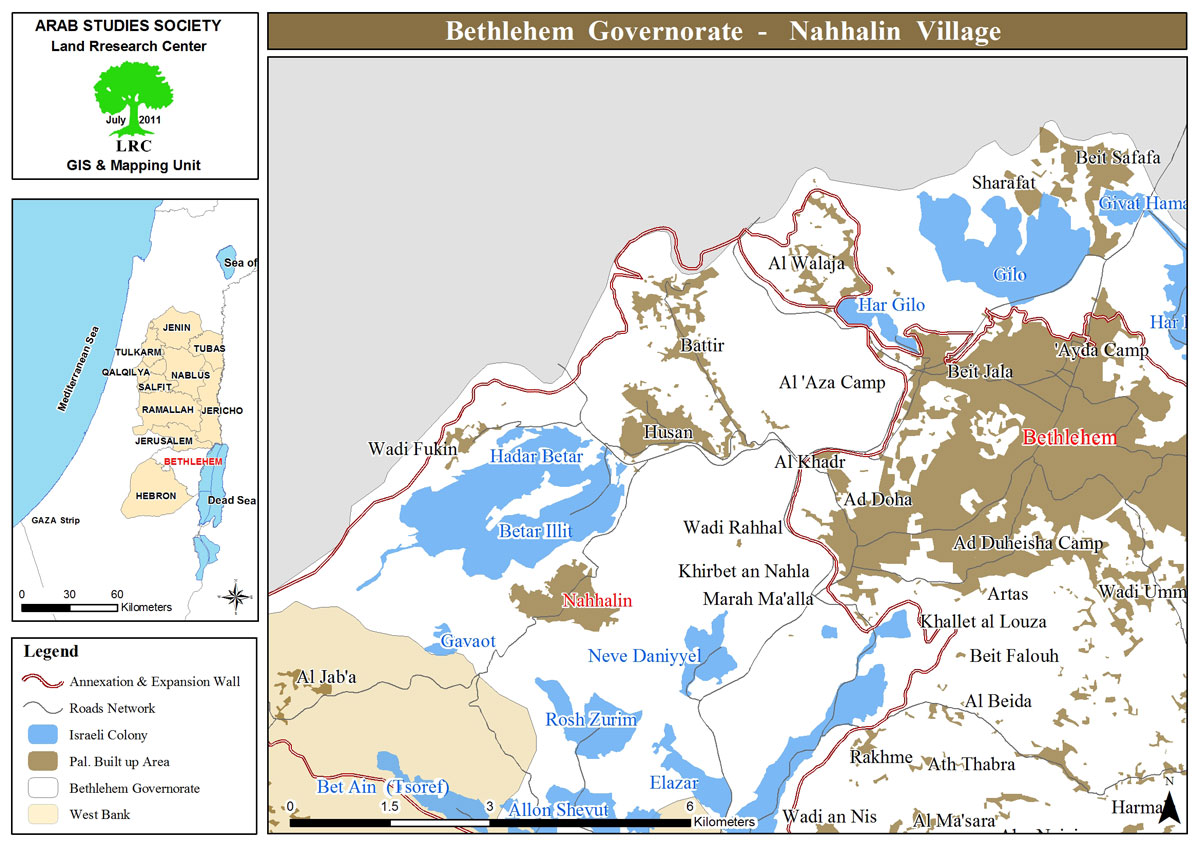
About Nahhalin[1]:
The village is located 10km to the south west of Bethlehem and 3.5 km to the east of the armistice line of 1949.
The village's total area is 18,858 dunums including 890 dunums of built-up area, inhabited by 8741 people according to the PBS statistics of 2017.
Israel has confiscated 4,283 dunums from the village lands 3,583 dunums of which for colonial expansion purposes and 700 dunums for the favor of bypass roads. There are 8 colonies founded on the village land, namely (Beit Ein, Tsoref, Majdal Oz, Jabot, Kfar Etzion, Efrat, Illit, Rosen Tsurem and Allon Shevut).
[1] GIS-LRC

The contents of this document is the sole responsibility of LRC and can under no circumstances be regarded as reflecting the position of the European Union