
Related
Military order to clear out lands in Al-Khader / Bethlehem
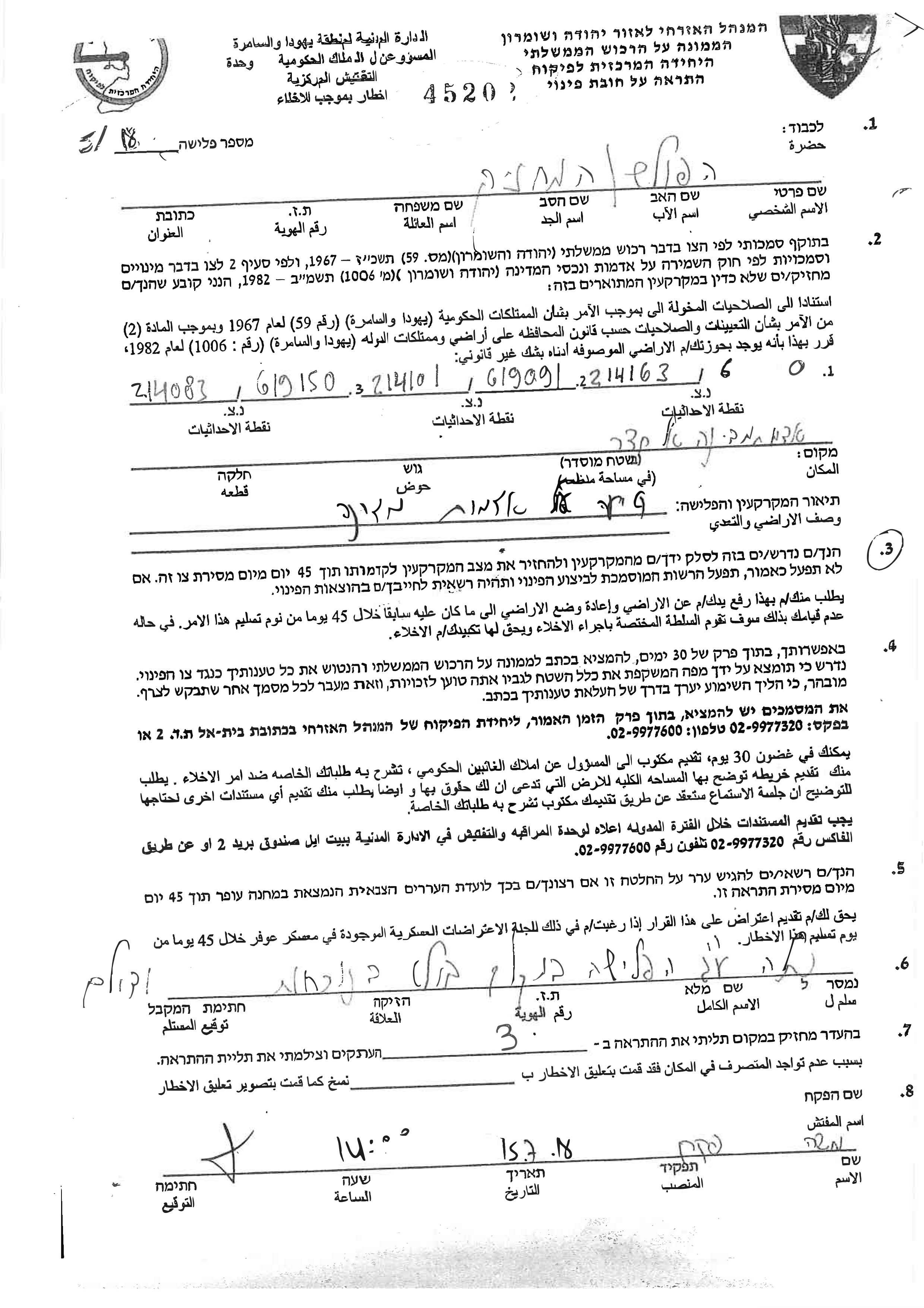
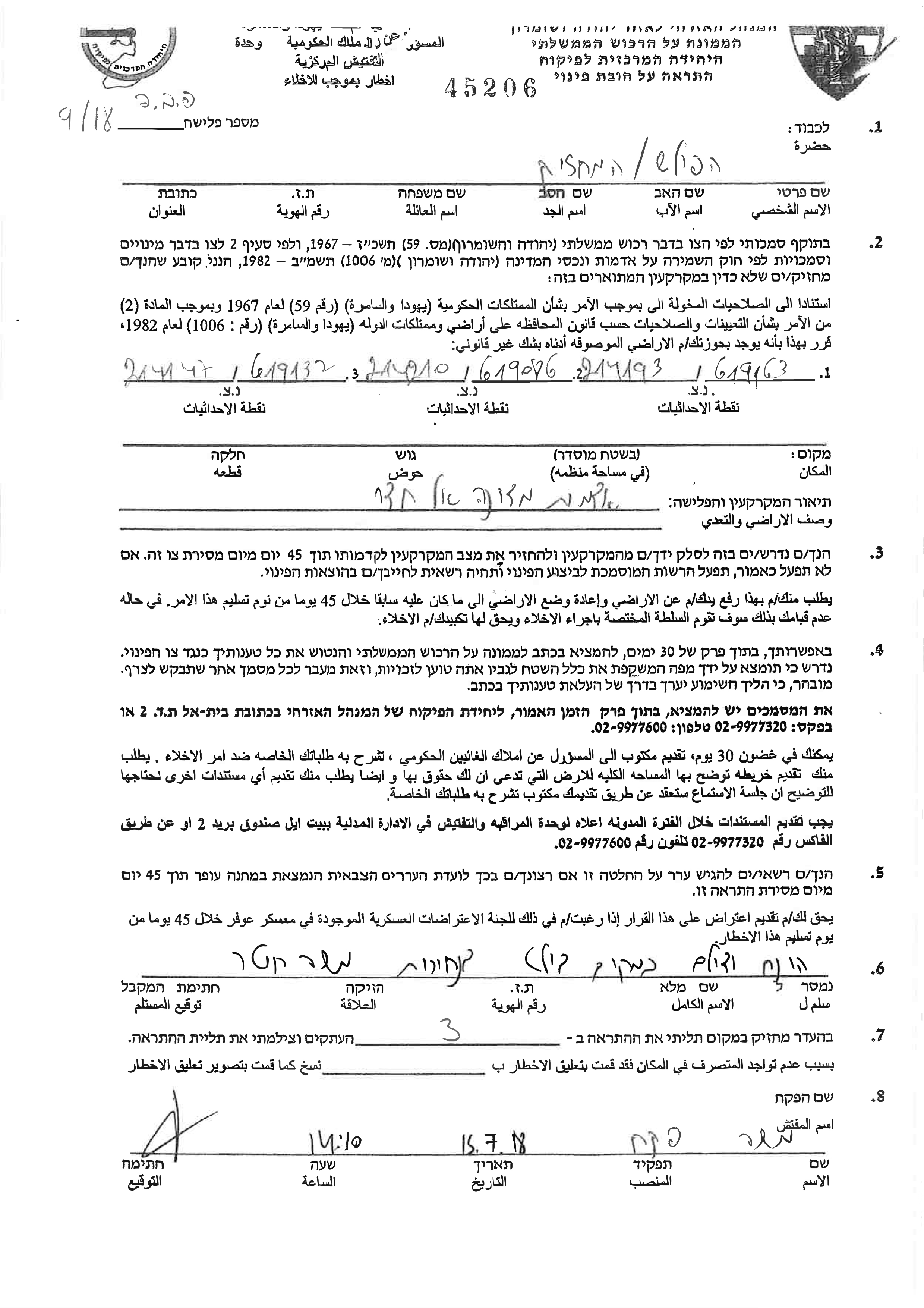
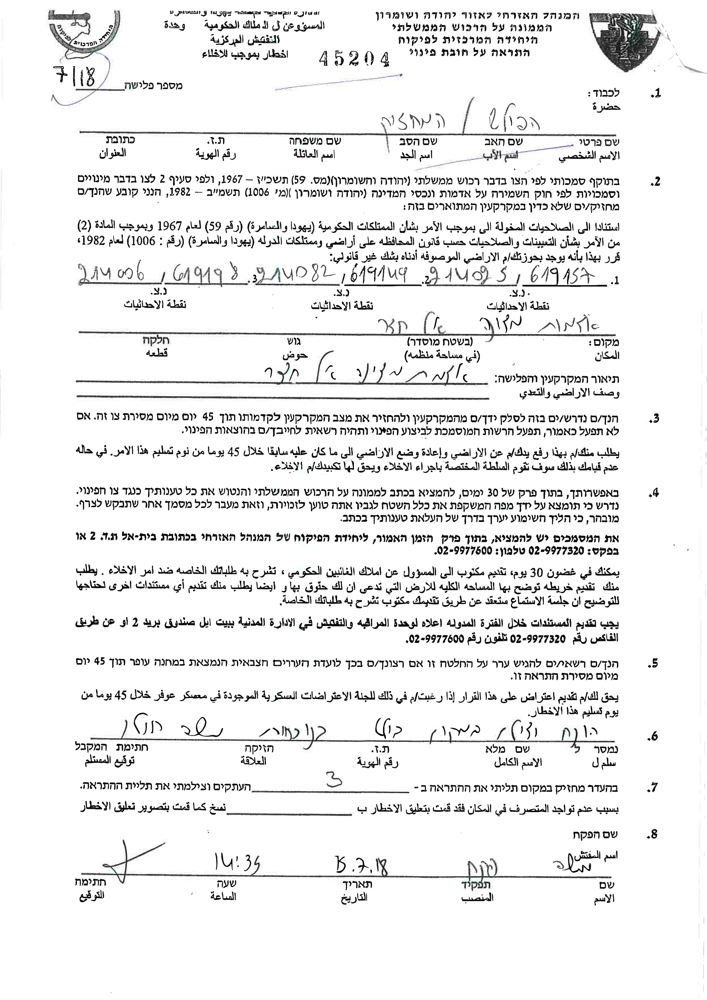
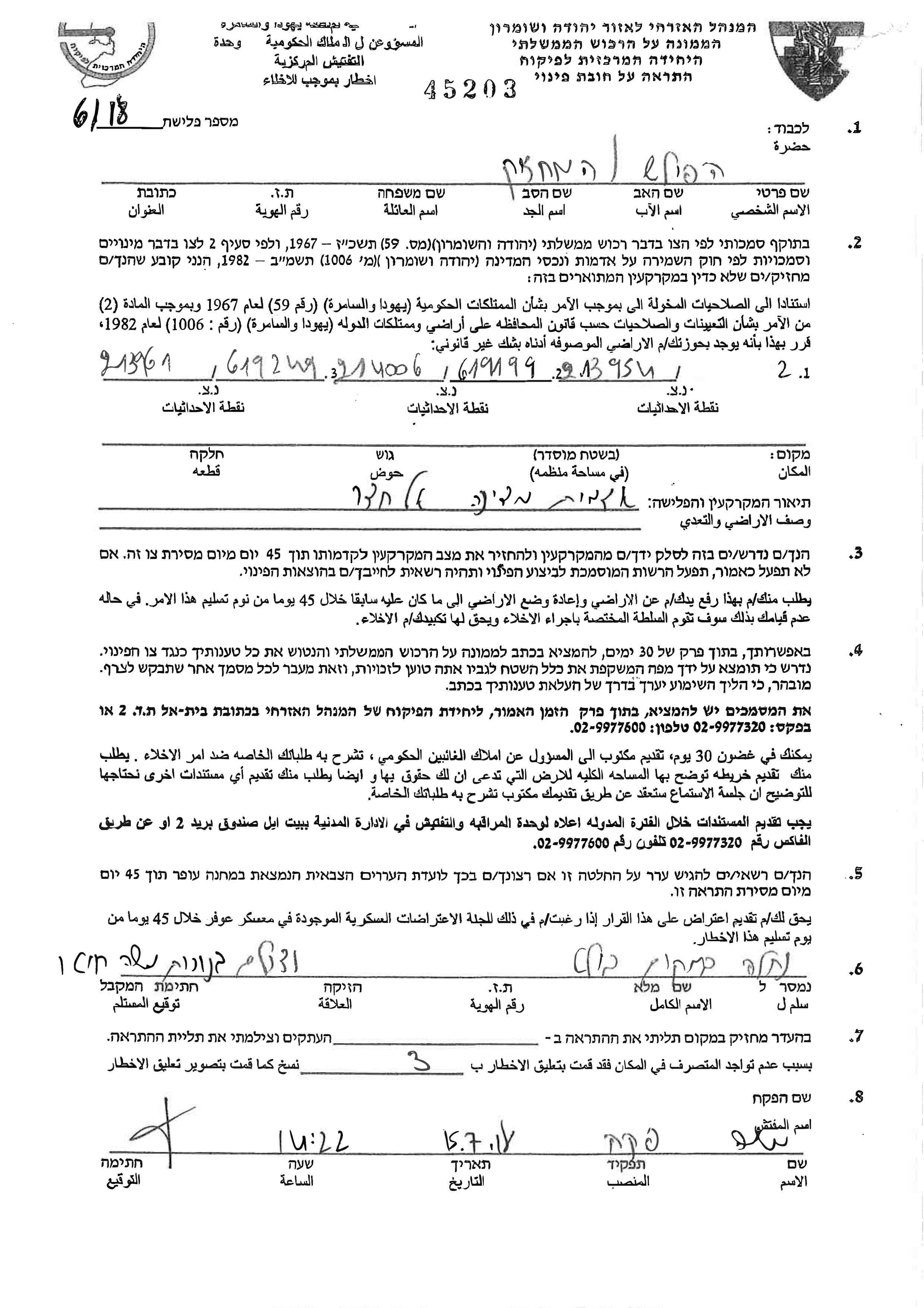
Violation: Military order to clear out lands.
Location: Al-Khader /Bethlehem.
Date: July 15 , 2018.
Perpetrators: The Israeli occupation forces and Central Inspecting Unit.
Victims: Members of Sbeih , Ghneim and Salah families.
Description:
The occupation's civil administration delivered notices to clear out 12 dunums of lands in Al-Khader village claiming that they are a (state's lands), In reality, they belong to farmers in Al-Khader village.
The military order requests "to clear out and return everything to its previous status within 45 days from receiving the order", and pointed out that affected citizens may file objections within 30 days from receiving the order.
Iyad Issa, member of a legal consults office (Melad) in Al-Khader municipality told LRC observer:
The Israeli occupation purpose is to take over all the lands that lie in high areas in Al-Khader. In order to use them in building illegal settlements, Attempting to achieve plan "The greater Jerusalem" (connecting illegal settlements in the south with Jerusalem)
The Israeli Occupation practice discrimination through confiscating Palestinian lands for Illegal settlers' favor, This is confirmed by one of Peace Now Movement reports: "When Israel occupied west bank in 1967, They declared 1.3 dunums of Palestinian lands as "State's lands", claiming that it was not private properties, In Israeli statistics of 2011, 600,000 dunums of the "state's lands" were assigned for building settlements, 400,000 dunums for "colonial brigade" (a colonial lobby with a firsthand contact with the government", 18,000 dunums were assigned for commercial and industrial purposes. Consequently, for each 1 dunum remained for Palestinians, Israelis got 370 dunums for illegal settlements "
There is constant increase in confiscating lands, and military orders of demolishing and appropriation. Farther more, The Israeli occupation declared "Basic Law" that was determined in the Israeli Knesset and declares "Israel" as the nation state for Jewish people and the right to self determination is limited for Jew immigrants.
The occupation state encourages colonialism in all parts of Palestinian lands, which means giving Illegal settlers preference in developing and housing. In addition to declaring, "Shaked" proposal that refuse clearing out any outpost.
The Israeli Occupation is trying to confiscate lands as much as it is possible from Al-Khader village, That's why members of Legal Consults office (Melad) , municipalities and humanitarian institutions are working to help villagers of the area to protect their lands.
|
|
|
|
|
|
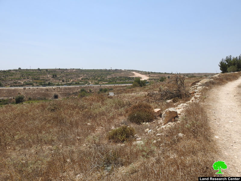
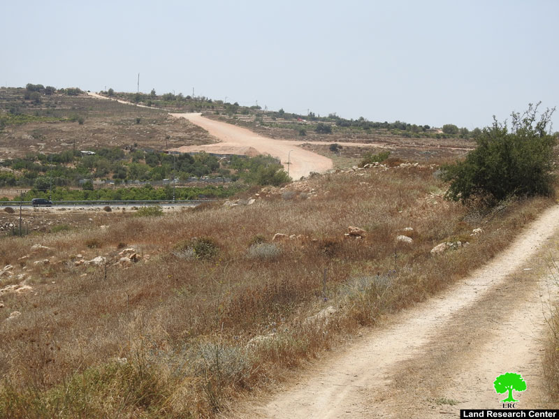
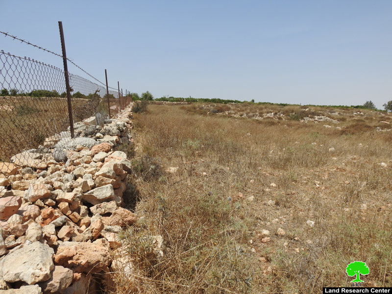
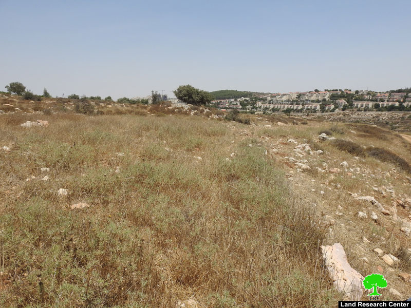
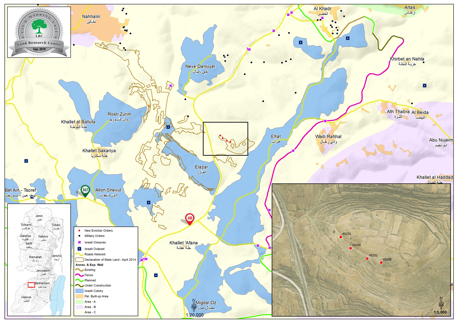
Subjected lands by the military order in Al-Khader
|
|
|
|
About Al-Khader village:[1]
Al-Khader village is located 4 km from the western side of Bethlehem, it is bordered by Beit Jala and Batir from the north, Hussan and Nahaleen villages from the west, Aldoha, Wadi Rahhal, Beit Jala villages from the east, and Wadi Al-Nees from the south. Its population is 11,960 people in 2017. Its gross area is 8,279 donums; 184 of them are the construction area.
The Israeli colonies have despoils 29 donums from the village's lands; two are colonies existed upon a part of the lands. The first one " Efrat" was constructed in 1979 A.D; they have usurped 5.8 donums, and its population 7037 colonists. The second one " Nafy Danial" eas constructed on 1982A.D; they have usurped 23 donums, and its population is 1073 colonists. A part of which is established upon the village's lands.
The bypass roads number 60 and 375 also despoiled more than 487 donums. In addition to establishing the apartheid upon its lands which causes the demolishing of 280 donums and isolating of 5638 donums behind it. The length of this apartheid existing upon the village's land is 2,805 meters.
The village's lands are classified in accordance with Oslo concord into areas( A,B ,C). Area A composes 10% , Area B 6%, Area C is the greatest area and it is under the total occupation domination, and it composes 84% from the total area. The areas are clarified in donums as following:
Area A (808) donums
AreaB (475) donums
Area C(6,996) donums
[1] GIS-LRC

The contents of this document is the sole responsibility of LRC and can under no circumstances be regarded as reflecting the position of the European Union