Related
“Halt of construction†orders in Al-Khader/ Bethlehem governorate
Violation: delivering Halt of construction military orders for a family home.
Date: 07/05/2018
Location: Al-Khader/ Bethlehem governorate.
Perpetrators: The Israeli occupation civil administration.
Victims: Families of Bder Sbeih.
Description:
A vehicle from the occupation's civil administration broke into Al-Khader village and delivered military orders “Halt of construction” on a house for a family in the town on the pretext of unauthorized buildings.
In May 07 , the session of subcommittee will be held to discuss demolishing the subjected construction, Owner of the construction is taking legal measures hoping to protect his home.
Bader Sbeih told LRC observer:
I have the documents that prove I own the land where his house is built, I did not see this coming at all. However, I will protect my home now that it is targeted by the occupation.
The following table provides information about the affected family:
owner | Number of family members | children | Area of the building m2 | Status of the building | Order’s number |
Bader Sbeih | 5 | 2 | 120 | Under construction | 050184 |

The halt of construction order

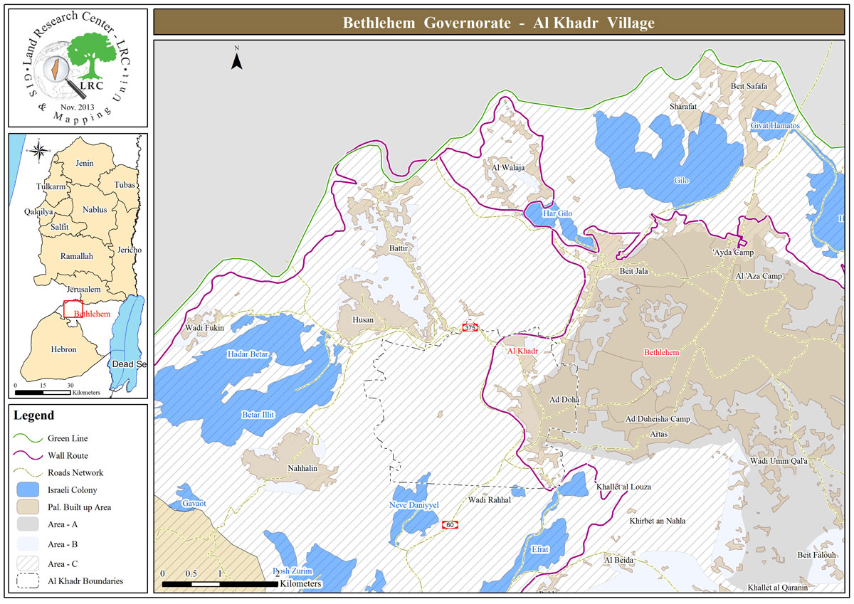
About Al-Khader village:[1]
Al-Khader village is located 4 km from the western side of Bethlehem, it is bordered by Beit Jala and Batir from the north, Hussan and Nahaleen villages from the west, Aldoha, Wadi Rahhal, Beit Jala villages from the east, and Wadi Al-Nees from the south. Its population is 11960 people in 2017. Its gross area is 8,279 donums; 184 of them are the construction area.
The Israeli colonies have despoils 29 donums from the village's lands; two are colonies existed upon a part of the lands. The first one " Efrat" was constructed in 1979 A.D; they have usurped 5.8 donums, and its population 7037 colonists. The second one " Nafy Danial" eas constructed on 1982A.D; they have usurped 23 donums, and its population is 1073 colonists. A part of which is established upon the village's lands.
The bypass roads number 60 and 375 also despoiled more than 487 donums. In addition to establishing the apartheid upon its lands which causes the demolishing of 280 donums and isolating of 5638 donums behind it. The length of this apartheid existing upon the village's land is 2,805 meters.
The village's lands are classified in accordance with Oslo concord into areas( A,B ,C). Area A composes 10% , Area B 6%, Area C is the greatest area and it is under the total occupation domination, and it composes 84% from the total area. The areas are clarified in donums as following:
Area A (808) donums
AreaB (475) donums
Area C(6,996) donums
[1] GIS-LRC