
Related
The Israeli occupation sets up a metal gate in Al-Khader / Bethlehem
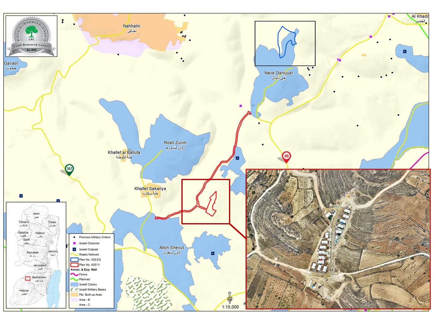
Violation: setting up a metal gate on the entrance of an Israeli illegal outpost.
Location: Khallet Al-Fahem/ Khader village/ Bethlehem governorate.
Date: 10/06/2018.
Perpetrator: The Israel occupation army and “Eleazer” settlers.
Victims: People of Al-Khader.
Description:
In June 10-2018, the Israeli occupation forces set up a metal gate on an outpost related to “Eleazer” settlement, the outpost was an implementation of plan 405/11 , which included building 86 residential units on confiscated lands from Al-Khader and opening a colonial road.
Iyad from MILAD office in Al-Khader told LRC reporter:
“Settlers placed metal gates on the outpost’s entrance on the pretext of providing security for settlers”
Noteworthy, placing the metal gate obstructs Palestinian farmers from reaching their lands, now they have to go a longer and difficult route to reach their lands.
Al Khader is struggling with one of the largest capture campaigns as demolition and confiscation orders are being served in tens and colonists have been capturing lands and building on those lands freely while enjoying the blessing and protection of the Israeli Occupation Army.

About Al-Khader village:[1]
Al-Khader village is located 4 km from the western side of Bethlehem, it is bordered by Beit Jala and Batir from the north, Hussan and Nahaleen villages from the west, Aldoha, Wadi Rahhal, Beit Jala villages from the east, and Wadi Al-Nees from the south. Its population is 9774 people in 2007. Its gross area is 8,279 donums; 184 of them are the construction area.
The Israeli colonies have despoils 29 donums from the village's lands; two are colonies existed upon a part of the lands. The first one " Efrat" was constructed in 1979 A.D; they have usurped 5.8 donums, and its population 7037 colonists. The second one " Nafy Danial" eas constructed on 1982A.D; they have usurped 23 donums, and its population is 1073 colonists. A part of which is established upon the village's lands.
The bypass roads number 60 and 375 also despoiled more than 487 donums. In addition to establishing the apartheid upon its lands which causes the demolishing of 280 donums and isolating of 5638 donums behind it. The length of this apartheid existing upon the village's land is 2,805 meters.
The village's lands are classified in accordance with Oslo concord into areas( A,B ,C). Area A composes 10% , Area B 6%, Area C is the greatest area and it is under the total occupation domination, and it composes 84% from the total area. The areas are clarified in donums as following:
Area A (808) donums.
AreaB (475) donums.
Area C(6,996) donums .
[1] GIS-LRC

The contents of this document is the sole responsibility of LRC and can under no circumstances be regarded as reflecting the position of the European Union