
Related
The occupation reveals a scheme to take over agricultural lands in Al-Khader for colonial purposes/ Bethlehem governorate
Violation: revealing a scheme to transform agricultural lands in Al-Khader to a build up area for colonists.
Location: Wad Sala’a/ Al-Khader town/ Bethlehem governorate.
Perpetrator: “Neve Daniyyal” settlers.
Victim: Rezeq Salah and his brothers, Ibrahim Sbeih.
Description:
July 30, the Israeli occupation civil administration revealed detailed plan (402/7) to change detailed plan (402/2/2), The plan changes agricultural land customizations into (C building area, public institutions, facilities, open public areas and roads) in addition to settling building terms within the maps frame and assigning roads network.
According to the revealed plan, 63 dunums of Al-Khader agricultural lands will be confiscated and used to build 170 Israeli colonial units connected to “Neve Daniyyal” settlement.
|
|
|
|
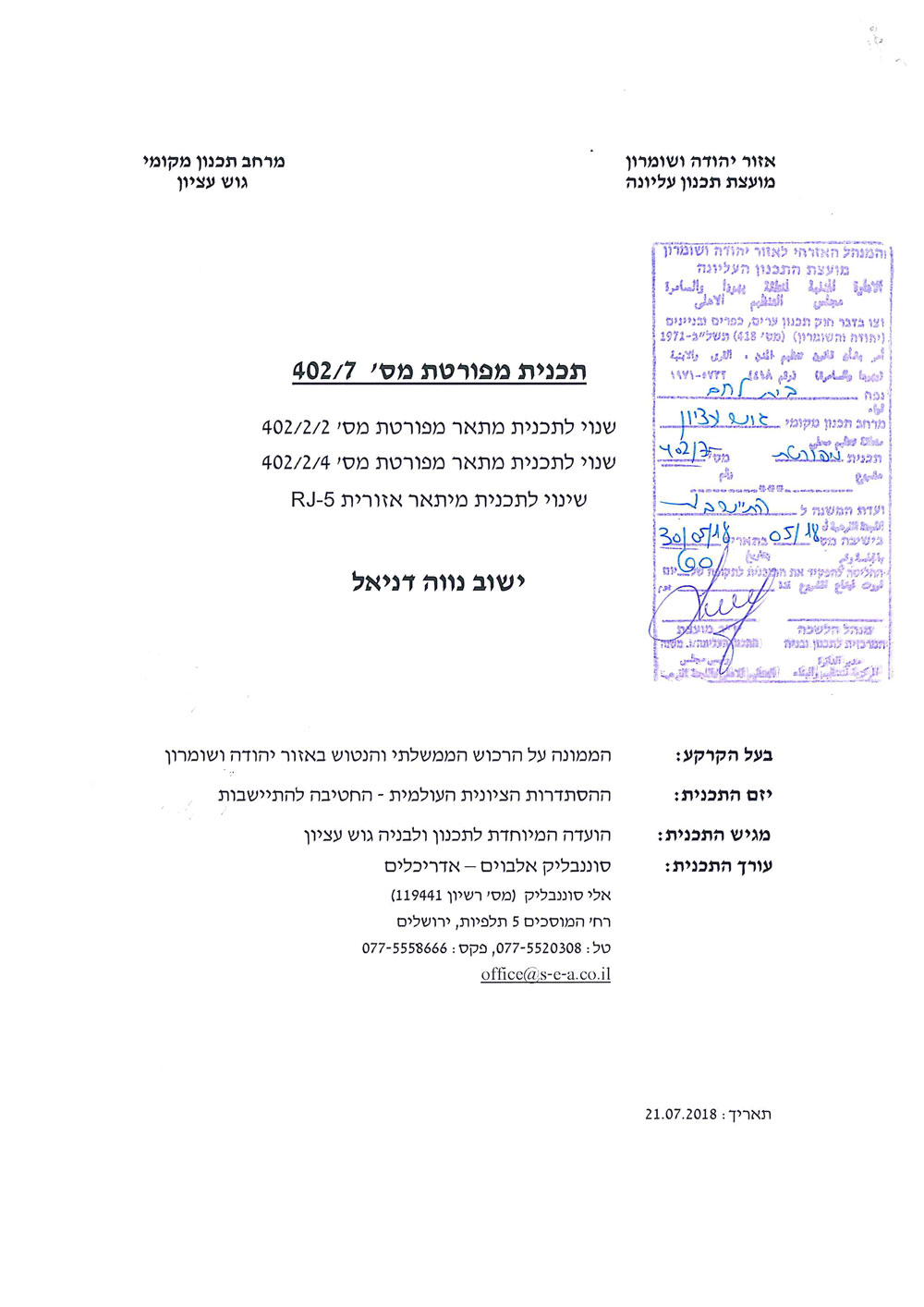


Part of the scheme revealed on the Israeli Ministry of Finance webpage

Map revealed on the Israeli Ministry of Finance webpage
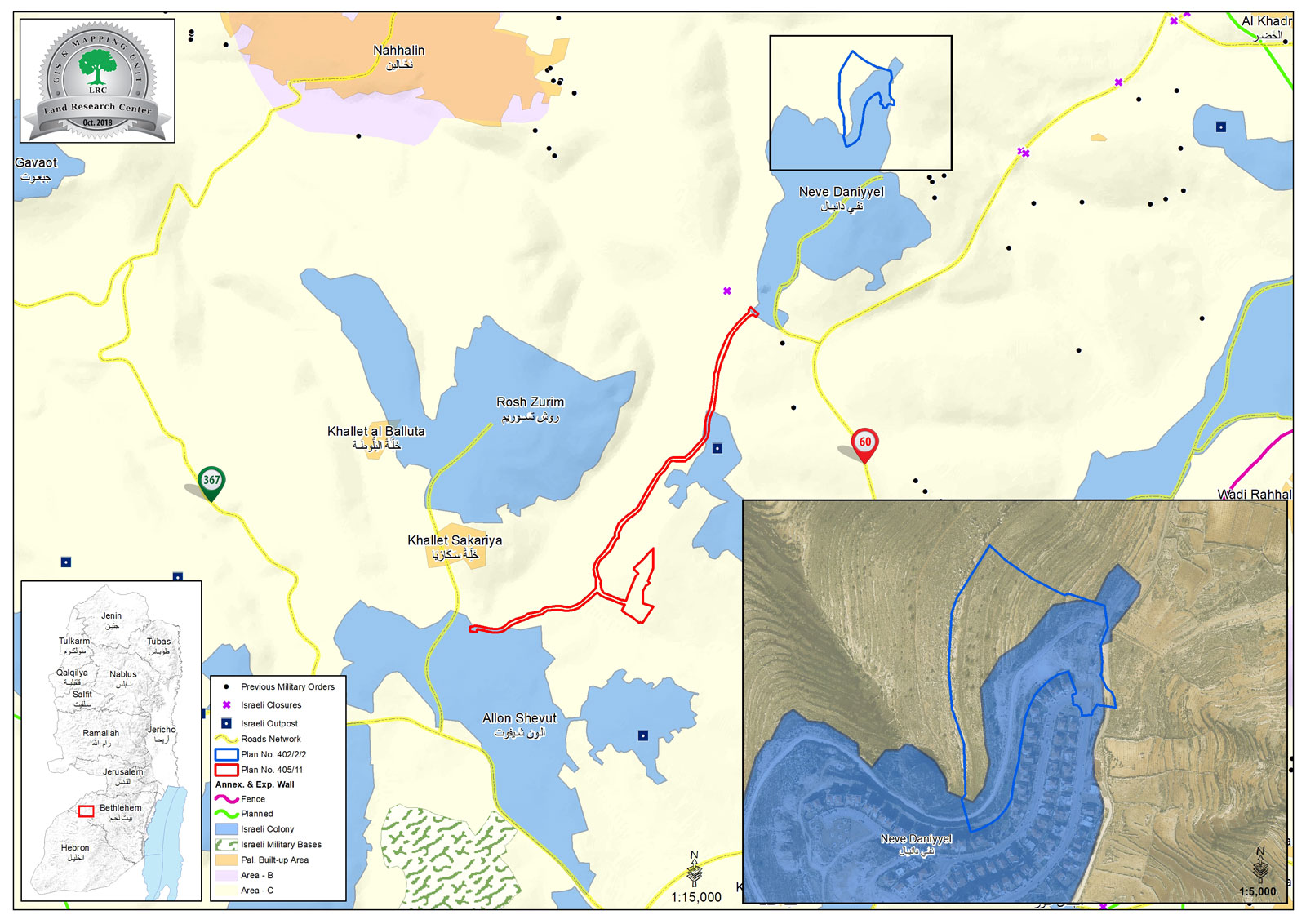
Aerial plan shows the targeted area
The announcement pointed out that affected farmers have the right to object, and they are Rezeq Salah and his brothers and Ibrahim Sbeih. Noteworthy, mentioned farmers possess legal documents that prove they own the lands, and they are continuously present in their property, despite the continuous assaults of the settlers.
In the same time the Israeli government reveals plans to build hundreds of colonial units over Palestinian agricultural lands, It destroys Palestinian homes and violate their basic rights granted by international conventions which is the right of an appropriate residence. since the beginning of 2018, The Israeli Occupation Civil Administration served demolition military orders to 23 residences, inhabited by 70 members 41 of them are children and 3 facilitiesdespite that they live on their lands inherited from their grandfathers.
About Al-Khader village[1]:
Al-Khader village is located 4 km from the western side of Bethlehem, it is bordered by Beit Jala and Batir from the north, Hussan and Nahaleen villages from the west, Aldoha, Wadi Rahhal, Beit Jala villages from the east, and Wadi Al-Nees from the south. Its population is 9774 people in 2007. Its gross area is 8,279 donums; 184 of them are the construction area.
The Israeli colonies have despoils 29 donums from the village's lands; two are colonies existed upon a part of the lands. The first one " Efrat" was constructed in 1979 A.D; they have usurped 5.8 donums, and its population 7037 colonists. The second one " Nafy Danial" eas constructed on 1982A.D; they have usurped 23 donums, and its population is 1073 colonists. A part of which is established upon the village's lands.
The bypass roads number 60 and 375 also despoiled more than 487 donums. In addition to establishing the apartheid upon its lands which causes the demolishing of 280 donums and isolating of 5638 donums behind it. The length of this apartheid existing upon the village's land is 2,805 meters.
The village's lands are classified in accordance with Oslo concord into areas( A,B ,C). Area A composes 10% , Area B 6%, Area C is the greatest area and it is under the total occupation domination, and it composes 84% from the total area. The areas are clarified in donums as following:
Area A (808) donums
AreaB (475) donums
Area C(6,996) donums .
[1] GIS-LRC

The contents of this document is the sole responsibility of LRC and can under no circumstances be regarded as reflecting the position of the European Union