
Related
The occupation’s military orders target an agricultural cistern in Al-Khader / Bethlehem
Violation: The occupation’s notifies an agricultural cistern of a stop work military order.
Location: Wad Al-Bayar – Al-Khader / Bethlehem governorate.
Date: 02/07/2018.
Perpetrator: The Israeli occupation civil administration and army.
Victims: Nisreen Hamdan.
Description:
The Israeli occupation army and civil administration notified an agricultural cistern in Al-Khader , that belongs to farmer Nisreen Hamdan. The notice said that the subcommittee in its upcoming session will decide the fate of the structure.
It is reported that the targeted cistern serves 2 dunums of planted fields. The owner tries to provide food on the table for her family, after a fanatic settler from Gosh Etzion ran over her husband by his car.
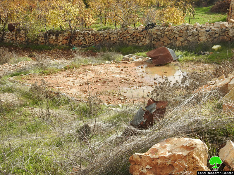
The notified cistern
Al Khader:[1]
Located 4 kilometer west of Bethlehem, Al Khader village is surrounded by Beit Jala and Battir (north), Husan and Nahhalin (west), Ad Doha, Wadi Rahall, and Beit Jala (east), Wadi An Nais (south).
Al Khader has a population of 9774 according to statistics conducted in 2007. It has a total area of 8279 dunums, 184 of which are built-up area.
The Israeli occupation confiscated 29 dunums of Al Khader lands for Efrat and Daniel colonies. Efrat was built in 1979 and devoured 5.8 dunums of Al Khader. It is inhabited by 7037 colonists. Daniel was built in 1982 and confiscated 23 dunums. 1073 colonists live in the colony.
Bypasses number 60 and 375 devoured more than 487 dunums. Not to mention the Apartheid Wall that destroyed 280 dunums and isolated 5638 dunums of the village. The Wall in Al Khadr is 2805 meters long.
According to Oslo Accords, 10% of Al Khadr is under Area A (PA has full civil and security control) while 6% is under Area B (PA is in charge of civil matters with Israel responsible for security). However, most of the village lands (84%) is under Area C (Israel maintains full security and administrative control). Here are the area in dunums:
Area A (808) dunums
Area B (475) dunums
Area C (6996) dunums
[1] GIS-LRC

The contents of this document is the sole responsibility of LRC and can under no circumstances be regarded as reflecting the position of the European Union