
Related
Reallocation of lands for the favor of Colonization – Nahalin / Bethlehem governorate
Violation: Announcing activation of detailed map 2/2/418 to reallocate agricultural lands.
Location: Marah Beit ‘Issa – Nahalin village / Bethlehem governorate.
Date: 13/10/2019.
Perpetrators: Colonization subcommittee / The Israeli occupation civil administration.
Victims : Ali Fanoun and his brothers.
Description:
The Israeli occupation colonization subcommittee announced activating detailed map plan (2/2/418) in natural block 4 of Abu Klaiba and Marah Beit Issa lands in Nahalin , which will be interpreted in shifting allocation of agricultural lands into an institutional property for settlers of illegal settlement “Allon Shevout”.
Eng. Jihad Fanoun told LRC reporter:
“The targeted plot has an area of 4 dunums and planted with olive groves , and its owners have ownership deeds.”
According to the notice, the plan will be valid two weeks after the announcement, and the owner has the right to object during this period.
In fact the plan will mean confiscating more lands in the future under security claims, other than “Allon Shevout” settlers who continuously seek to expand their settlements and annexing more lands from Nahalin and Al-Khader.
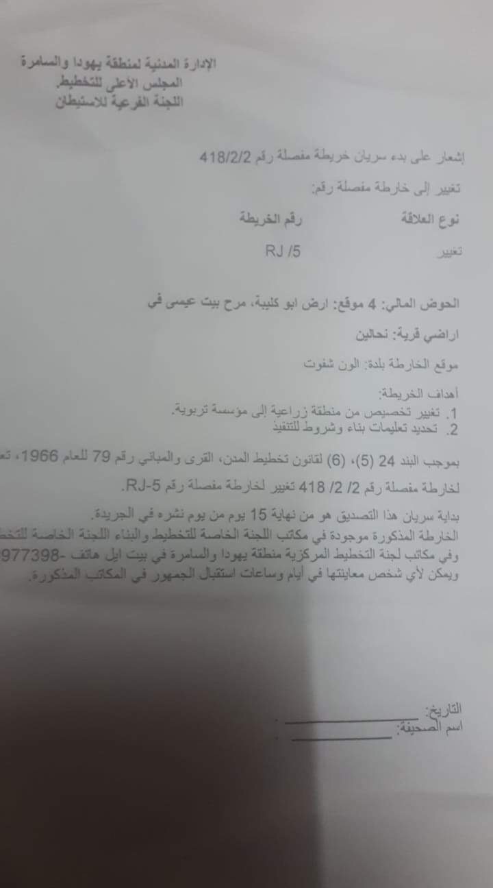
The announcement issued by the Colonization Subcommittee
|
|
|
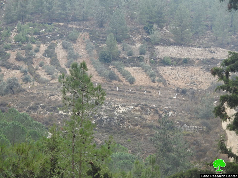
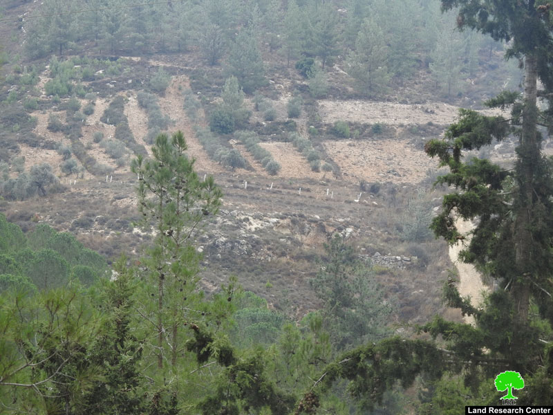
The targeted plot in the announcement
Noteworthy, this plan is a violation of human rights and a confiscation of properties for the purpose of achieving colonial goals, which is a violation of international conventions and agreements, this is confirmed in Security Council resolution 2334 in 2016, which states that Israel's settlement activity constitutes a "flagrant violation" of international law and has "no legal validity". It demands that Israel stop such activity and fulfill its obligations as an occupying power under the Fourth Geneva Convention.
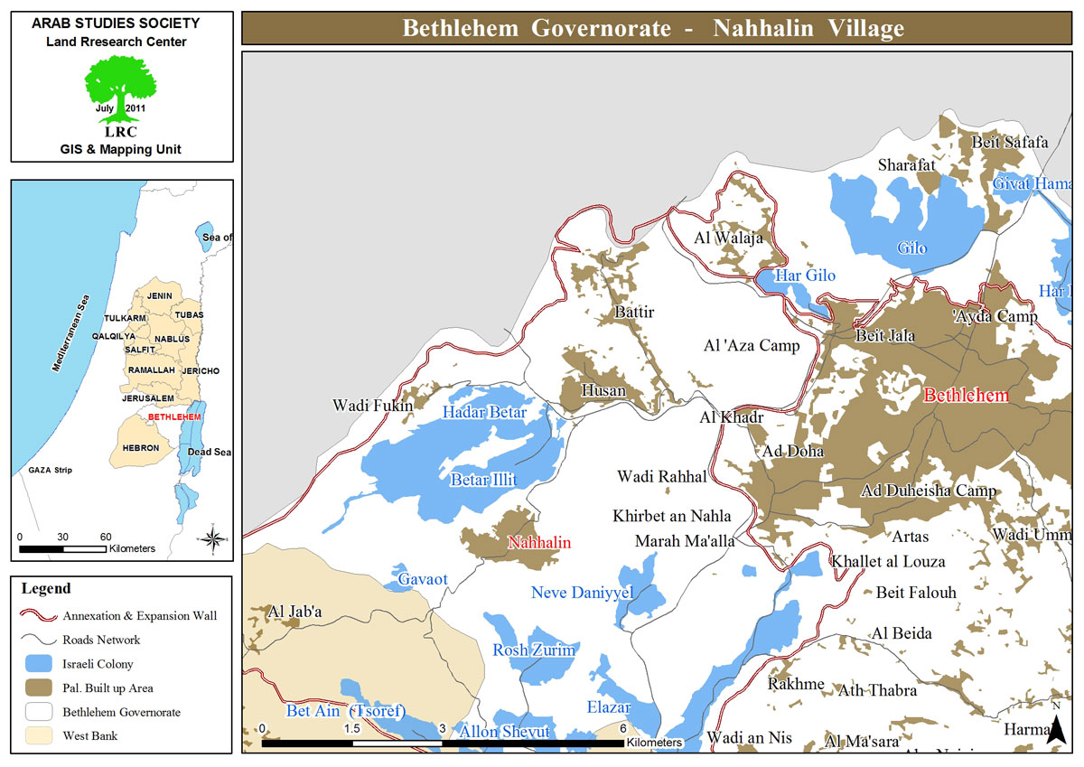
Nahalin: [1]
The village is located 10km to the south west of Bethlehem and 3.5 km to the east of the armistice line of 1949.
The village's total area is 18,858 dunums including 890 dunums of built-up area, inhabited by8741 people according to the PBS statistics of 2017.
Israel has confiscated 4,283 dunums from the village lands 3,583 dunums of which for colonial expansion purposes and 700 dunums for the favor of bypass roads. There are 8 colonies founded on the village land, namely (Beit Ein, Tsoref, Majdal Oz, Jabot, Kfar Etzion, Efrat, Illit, Rosen Tsurem and Allon Shevut).
[1] GIS - LRC

The contents of this document are the sole responsibility of LRC and can under no circumstances be regarded as reflecting the position of the European Union