
Related
Settlers sabotage vine trees of a yard for Subaih family in Al-Khader / Bethlehem
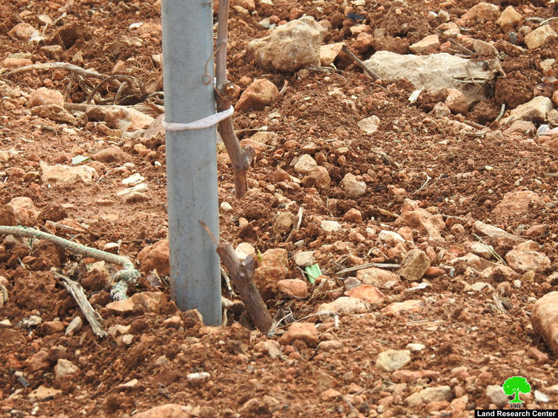
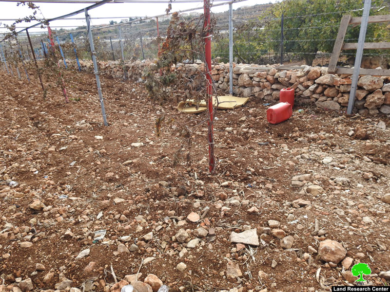
Violation: Sabotaging vine trees.
Location: Ein Al-Asafer – Al-Khader/ Bethlehem governorate.
Date: November 28th 2019.
Perpetrator: Settlers of (Efrat and Elazer).
Victims: Yehia Subaih
Description:
Thursday November 28th 2019, Settlers of Efrat and Elazer carried on cutting and sabotaging about 100 vine trees from a plot that belongs to Yehia Subaih in Ein Al-‘Asafer / Al-Khader.
Owner Yehia told LRC:
“This trees age more than 20 years , I take good care of them daily , this plot means the home to me, I take care of its trees as if they were my children, but the occupation won’t even let them grow?!”
Eyad Subaih told LRC the following:
“Settlers constantly target Al-Khader area , through attacking plots and plants, the occupation supports that through threatening and demolishing Palestinian homes , all this came to support their schemes that target Al-Khader area in an attempt to transform it into a colonial reserve.”
Noteworthy, Yehia depends mainly on agriculture for living , sabotaging the vine trees will affect his life for a long period of time , as they need at least three years to start growing grapes if he attempted to start all over.
Al-Khader area has a fertile soil and its people practice agriculture wildly, but the Israeli occupation heavily targets the area in an attempt to expel its people, and replace them with illegal Israeli settlers.
|
|
|
|

sabotaging vine trees
About Al-Khader village:[1]
Al-Khader village is located 4 km from the western side of Bethlehem, it is bordered by Beit Jala and Batir from the north, Hussan and Nahaleen villages from the west, Aldoha, Wadi Rahhal, Beit Jala villages from the east, and Wadi Al-Nees from the south. Its population is 9774 people in 2007. Its gross area is 8,279 donums; 184 of them are the construction area.
The Israeli colonies have despoils 29 donums from the village's lands; two are colonies existed upon a part of the lands. The first one " Efrat" was constructed in 1979 A.D; they have usurped 5.8 donums, and its population 7037 colonists. The second one " Nafy Danial" eas constructed on 1982A.D; they have usurped 23 donums, and its population is 1073 colonists. A part of which is established upon the village's lands.
The bypass roads number 60 and 375 also despoiled more than 487 donums. In addition to establishing the apartheid upon its lands which causes the demolishing of 280 donums and isolating of 5638 donums behind it. The length of this apartheid existing upon the village's land is 2,805 meters.
The village's lands are classified in accordance with Oslo concord into areas( A,B ,C). Area A composes 10% , Area B 6%, Area C is the greatest area and it is under the total occupation domination, and it composes 84% from the total area. The areas are clarified in donums as following:
Area A (808) donums
AreaB (475) donums
Area C(6,996) donums .
[1] GIS-LRC