
Related
Halt of Work notice on a house in Beit Dajan village / East Nablus
- Violation: Halt of Work notice.
- Location: Beit Dajan village / Nablus governorate.
- Date: May 5th 2013.
- Perpetrators: The Israeli Occupation Civil Administration.
- Victims: Citizen Najm Salman Abdul Rahman Hunaini.
Description:
Sunday morning May 5th 2013, about 7:00 a massive army force accompanied by the building and organization officer raided Beit Dajan East Nablus, and served a halt of work military order to Najm Hunaini on his house in Al-Mujeez location, Reportedly, the notice targets an under construction house with a total area of 200 m2.
Najm Salman (65) told LRC the following:
“Sunday morning, I went to my under construction house after I saw two Israeli military vehicles heading to the location, and when I got there I found an Israeli military notice hanged on the door.
I headed immediately to the village council, which guided my to prepare a legal file, and file an objection through Jerusalem Legal Aid and Human Rights Center.”
|
|
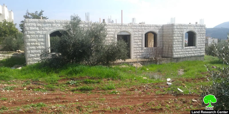
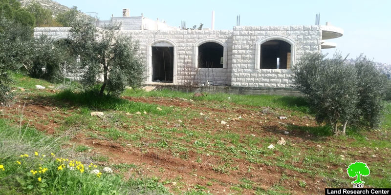
Noteworthy, the house Is located to the west of the village in C area , on a 5 dunums plot planted with olives ,. Hanini built the house to provide an appropriate home for his family of 7 people.
About Beit Dajan:[1]
Beit Dajan is located 12 km to the east of Nablus; its total area is 44100 dunums including 360 dunums of built up area inhabited by 758 pople (207 census) in addition to 12500 dunums that are related to al-Ghoor area . A large part of the village lands were confiscated for the construction of the colony of Mehola in 1973.
Beit Dajan is surrounded by a number of villages namely (Salem, Deir al-Hatab, Talluza, Beit Furik, Ghoor el-Far'a ) and depends on grains plantation and fruitful trees such like olive, figs and almond.
In 1971 , Al-Humra settlement was constructed on 123 dunums confiscated from Beit Dajan, while the settlement controls 3855 dunums for security claims, and inhabited by 126 settlers (2013).
[1] GIS-LRC

This document has been produced with the financial assistance of the European Union
The contents of this document is the sole responsibility of LRC and can under no circumstances be regarded as reflecting the position of the European Union