
Related
Settlers Ravage Jaloud lands / Nablus governorate
Violation: Ravaging lands to link “Shilo” and “Shevout Rahel” illegal settlements .
Location: Jaloud village / Nablus governorate.
Date: February 19th 2020.
Perpetrators: illegal settlers of “ Shilo” and “Shevout Rahel” .
Victims: Several families in the village.
Description:
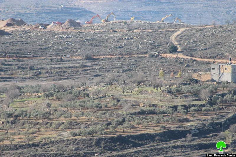
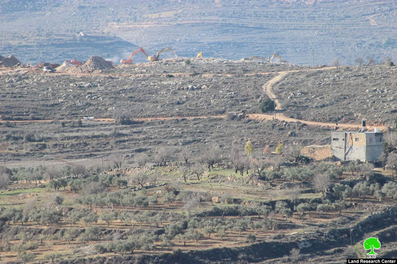
Wednesday morning , Heavy machineries from Shilo and Shevout Rahel illegal settlements were seen ravaging vast areas of lands in Jalud , with a clear intention to connect the two illegal settlements to each other.
Abdullah Haj Mohammed Jalud village council head told LRC the following:
“The Occupation’s heavy machineries were ravaging lands in Natural block 12 locally known as Ras Mouris area and located southeast the village. This is the first time we see about ten machineries working at the same time at one location.
It is predicted that this land leveling aims to construct 534 colonial units on confiscated lands in natural block 12 , after the Israeli government revealed their intention to construct thousands of colonial units in the West Bank.”
Reportedly , the occupation have been prohibiting original owners of the land from using it for years, owners’ families were frightened by the threats of weapons and stayed away from their land.
|
|
|

About Jalud:[1]
Jalud is located 29km to the southeast of Nablus city and is edged by Qusra village from the northeast, Qaryut village from the west, Yesh Kodish and Ahya outposts from the east and Shilo colony from the south.
Its population mounts up to 598 people (2014 census). Jalud's total land area is 22,473 dunums, of 80 dunums are considered the village's built-up area.
Israeli colonies confiscated 2227 dunums from Jalud lands. Shilo colony that was established in 1978 confiscated 640 dunums from the village. Mizpe Rahel colony and other outposts namely (Yesh Kodish, Ahya, Eli, Adi Ad and Kida) are founded on confiscated lands from the village.
Bypass roads confiscated around 436 dunums from the village.
The lands of Marda are classified according to Oslo Accords as the following:
5541 dunums (25%) are classified as area B.
16932 dunums (75%) are classified as area C.
[1] GIS-LRC

This document has been produced with the financial assistance of the European Union
The contents of this document is the sole responsibility of LRC and can under no circumstances be regarded as reflecting the position of the European Union