
Related
Image title The Israeli Occupation municipality forces a rancher to demolish his barracks in Sur Baher/ Occupied Jerusalem
Monday, November 26th 2019, Mahmoud ‘Ubaidat from Jabal Al-Mukabir Neighborhood demolished two barracks for sheep and Horses in Wad Al-Humus in ur Baher south occupied Jerusalem.
‘Ubaidat received demolition orders on his properties (each barracks is with an area of 160 m2). Noteworthy, in October the occupation municipality demolished number of barracks in Al-Humaidiya area , among them two barracks belong to Mahmoud ‘Ubaidat in Jabal Al-Mukabir on the pretext of building without licenses, the owner moved to Sur Baher with his barracks , but he faced the same tragedy.
‘Ubaidat found himself forced to demolish his own barracks, instead of waiting for the municipality to demolish the barracks and forced him to pay a high fine (as demolition costs), which may reach thousands of shekels, as he told LRC.
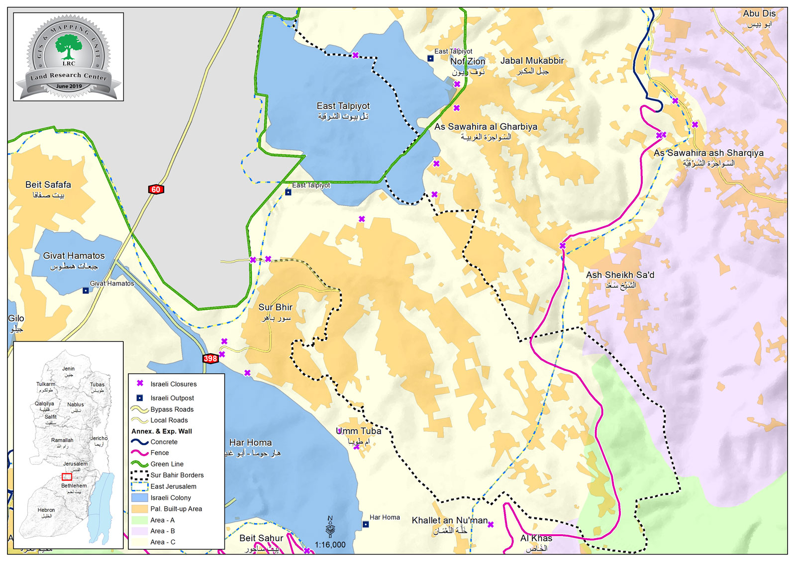
Sur Baher village[1]:
3 km south Jerusalem city, Sur Baher is bordered by Al-Sawahira Al-Gharbiyya, Jabal Al-Mukabir and (Talpiot) settlement on confiscated lands (North), The Green Line and the occupied territories of 1948 , Ash-Shaikh Sa’ad village (east), and Beit Sahour ,Umm Tuba and Har Homa settlement (south).
Sur Baher and Um Tuba together have a population of 18,137 people in 2011 census “The Jerusalem Institute for Israeli studies 2012”.
The town’s population come from several families: Duyat, Dabesh, Nemr, Eleyan, Hamada, 'Amaira, Abu Kufur, Bukairat, Jbour, Jad Allah, Abu Jamid , Al Atrash.
Sur Baher has a total area of 6,894 dunums , of which 2,076 dunums are the town’s built up area, it is in the borders of the occupation’s municipality in Jerusalem, after they illegally annexed it in 1967.
The occupation confiscated (1517) dunums from Sur Baher for the following purposes:
Talpiot settlement, which was established in 1973 devoured 1291 dunums , and inhabited by 12,591 people.
The segregation wall (2,260 m long) devoured 226 dunums, and blocked 6,033 dunums (west) and 861 dunums (east).
Oslo conventions divided the land as the following :
- A area (764) dunums.
- B area (134) dunums.
- C area (5,995) dunums.
[1] GIS-LRC