
Related
The Occupation Municipality forces Rabaya’a family to demolish their own home in Sour Bahir
Israeli Violations in the Time of Corona
June 12th 2020, member of Ar-Rabaya’a family demolished two apartments in Sour Bahir village south Jerusalem, on the pretext of building without licenses.
One of the apartments belongs to Eleyan Rabaya’a who told LRC:
“3 months ago in march, we started building two apartments (each one has a total area of 100 m2) over the house we live in.
Before we completed the construction works, the Israeli municipality employees showed up and gave us halt of work notices, then we applied for a license, but the occupation authorities refused.
The Occupation municipality decided to demolish the new building, and make us pay the costs of the demolition (80,000 NIS) , so I decided to carry out the operation myself to reduce the loss.”
Reportedly, during the last 3 months and the Corona lockdown, the occupation municipality forced tens of Jerusalemite families to demolish their own houses.
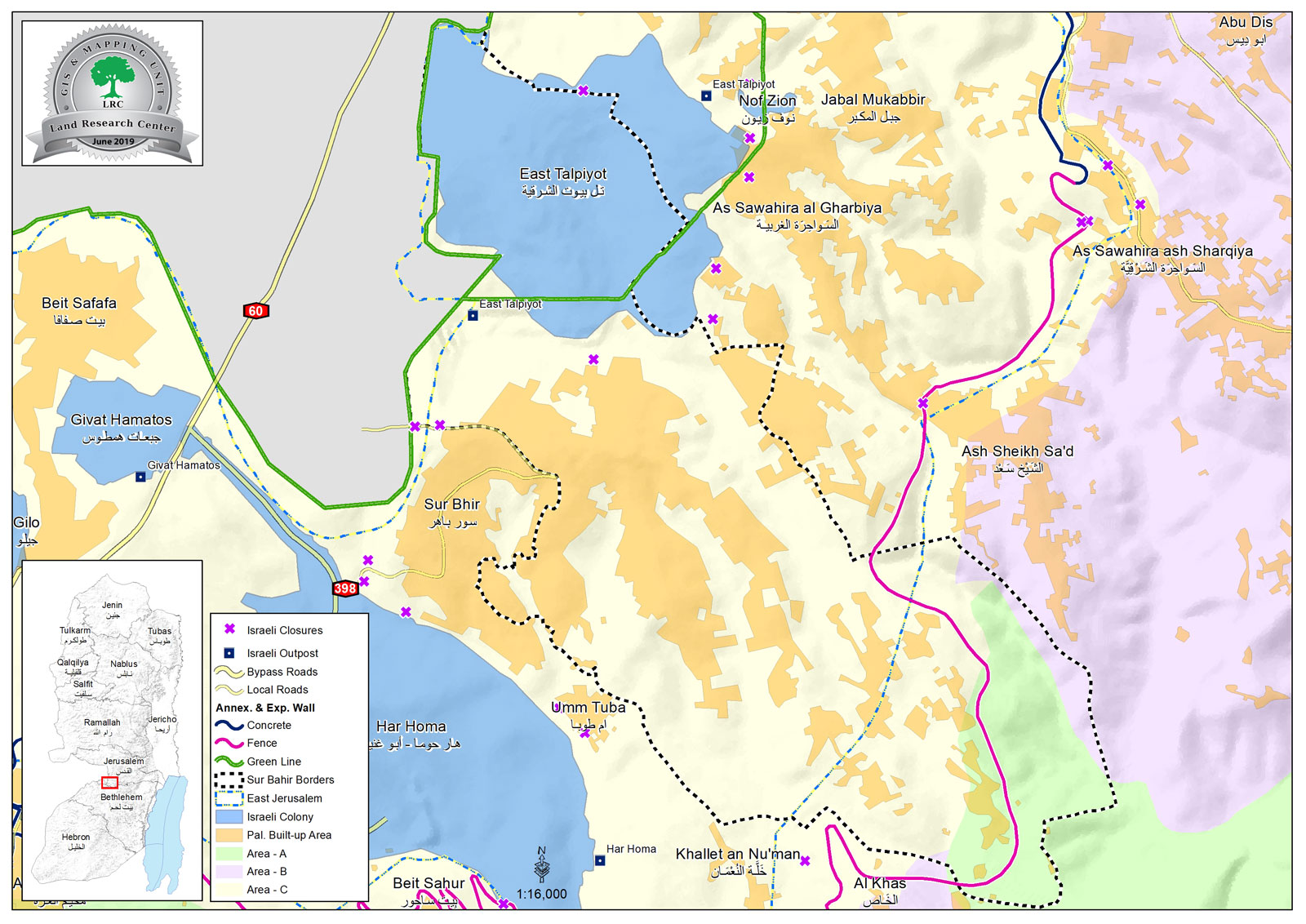
Sur Baher village:[1]
3 km south Jerusalem city, Sur Baher is bordered by Al-Sawahira Al-Gharbiyya, Jabal Al-Mukabir and (Talpiot) settlement on confiscated lands (North), The Green Line and the occupied territories of 1948 , Ash-Shaikh Sa’ad village (east), and Beit Sahour ,Umm Tuba and Har Homa settlement (south).
Sur Baher and Um Tuba together have a population of 18,137 people in 2011 census “The Jerusalem Institute for Israeli studies 2012”.
The town’s population come from several families: Duyat, Dabesh, Nemr, Eleyan, Hamada, 'Amaira, Abu Kufur, Bukairat, Jbour, Jad Allah, Abu Jamid , Al Atrash.
Sur Baher has a total area of 6,894 dunums , of which 2,076 dunums are the town’s built up area, it is in the borders of the occupation’s municipality in Jerusalem, after they illegally annexed it in 1967.
The occupation confiscated (1517) dunums from Sur Baher for the following purposes:
Talpiot settlement, which was established in 1973 devoured 1291 dunums , and inhabited by 12,591 people.
The segregation wall (2,260 m long) devoured 226 dunums, and blocked 6,033 dunums (west) and 861 dunums (east).
Oslo conventions divided the town as the following :
A area (764) dunums.
B area (134) dunums.
C area (5,995) dunums.
[1] GIS-LRC

Protecting marginalized communities in Jerusalem through legal support and advocacy
This report was prepared with EU funding, the contents of this document do not reflect positions of the European Union