2019-05-17
Israeli settlers torch 100 olive trees in Asira Al-Qibliya/ Nablus governorate
Violation: Torching olive trees.
Location: Asira Al-Qibliya / Nablus governorate.
Date: 17/05/2019.
Perpetrator: Settlers of “Yitzhar”.
Victims: Farmers from the town.
Description:
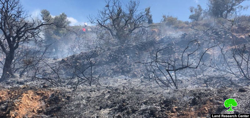
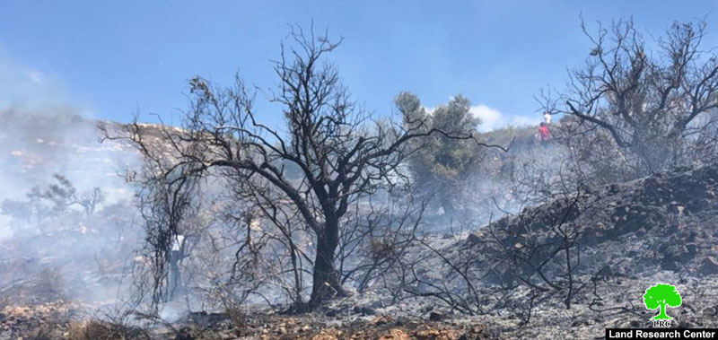
Friday about 10:00 am, Israeli settlers set fire on tens of dunums of Palestinian olive groves close to “Yitzhar” illegal Israeli settlement in Nablus.
Hafith Salih , Head of Assira Al-Qibliya village council told LRC reporter:
“tens of settlers attacked the southern area of the village , and set fire on olive trees in the area also knows as Al-Brijma, The town’s people rushed to stop the fire. But unfortunately, they only managed to kill it after it ate up about 100 olive trees (aging 50 years old).”
The following table shows more information about the affected:
owner | Number of torched trees |
Ribhi Asayra | 22 |
Mohammad Ahmad | 18 |
Abdul Karim Asayra | 18 |
Nassir Asayra | 17 |
Jaber Salih | 10 |
Ahmad Asayra | 8 |
Abdul Aziz Abu Ahmad | 7 |
total | 100 |
|
|
|
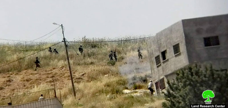
Village council head asserted: After the fire stopped, settlers protected by Israeli forces headed inside the village and started throwing stones towards people’s houses.
The village council estimated that farmers’ financial lost reached 30,000 NIS (8310 $).
General Information about ‘Asira al Qibliya:[1]
‘Asira al Qibliya is located 20 km south of Nablus city; it is surrounded by the villages of Tell (north), Tell, Zita and Jamma’in (West), Madame (East) and ‘Urif and Jamama’in (south). Its total area is about 6440, 332 are the town’s built up area. There are 530 dunums confiscated for the enlargement of Yitzhar, which was established in 1983 and populated about 440 settlers.
According to Oslo convention the land is divided to:
B areas (4,503) dunums
C areas (1,937) dunums.
(Yiizhar) settlement:
Yitzhar is translated to “olive oil”, the name of the town is related to olive oil milling.
Yitzhar was at first a military point “Nahal” established in 1/8/1983, then converted into a colony in 23/7/1984, it is about 8 km south west Nablus, on the main road that links Ramallah to Nablus.
It is built on Palestinian ground (the villages of Burin, Huwwara, ‘Einabus, ‘Urif, ‘Asira al Qibliya, and Madama), like any other Israeli colony, and carried on expanding on tens of agricultural dunums.
The illegal colony was built with plan 86/1, and confiscated lands belong to Palestinian citizens , and located in natural block 8 from Burin lands, block 4 from Madma lands, block 1 from Asira Al-Qibliya and block 3 from Urif lands.
[1] GIS-LRC

This document has been produced with the financial assistance of the European Union The content of this document is the sole responsibility of LRC and can under no circumstances be regarded as reflecting the position of the European Union