2019-07-03
IOF serve Halt of Work order on an under construction room in Burqa / Nablus governorate
Violation: Halt of work and construction order.
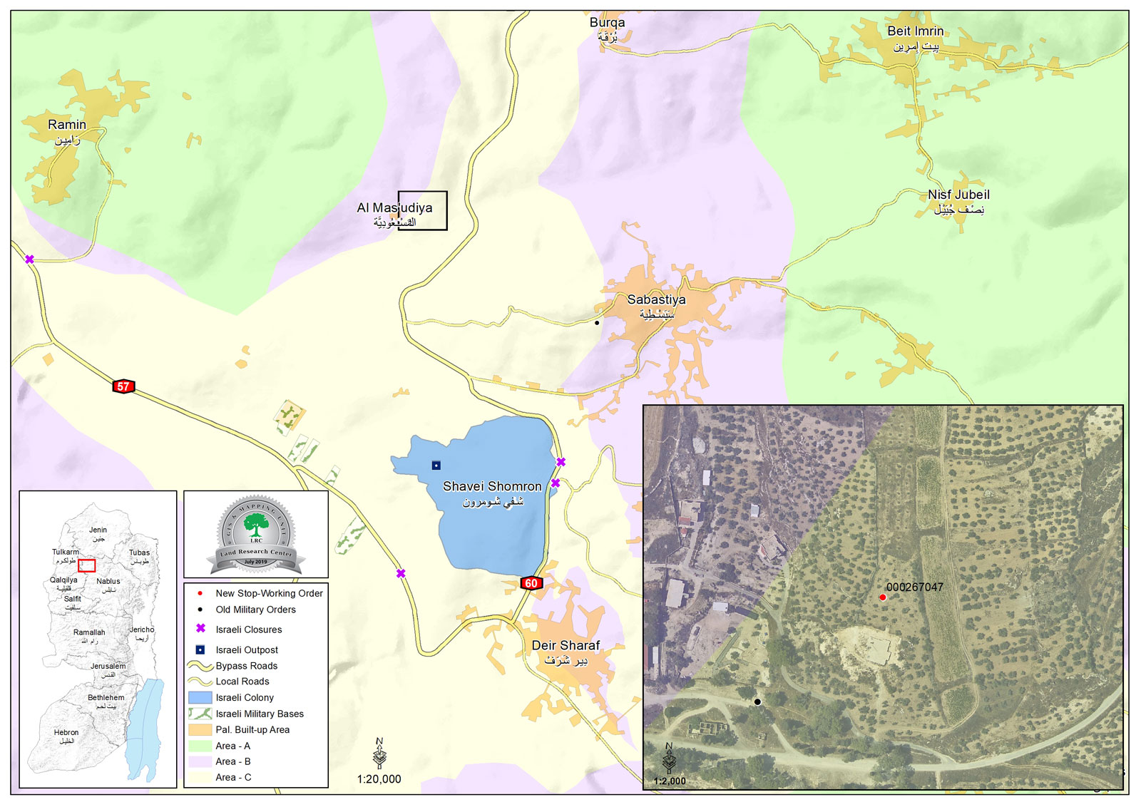
Location: Burqa village / Nablus governorate.
Date: 3/7/2019.
Perpetrator: The Israeli occupation army.
Victims: Family of Mosheer Saif.
Description:
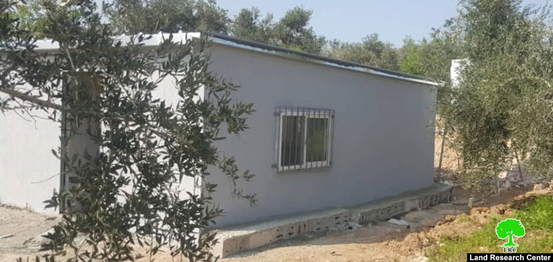
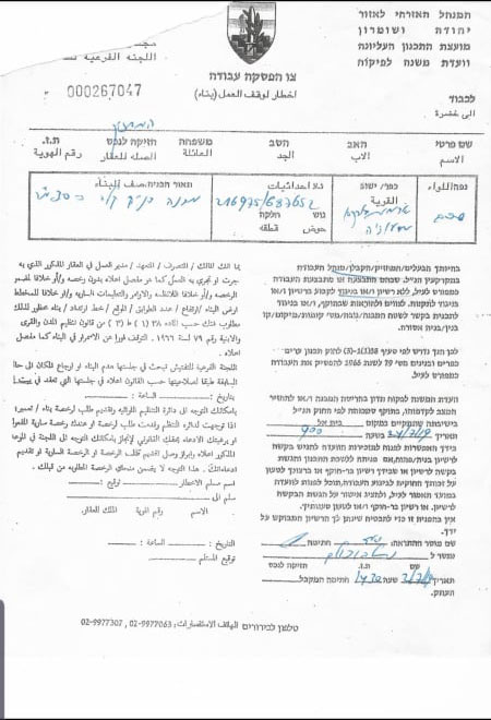
3 July 2019, An army force raided Al-Mas’udiya area north Nablus , and hanged a halt of work notice on citizen Musheer Saif’s house (55) on the pretext of building without licenses, as the owner Mosheer Saif told LRC reported.
Saif asserted:
“ My house has an area of 32 m2, and provides a home for my family that consists of 6 members , the targeted structure is a mobile home provided by the International Relief France, after the occupation demolished our house in March 2019.
After the occupation forces withdrew from the location I found a halt of work military order hanged on the door, that’s when I informed the official bodies in Nablus that I received a notice , they leaded me to the legal consultant office in the joint services council , which implemented by LRC with EU funding.”
Noteworthy, the occupation army demolished a house belongs to Saif in 7/3/2019 , on the pretext of building without licenses in C area, read the report.
About Burqa:[1]
12 km north Nablus city, Burqa is surrounded by the Israeli illegal colony “Homesh” (north), Ramin and Al-Masa’adeyeh villages (west) , Beit Amrin (east) and Sabastiya (south).
Burqa has a population of (4152) people in 2017.
Burqa has a total space of 18174 dunums, 506 of them are the town’s built-up area.
The Israeli occupation confiscated (1047) dunums from Burqa’s lands to establish “Homesh” settlement in 1980, the Israeli government claim that “Homesh” is evicted but that is not the truth,the settlement is inhabited by radical settlers who implemented several attacks against villagers of Burqa.
Oslo conventions divided Burqa into:
A area: (4796) dunums.
B area: (5131) dunums.
C area : (8247) dunums.
About Homesh:
The colony was established in 1980 on the boundary between the Nablus and Jenin governorates on the expense of the village of Burqa. It was built atop Parcel 6 of Jabal Al Dohoor on land pieces number 1 through 22. Until 2005, the colony had confiscated 1050 dunums of which 157 were its built-up area. Upon its eviction, there were 181 colonists living in the colony’s houses and 10 mobile caravans. In addition, there were around 4,000 dunums surrounding the colony that were considered to be a buffer zone to which Palestinians were prevented from entering or using for any purposes.
[1] GIS-LRC

This document has been produced with the financial assistance of the European Union The content of this document is the sole responsibility of LRC and can under no circumstances be regarded as reflecting the position of the European Union


