2021-03-25
Halt of work Notice for a House in Budrus village / Ramallah governorate
- Violation: Halt of Work notice for a house.
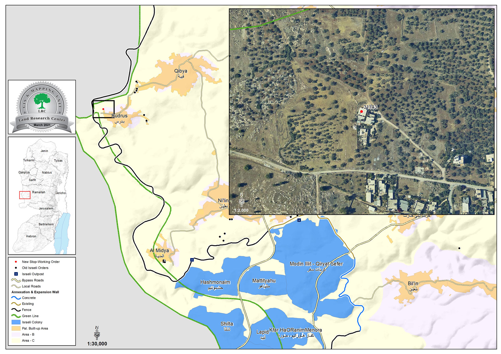
- Location: Budrus village / Ramallah governorate.
- Date: March 25th 2021.
- Perpetrators: The Israeli Civil Administration protected by the Occupation Forces.
- Date: Citizen Nidal Khlaif.
- Description:
Thursday, March 25th 2021, The So-called Israeli Civil Administration raided Budrus village, and delivered a halt of work notice to citizen Nidal Khlaif on his under-construction house on the pretext of building without a license in C area.
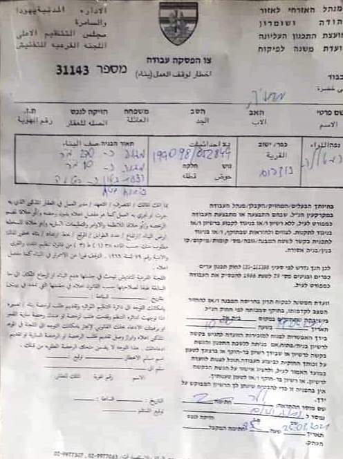
The notice was numbered (31143) , and stated that the subcommittee will discuss demolishing the building or returning it to its previous status in Beit El military court at April 14th .
The targeted building consists of a basement and a floor with a total area of 180 m2, and was supposed to accommodate be a home for 5 family members, 3 of them are children.
Budrus village council head Ahmed Khalid told LRC: “Budrus suffers from a small built-up area (about 286 dunums out of 3500 dunums of the village total area). As a result, 65 % of the houses are built outside the village outline.”
In 2016, Seven families in Budrus received halt of work notices on their houses, on the pretext of building without a license. And in 2019, a military order was issued numbered (07/17/t) to seize 3.15 dunums for the extension of the buffer zone east the Apartheid wall, through installing a 1.5 km segment of the siege east the Apartheid wall on the village lands , in order to prohibit farmers from using their lands nearby the wall.
Photo 1: The targeted house
Notice number 31143 which targets house of Nidal Khlaif
About Budrus village: [1]
38 km North west Ramallah, Budrus is bordered by Qabiya and the green line (north), also the green line (west), Qabiya and Na’alin (east) and Na’alin (south).
Budrus has a population of (1596) people until 2017.
Budrus has a total area of 3,162 dunums, of which 276 dunums are the town’s built up area.
The segregation wall (2,152 m) devoured 215 dunums under its route , and isolated 841 dunums.
Oslo conventions divided the town’s lands as the following:
- B area (382) dunums.
- C area (2,780) dunums.
[1] GIS-LRC

This report was prepared as part of Secure Palestinian Land & Housing Rights project activities
The Contents of this document are the responsibility of LRC and do not reflect EU positions


