2024-09-26
Colonists Establish a New Settlement Outpost on the Lands of Um Safa Village, North of Ramallah
Violation: Establishment of a colonial grazing outpost.
Location: Um Safa Village, north of Ramallah City.
Date of Violation: September 26, 2024.
Perpetrators: A group of settlers.
Affected Parties: Residents of the village and nearby communities.
Description:
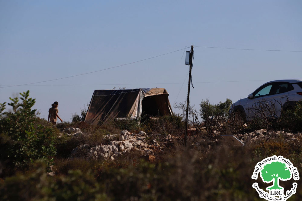
Settlers continue their attacks on farmers in the villages and rural areas of Ramallah Governorate, as they do in other parts of the West Bank. The latest of these assaults involves a group of settlers, believed to be from the "Ataret" settlement, establishing a new grazing settlement outpost on the lands of Um Safa Village in an area known as "Jabal al-Ras." The targeted site consists primarily of pasture lands, which the occupation authorities classify as "state lands."
View of the new colonial agricultural outpost
View of the New Agricultural Colonial Outpost:
The settlers set up colonial tents on lands owned by Maher Saeed Sabah and Nimer Sbiti Suleiman Sabah. This coincided with ongoing land leveling that has been occurring for over a month and the systematic seizure of land in Jabal al-Ras. The village residents possess documentation proving their ownership of the land, despite the occupation's claim that much of it is state land.
Recently, settlers, under the protection of the Israeli army, began leveling approximately 450 dunams of land in the villages of Um Safa and Arura, northwest of Ramallah. They also blocked the road connecting the villages of Deir Sudan, Arura, and Um Safa, preventing citizens from passing through. This is part of a systematic seizure process carried out by the occupation, targeting the northwestern section of Ramallah Governorate to cut off connectivity between area villages and northern West Bank governorates in preparation for a large colonial project under development.
Mr. Marwan Sabah, the head of the village council in Um Safa, told a researcher from the Land Research Center:
"The leveling operations have become daily occurrences, and today the settlers are establishing a new colonial nucleus in the area, which may eventually lead to the creation of a large settlement that will consume hundreds or even thousands of dunams of village land, turning the area into a disaster zone due to the occupation. The leveling is happening just meters away from the village homes, and it’s likely the occupation will impose restrictions on building and movement for residents while seizing the remaining village lands."
About Um Safa Village:
Um Safa Village is located 12 kilometers north of Ramallah City. It is bordered by the lands of the villages of Ajoul and Atara to the east, Ajoul and Deir Sudan to the north, Deir Nitham and Nabi Saleh to the west, and Barham, Jibiya, and Kobar to the south.
The village's population was approximately 670 as of 2017, with residents from families such as Tanaatra, Sabah, Musleh, Arqoub, Bahr, Quna, and Hamad. The total area of the village is 4,403 dunams, with 93 dunams designated for construction. The occupation has confiscated 230 dunams for the benefit of the "Ataret" and "Halamish" settlements, which occupy parts of the village lands.
مشروع: حماية الحقوق البيئية الفلسطينية في مناطق "ج" SPERAC V - FCDO
Disclaimer: The views and opinions expressed in this report are those of Land Research Center and do not necessarily reflect the views or positions of the project donor; the Norwegian Refugee Council.
إخلاء المسؤولية: الآراء ووجهات النظر الواردة في هذا التقرير هي آراء ووجهات نظر مركز أبحاث الأراضي ولا تعكس بالضرورة وجهات نظر أو مواقف الجهة المانحة للمشروع؛ المجلس النرويجي. للاجئين

