Olive Tree Cutting and Destruction in Deir Ballout Village by the Israeli Army
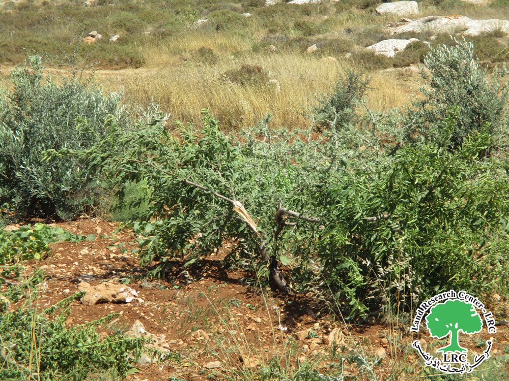
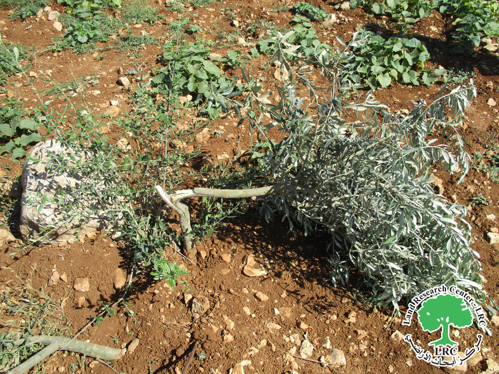
Violation: Cutting and destruction of 16 olive saplings.
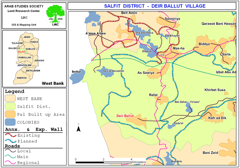
Location: Deir Ballout village, west of Salfit Governorate.
Date of violation: 13/10/2024.
Perpetrator: Israeli Occupation Army.
Affected Party: Farmer Mohammad Jabri Damra.
Description:
On the morning of Sunday, October 13, 2024, the Israeli occupation army targeted the lands of farmers adjacent to the annexation and expansion wall built on the lands of Deir Ballout village. They attacked the land by cutting and destroying (16) fruitful olive saplings.
The affected land belongs to farmer Mohammad Jabri Damra, who reported that Israeli soldiers broke the olive branches with their hands and feet, causing significant damage to the trees.
It is noted that farmer Mohammad Damra is the sole provider for a family of (6) adults, including (3) females.
Effects of the Attack on Olive Trees
It is worth noting that Deir Ballout village, like other villages and towns in the Salfit Governorate, faces frequent targeting by the Israeli occupation. This includes the cutting of trees and the destruction of agricultural lands, particularly those near the annexation and expansion wall. Over the past five years, more than 400 trees have been cut down and destroyed in the village under various pretexts, including claims that the land is "state land."
Introduction to the Town of Deir Ballut:[1]
Deir Ballut is located 24 kilometers west of the city of Salfit. It is bordered to the north by the village of Rafat, to the west by the Green Line -the lands occupied in 1948- to the east by the village of Kafr ad-Dik, and to the south by the village of Al-Lubban Al-Gharbi.
As of (2017), the population of the town was (3,873). The residents belong to nine families: Tuffaha, Khair, Abdullah, Qasim, Qar'oush, Mashel, Mustafa, Mousa, and Hadrous.
The total area of the town is 11,399 dunams, of which 503 dunams are designated as the village's built-up area.
On its eastern lands, the Israeli occupation has established two settlements (Har Eli Zahav and Peduel). The occupation has confiscated 436 dunams of its land for this purpose, as detailed below.
The settlement of "Har Eli Zahav" has seized 190 dunams of the village's lands. It was established in 1983 and, as of January 3, 2019, is home to 3,119 settlers, according to statistics from the Israeli Ministry of Interior.
The bypass road No. 446 has taken an additional 127 dunams of the village's land.
Furthermore, the separation wall runs through the village's lands, confiscating 119 dunams under its path and isolating 895 dunams. The current length of the wall in the village is 1,189 meters. If the planned construction of the wall on the village's lands is completed, it will confiscate 670 dunams under its path and isolate 2,613 dunams, with a total length of 6,695 meters.
According to the Oslo Accords, the village's lands are classified as follows:
- Area B: 689 dunams.
- Area C: 10,710 dunams.
- مشروع: حماية الحقوق البيئية الفلسطينية في مناطق "ج" SPERAC V - FCDO
Disclaimer: The views and opinions expressed in this report are those of Land Research Center and do not necessarily reflect the views or positions of the project donor; the Norwegian Refugee Council.
إخلاء المسؤولية: الآراء ووجهات النظر الواردة في هذا التقرير هي آراء ووجهات نظر مركز أبحاث الأراضي ولا تعكس بالضرورة وجهات نظر أو مواقف الجهة المانحة للمشروع؛ المجلس النرويجي. للاجئين


