2018-02-04
Stop-work and demolition orders in the Bethlehem village of Al-Walaja
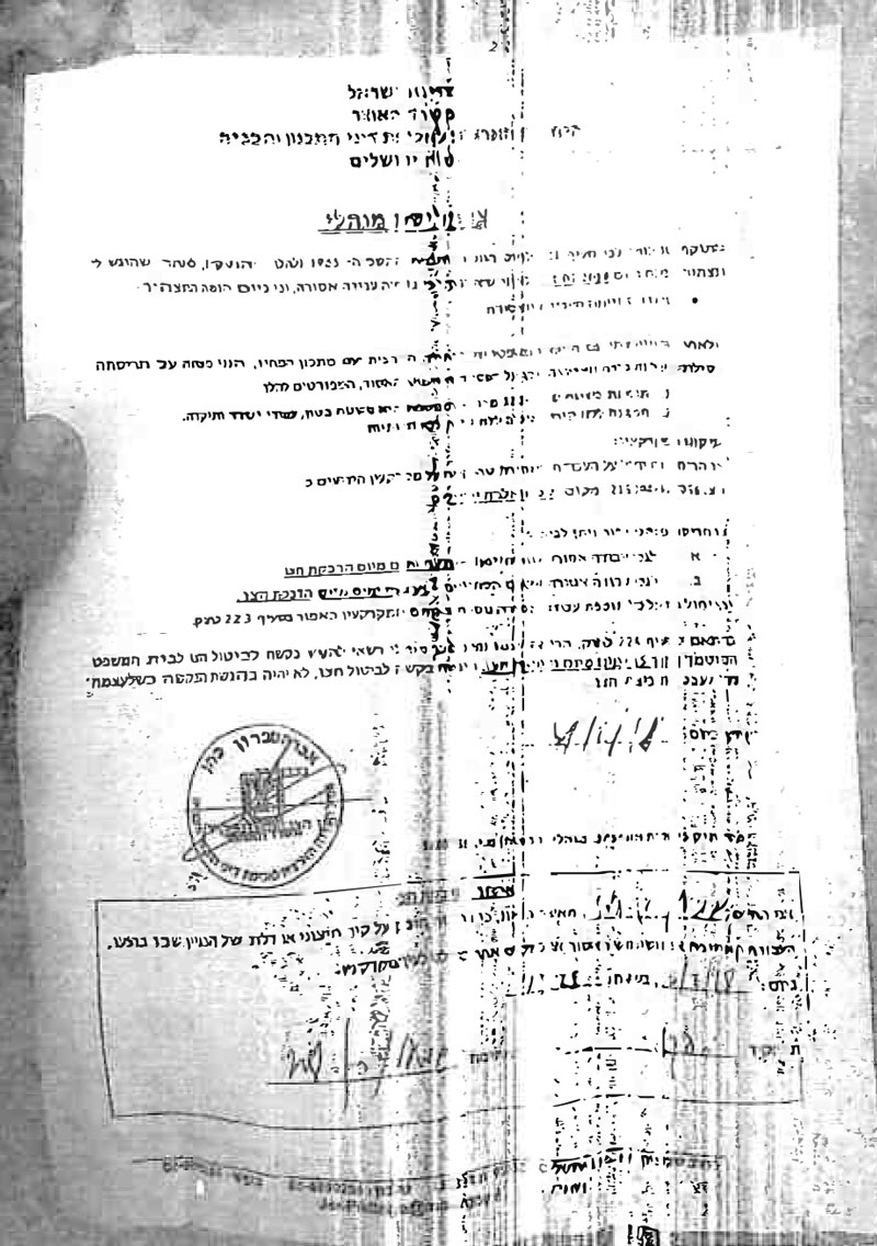
On February 11, 2018, a massive force from the Israeli occupation army raided Al-Walaja village in Bethlehem and delivered three demolition orders to families on the claim of "unlicensed construction". Israel Municipality in Jerusalem claimed the targeted structures to lack building permits and that they are located within the borders of Jerusalem, despite that the owners have ownership documents for the lands on which the structures are built in addition to holding Jerusalem identity cards.
The threatened residences belong to the following people:
- Citizen Ahmad Abu Ettin: the house is inherited and was built in early seventies with a total area of 50m2. The owner had to annex a 100m2 area to the house to accommodate his family that is getting bigger with time. Noteworthy, the Israeli Occupation Authorities served a stop-work order on the structure on January 2018 before serving the latest demolition order, which the family found left under a rock nearby the house.
Ahmad told Land Research Center that " the house is ancient and I rehabilitated it in order not to fall on our heads and expanded it to accommodate us. Israel Municipality in Jerusalem refused to grant us building permits and we have the right to live with dignity in our lands".
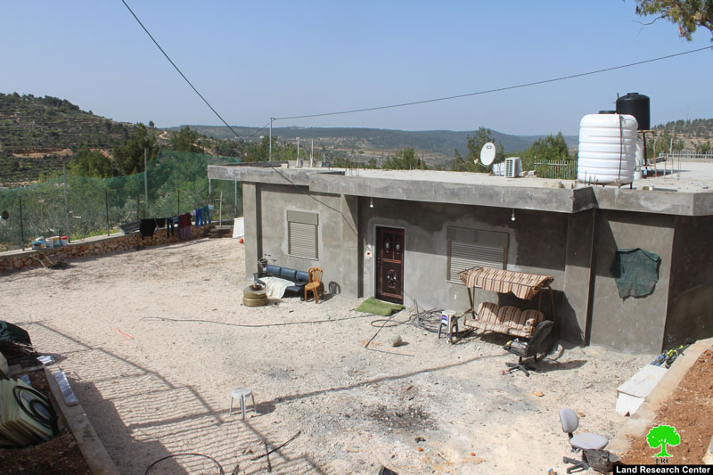
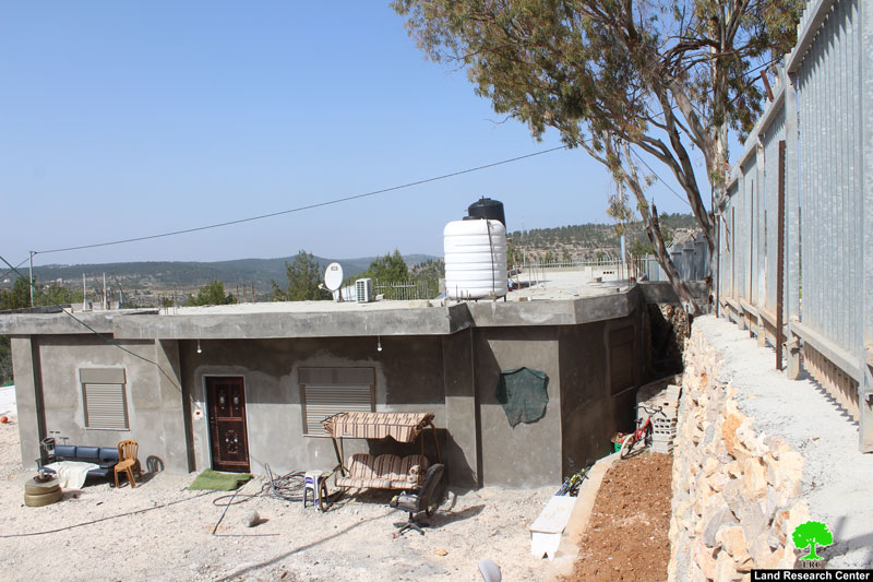
the threatened residence of citizen Ahmad
- Citizen Alaa Hajajla: he was served a demolition order on his under construction residence. Construction works started in early 2018 on a 500m2 area.
Alaa told Land Research Center the following:
" After we received the order, we hired an attorney and paid 10,000 NIS to halt and postpone the demolition operation until we obtain a building license, which is something almost impossible to get from the Israeli side. Recently, the Israeli court delayed its final decision until March 12, 2018. As for me, I stopped all construction works until the decision is made"
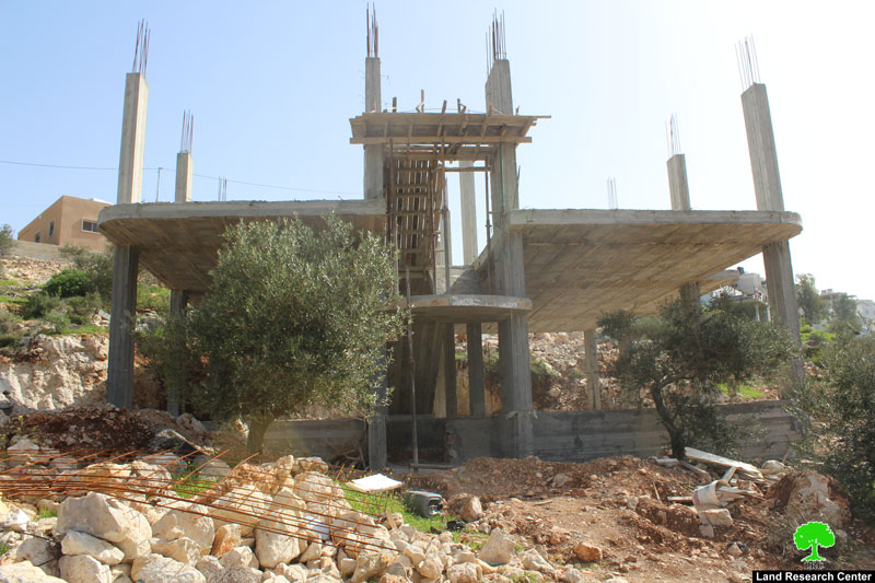
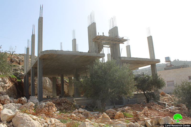
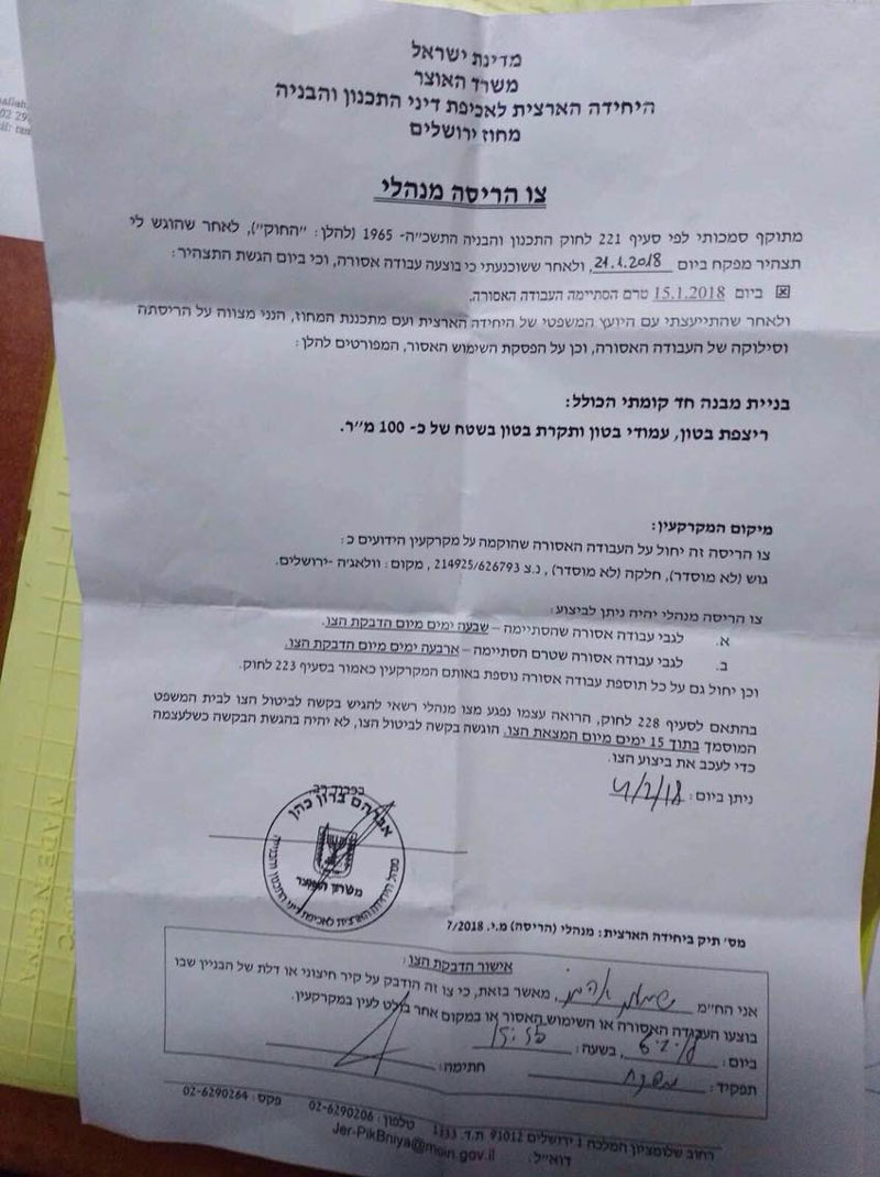
the threatened residence of citizen Alaa
- Citizen Hanan Al-Razim: she received a demolition order for her 120m2 house and three bricks (60cm) that were put in shape of a wall!!.
Hanan told Land Research Center the following:
" We are a big family and we have a two story house. We added the second floor but the occupation notified it. We have been living there since long time ago. Now, an attorney is following up on our case".
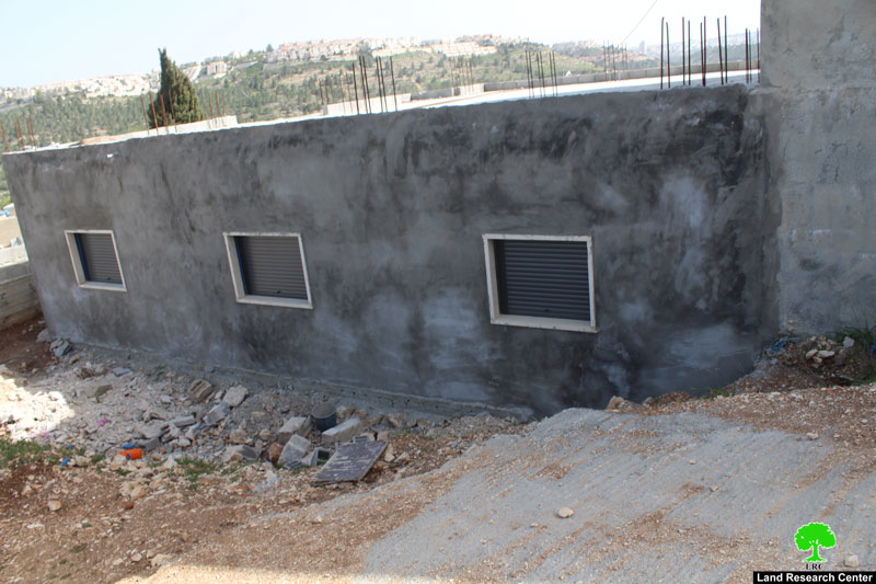
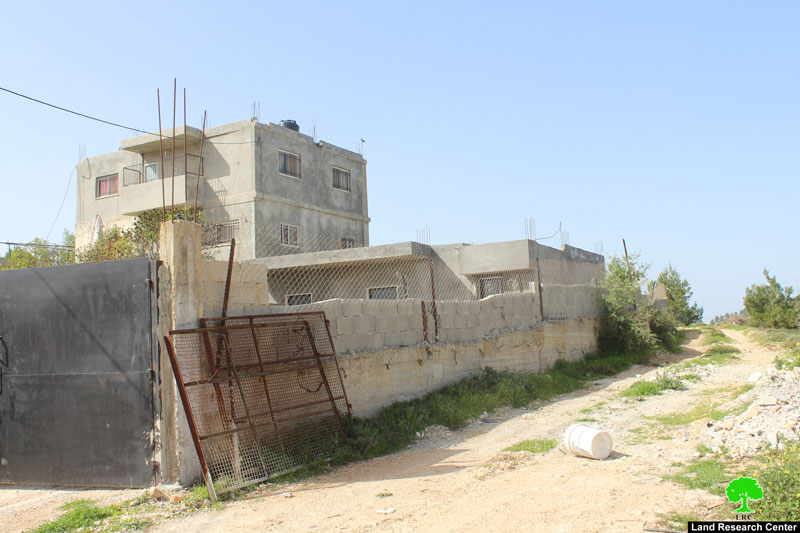
residence of citizen Hanan
The following table shows information about the affected families:
| Family | Minors | Area of structurem2 | Status of structure |
Ahmad Abu Ettin | 5 | 3 | 100 | Under construction |
Alaa Hajajla | 5 | 3 | 150 | Under construction |
Hanan Al-Razim | 6 | 2 | 120 | Under construction |
Total | 16 | 8 | 370 |
Source : Field observation- Department of Monitoring Israeli Violations- Land Research Center-2018
In the same context, Israeli Occupation Forces notified a cemetery in the area of demolition. The occupation seeks to confiscate as much land as possible from Al-Walaja village to be later annexed to Jerusalem.
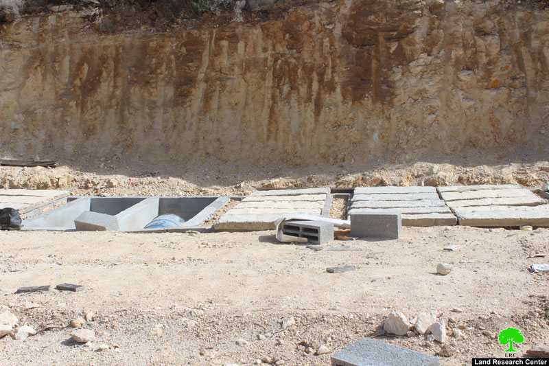
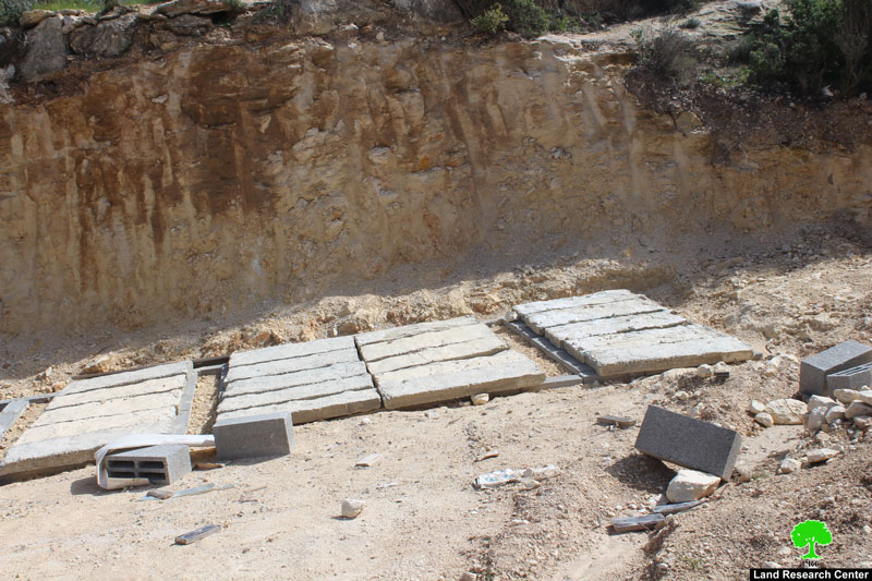
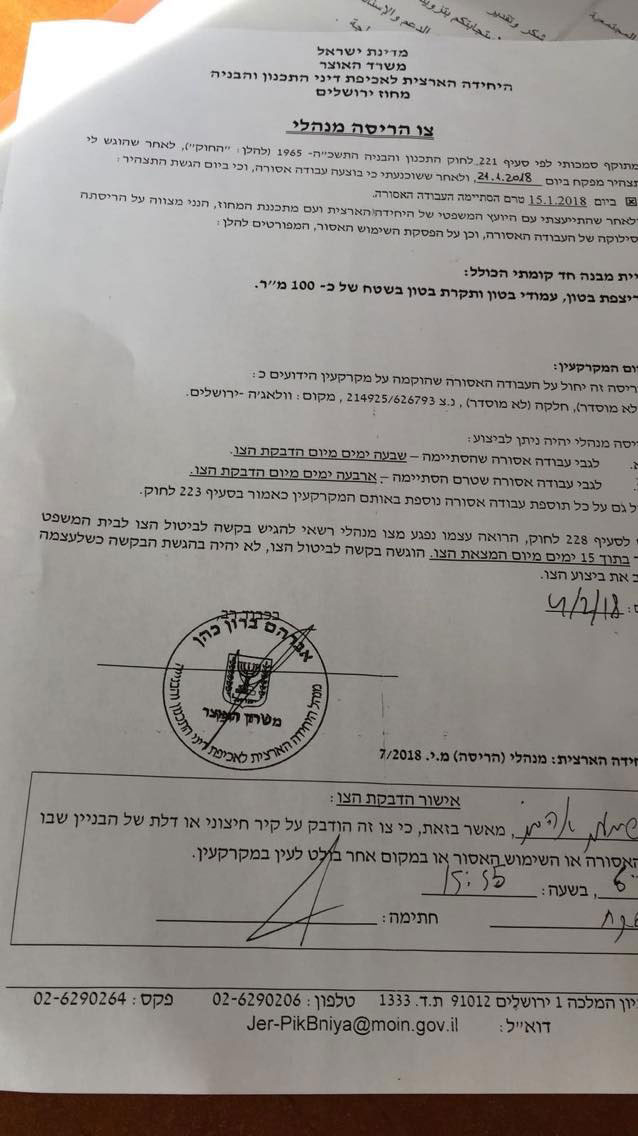 the demolition notice and view of the cemetery
- Al Walaja:
5 kilometer northwestern Ramallah, Al Walaja is surrounded by Battir (west), Sharafat (east), and Beit Jala (south).
Al Walaja has a total population of 2041 people according to statistics conducted in 2007. It has a total area of 4327 of which 446 dunums are a built-up area of the village.
The Israeli occupation devoured 155 dunums of the lands of the village for two colonies:
- Har Gilo: it was built in 1972 and confiscated 104 dunums of the village. It is inhabited by 365 colonists.
- Gilo: it was built in 1981 and devoured 51 dunums. It is inhabited by 27569 colonists.
Moreover, bypass number 436 took over 246 dunums of the village lands. Also, the Apartheid Wall damaged 69 dunums and is expected to isolate 4171 other dunums from the area. The length of the wall built on Al Walaja lands is 6942 meters.
According to Oslo Accords, 3% of Al Walaja is under Area B (PA is in charge of civil matters with Israel responsible for security). However, most of the village lands (97%) is under Area C (Israel maintains full security and administrative control). Here are the area in dunums:
- Area B (115) dunums
- Area C (4056) dunums
This document has been produced with the financial assistance of the European Union.

The contents of this document is the sole responsibility of LRC and can under no circumstances be regarded as reflecting the position of the European Union.
