2018-03-22
The Israeli occupation ravages a road in Al-Khadr / Bethlehem governorate
Violation: Sweeping away land and laying infrastructure for a colonial expansion
Date: 22/03/2018
Location: Khallet al-Fahem, Al-Khadr- Bethlehem governorate
Perpetrators: The Israeli occupation army and civil administration
Victims: People of Al-Khadr
Details:
On March 22, 2018, Israeli bulldozers began to implement the outline plan No. 11/405, which aims to build 68 housing units on al-Khadr lands in proximity of Alon Shvut settlement.
Israeli bulldozers razed 19 dunums of agricultural land in Khallat al-Fahm area in Block 12, and set up infrastructure to prepare the land to install caravans on it. These caravans are to be used as an alternative housing for the settlers whose homes will be demolished in the settlement of Netiv Havot.
According to municipal engineer Hassan Sobeih, a researcher of the Land Research Center, "The Israeli occupation is very greedy and has plans for al-Khadr. The occupation acts are unjustified; bulldozers are ravaging land and opening roads that go for the interest of settlers."
It should be noted that the occupation forces shut down an agricultural road that was used by farmers to access their land under the pretext of it is being adjacent to Alon Shvut. The occupation forces opened a new road as an alternative to make sure farmers stay as far away from the periphery of the settlement as possible. The alternative road is in a remote area, forcing farmers to walk long distances to access their agricultural land.
The Israeli occupation is also working on the construction of walls around the colonial outpost, before laying down the caravans. It should be marked that walls are being built with old stone, and this must be a colonial goal so that in the long term, they can claim that the colony is old and has been established for a long time.
The occupation authorities use the declared land as "state land" as an excuse or pretext for land confiscation to be used in future settlement expansion plans.
" People in the town of Al Khader only have their lands as their main assets and breather, where the villagers spend most of their time in the summer and other seasons," Sobeih told the Land Research Center researcher.
.
|
|
|
|
|
|
|
|
|
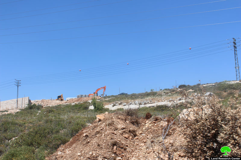
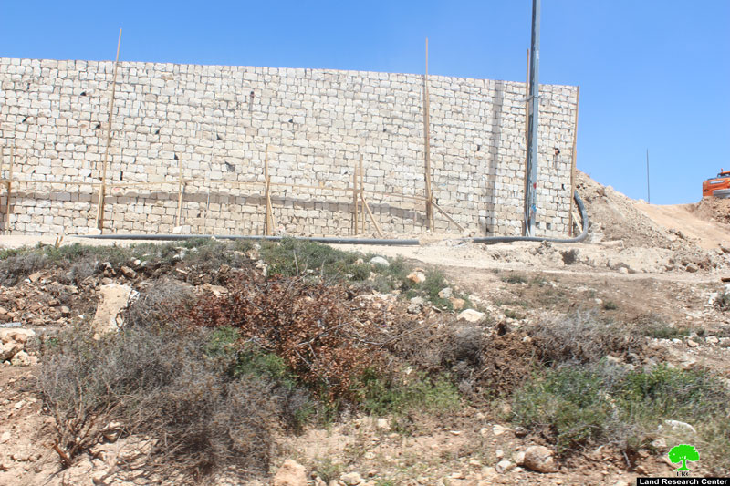
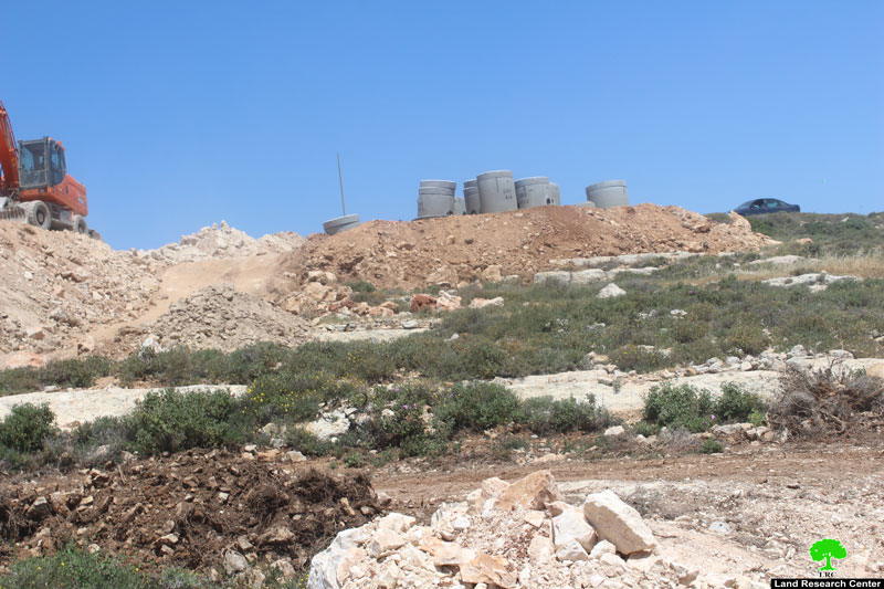
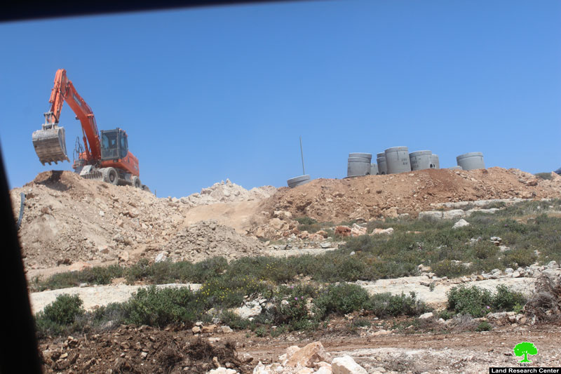
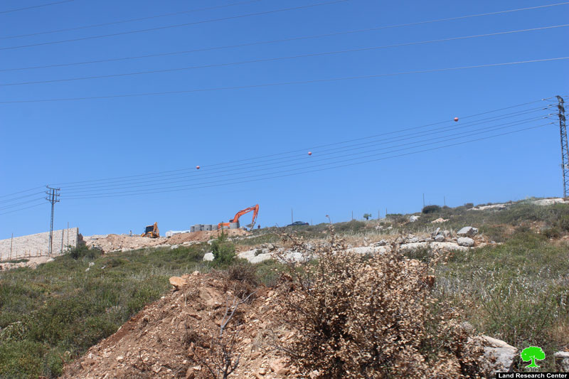
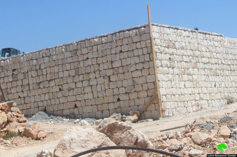
The pictures from 1-7 illustrate the dredging in the colonial outpost, the colony's infrastructure, and the wall around the colony
Al Khadr:
Located 4 kilometer west of Bethlehem, Al Khadr village is surrounded by Beit Jala and Battir (north), Husan and Nahhalin (west), Ad Doha, Wadi Rahall, and Beit Jala (east), Wadi An Nais (south).
Al Khadr has a population of 9774 according to statistics conducted in 2007. It has a total area of 8279 dunums, 184 of which are built-up area.
The Israeli occupation confiscated 29 dunums of Al Khadr lands for Efrat and Daniel colonies. Efrat was built in 1979 and devoured 5.8 dunums of Al Khadr. It is inhabited by 7037 colonists. Daniel was built in 1982 and confiscated 23 dunums. 1073 colonists live in the colony.
Bypasses number 60 and 375 devoured more than 487 dunums. Not to mention the Apartheid Wall that destroyed 280 dunums and isolated 5638 dunums of the village. The Wall in Al Khadr is 2805 meters long.
According to Oslo Accords, 10% of Al Khadr is under Area A (PA has full civil and security control) while 6% is under Area B (PA is in charge of civil matters with Israel responsible for security). However, most of the village lands (84%) is under Area C (Israel maintains full security and administrative control). Here are the area in dunums:
Area A (808) dunums
Area B (475) dunums
Area C (6996) dunums

The contents of this document is the sole responsibility of LRC and can under no circumstances be regarded as reflecting the position of the European Union