2019-02-17
The occupation destroys parts of a water network for Palestinian communities
Violation: Destroying parts of an under construction water network.
Location: Maraka – Beit Dajan , Beit Furik / Nablus governorate.
Date: 17/02/2019.
Perpetrators: The Israeli occupation army.
Victims/ affected: Beit Furik and Bait Dajan joint services council.
Description:
About 10:30 am, The Israeli occupation troops raided Maraka area and destroyed a segment of a water network (750 m long * 6 inches wide) , belongs to Beit Furik and Beit Dajan joint services council.
Mr Awad Hanini from Beit Furik village council told LRC reporter:
“I received a phone call from Beit Dajan village council head Munjid Abu Jish , saying that the Israeli occupation troops are destroying a segment of a water network that is under implementation for the two villages.
Abu Jish and I headed to the location, and talked to the officer in charge and he told us that we are not allowed to implement projects in the area, as it is classified C in Oslo conventions”.
|
|
|
|

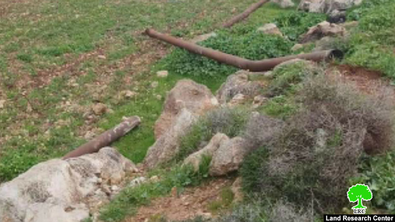
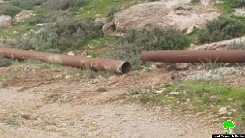
Beit Furik and Beit Dajan joint services council is implementing a self-funded project that aims to solve the water supply problems in the two villages, but the occupation won’t let Palestinians live in peace or have even basic life needs.
About Beit Dajan:[1]
Beit Dajan is located 10 km to the east of Nablus; its total area is 44100 dunums including 360 dunums of built up area inhabited by 3900 people (2010 census) in addition to 12500 dunums that are related to al-Ghoor area . A large part of the village lands were confiscated for the construction of the colony of Mehola in 1973.
Beit Dajan is surrounded by a number of villages namely (Salem, Deir al-Hatab, Talluza, Beit Furik, Ghoor el-Far'a ) and depends on grains plantation and fruitful trees such like olive, figs and almond.
About Beit Dajan:
It is located 10 km to the east of Nablus; its total area is 44100 dunums including 360 dunums of built-up area inhabited by 13,477 people (2017 census) in addition to 12500 dunums that are related to the Jordan Valley. A large part of the village lands was confiscated for the construction of the colony of Mehola in 1973.
Beit Dajan is surrounded by a number of villages namely (Salem, Deir al-Hatab, Talluza, Beit Furik, Ghoor el-Far'a ) and depends on grains cultivation and fruitful trees such like olive, figs and almond.
[1] GIS-LRC

This document has been produced with the financial assistance of the European Union
The contents of this document is the sole responsibility of LRC and can under no circumstances be regarded as reflecting the position of the European Union