2019-01-23
“Yitzhar†settlers ravage lands in Asira Al-Qibliya / Nablus governorate
Violation: ravaging lands.
Location: Asira Al-Qibliya / Nablus governorate.
Date: 23/01/2019.
Perpetrators: Settlers of “Yitzhar”.
Victims: Farmers from the village.
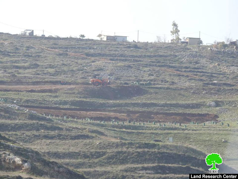
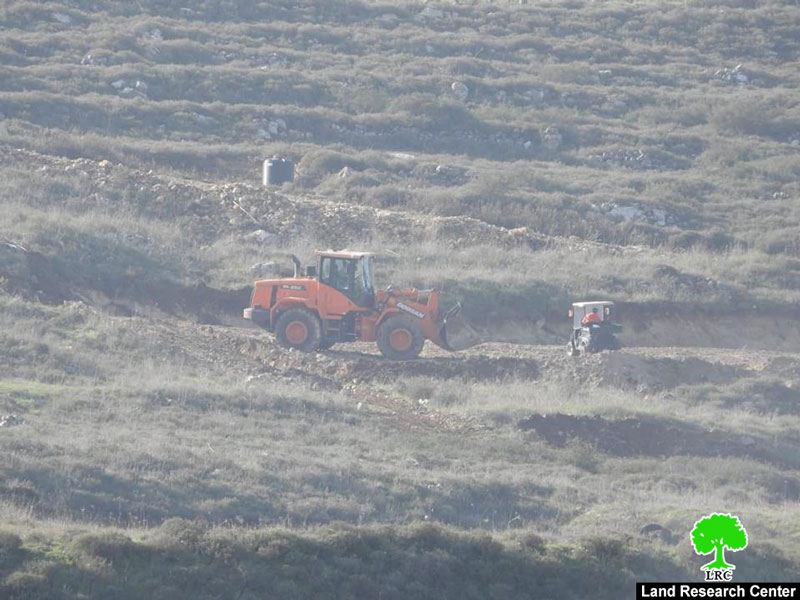
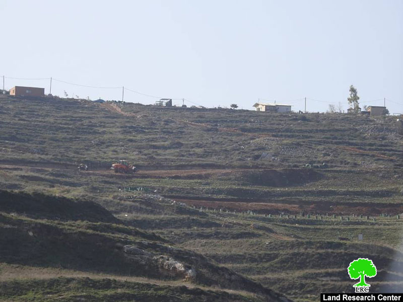
Description:
In the afternoon of Wednesday, 23rd January 2019, The occupation’s bulldozers were seen ravaging lands in Al-Suwana area. The targeted lands belong to : Abdul Raheem Ahmad “6 dunums” , Muhammad Hamdan “5 dunums”, Mitleq Othman “ 5 dunums” and Ibrahim Ismael “4dunums”.
Hafith Saleh head of Assira Al-Qibliya village council told LRC reporter:
“ We have noticed that “Yitzhar” settlers have been ravaging about 20 dunums of the town’s lands, in Al-Suwana location which is about 1.5 km south the town , we reported that attack to the Israeli police through the Palestinian coordination office”.
Saleh asserted: Yitzhar settlers have been carrying out frequent assaults against People of Assira Al-Qibliya such as slashing car tires , sabotaging trees and opening fire towards Palestinian houses.
|
|
|
|
|
|

General Information about ‘Asira al Qibliya:
‘Asira al Qibliyais located 20 km south of Nablus city; it is surrounded by the villages of Tell (north), Tell ,Zita and Jamma’in (west) , Madma (east) , Urif and Jama’en (south) . It has a population of (2935) people in 2017.
Its total area is about 6440 dunums, 322 dunums are the town’s built up area.
530 dunums were confiscated and used for the enlargement of Yizhar, Which was established in 1938 and populates about 440 settlers.
Oslo conventions divided the town into:
B area : (4,503) dunums.
C area: (1,937) dunums.
Yitzhar:
Yitzhar is translated to “olive oil”, the name of the town is related to olive oil milling.
Yitzhar was at first a military point “Nahal” established in 1/8/1983, then converted into a colony in 23/7/1984, it is about 8 km south west Nablus, on the main road that links Ramallah to Nablus.
It is built on Palestinian ground (the villages of Burin, Huwwara, ‘Einabus, ‘Urif, ‘Asira al Qibliya, and Madama), like any other Israeli colony.
The illegal colony was built with plan 86/1, and confiscated lands belong to Palestinian citizens , and located in natural block 8 from Burin lands, block 4 from Madma lands, block 1 from Asira Al-Qibliya and block 3 from Urif lands.

The contents of this document is the sole responsibility of LRC and can under no circumstances be regarded as reflecting the position of the European Union