2019-06-05
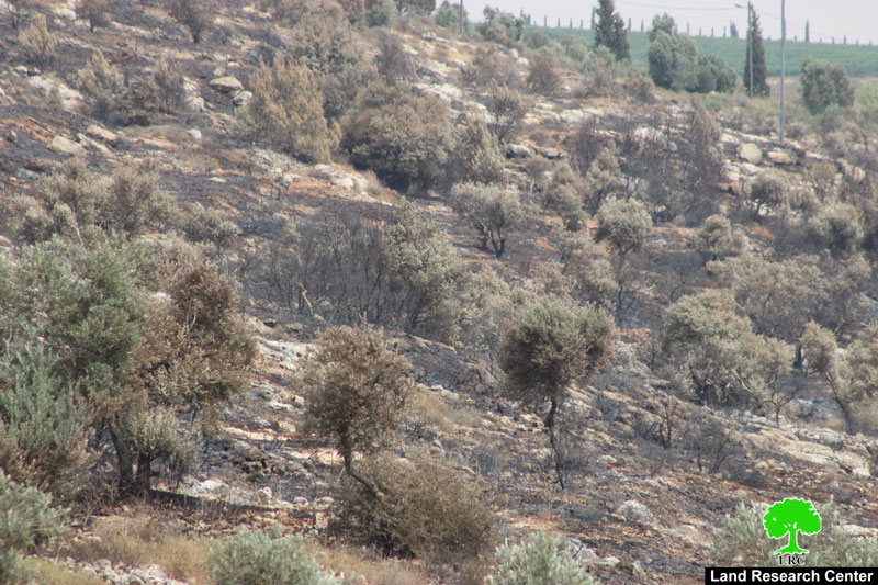
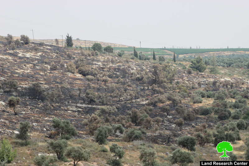
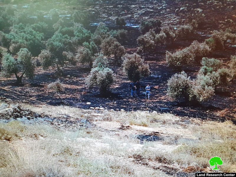
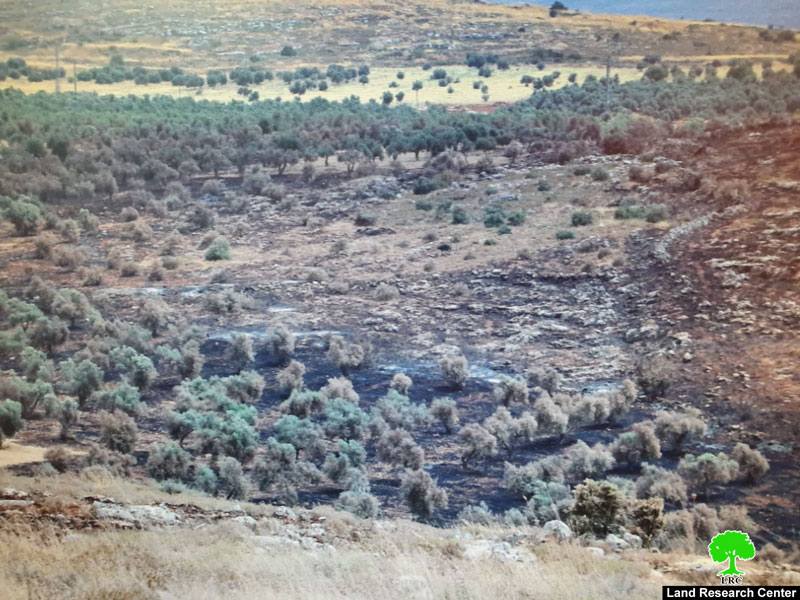
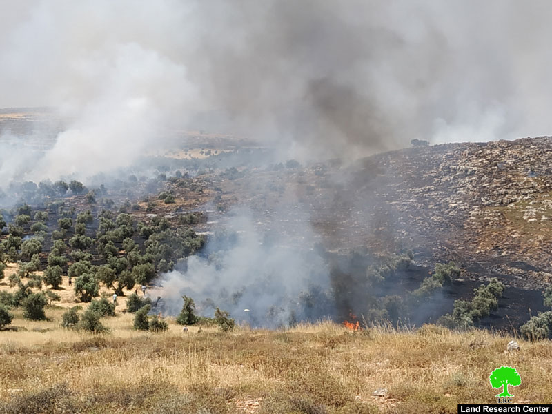
Settlers torch 890 aging olive trees in Jalud / Nablus governorate
Violation: Torching hundreds of olive trees.
Location : Jalud village / Nablus governorate.
Date: 05/06/2019.
Perpetrators: of “Ahya” and “Adei Ad”.
Victims: Number of farmers from the village.
Description:
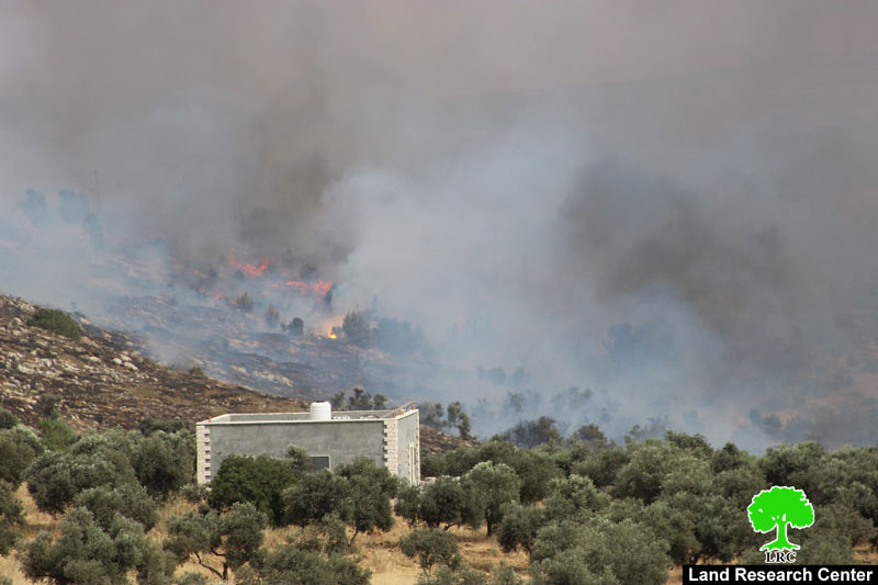
About 10:00 am , a group of settlers from “Ahya” and “Adei Ad” outposts set fire in wide areas of olive groves , about 200 m from the town’s houses and 500 m west the outposts in Jalud.
Village council head Abdullah Mohammad told LRC reporter:
“The fanatic Settlers set fire in several locations: Ar-Rous , At-Tuwwal , Ma’aser Ghzail, Al-Huqan, Sahel Jaloud and Al-Khafafeesh, the fire fighter were not able to stop the flames or reach all places , at the time all the people of the village gathered to kill the fire.”
He asserted:
“The fire ate up hundreds of aging olive trees , about 890 (60 years of age) , in addition to a dunum planted with wheat.”
When the fire approached towards Israeli outpost, the occupation army called Aerial firefighters to stop the flames.
About Jalud:[1]
Jalud is located 29km to the southeast of Nablus city and is edged by Qusra village from the northeast, Qaryut village from the west, Yesh Kodish and Ahya outposts from the east and Shilo colony from the south.
Its population mounts up to 598 people (2014 census). Jalud's total land area is 22,473 dunums, of 80 dunums are considered the village's built-up area.
Israeli colonies confiscated 2227 dunums from Jalud lands. Shilo colony that was established in 1978 confiscated 640 dunums from the village. Mizpe Rahel colony and other outposts namely (Yesh Kodish, Ahya, Eli, Adi Ad and Kida) are founded on confiscated lands from the village.
Bypass roads confiscated around 436 dunums from the village.
The lands of Marda are classified according to Oslo Accords as the following:
5541 dunums (25%) are classified as area B
16932 dunums (75%) are classified as area C
[1] GIS-LRC

The contents of this document is the sole responsibility of LRC and can under no circumstances be regarded as reflecting the position of the European Union
