2020-04-16
Itamar settlers release their cows in ‘Awarta agricultural lands / Nablus governorate
Violation: Settlers graze their cows in Palestinian groves.
Location: ‘Awarta village / Nablus governorate.
Date: April 16th 2020.
Perpetrator: Settlers of “Itamar”.
Victims: number of farmers from the village.
Description:
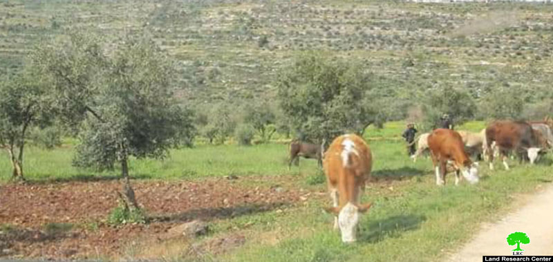
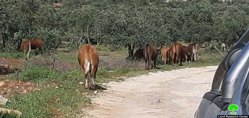
Friday, April 16th 2020, Israeli illegal settlers released tens of sheep and cows in Palestinian olive groves, according to eyewitnesses.
Photos 1-4 : Cows released by Israeli settlers grazing in Palestinian olive groves
Village council head Sa’ad Abu Sameh told LRC:
“After coordination with the occupation authorities to access olive groves under restrictive measurements, I went with number of farmers to cultivate their olive groves, but we found tens of sheep and cows grazing in the olive groves which notably affect the crop, we called the Palestinian liaison office which in turn called the Israeli police who showed up and told herders to lead their sheep out of the olive groves.
The Israeli Occupation authorities prohibit Palestinian farmers from accessing their lands , while Itamar settlers can freely access any land they want and wreck havoc.”
This is not the first time settlers release their cows and sheep in Palestinian olive groves, later they destroyed tens of dunums through overgrazing in Palestinian fields.
About ‘Awarta village:[1]
It is located 7km to the southeast of Nablus city and is considered the historical gate to the valleys and mountains of Nablus. The village is edged by Beit Furik from the north, Beita from the south, Huwwara from the west and Aqraba from the east. Awarta overlooks 12 Palestinian villages in addition to Nablus city; part of the village’s land is founded within the municipal borders of Nablus.
‘Awarta has a population of 7054 people until 2017 census.
‘Awarta has a total area of 13,448 dunums , among them 653 dunums are a built up area.
The occupation confiscated about (2697) dunums from its lands for the following purposes:
Israeli settlements took over (2409) dunums, as the following:
| Settlement name | Establishment year | Area of lands | Number of settler 2018 | notes |
|
Itamar |
1948 |
2,408 |
1224 |
Total area for Itamar 3,098 dunums |
Bypass 555 took over 100 dunums.
Israeli settlements took over (188) dunums.
Oslo accords divided the town lands as the following:
B area : 4,822 dunums.
C area: 8,626 dunums.
[1] GIS-LRC

The contents of this document is the sole responsibility of LRC and can under no circumstances be regarded as reflecting the position of the European Union


