2024-07-23
Israeli Occupation Army Destroys Agricultural Road and Water Network in Sabastiya Village North of Nablus
- Violation: Destruction of an agricultural road and a section of a water line.
- Location: Sabastiya Village / Nablus Governorate.
- Date of Violation: 23/07/2024.
- Perpetrator: Israeli Occupation Army.
- Affected Party: Landowners benefiting from the road and local residents.
Description: On the night of Tuesday, July 23, 2024, the Israeli Occupation Army carried out the destruction of a section of an agricultural road connecting the villages of Burqa and Sabastiya - Al-Wadi Al-Shami area - north of Nablus. The army used a civilian bulldozer to demolish the road, causing severe damage, and also damaged a water line with a diameter of a quarter inch and a length of 12 meters.
The targeted road is 800 meters long and 6 meters wide. It served at least 60 dunams of olive orchards and was also a crucial link between the agricultural lands of Sabastiya and Burqa. Additionally, it was sometimes used as an alternative route when the occupiers closed secondary and main roads in the area.
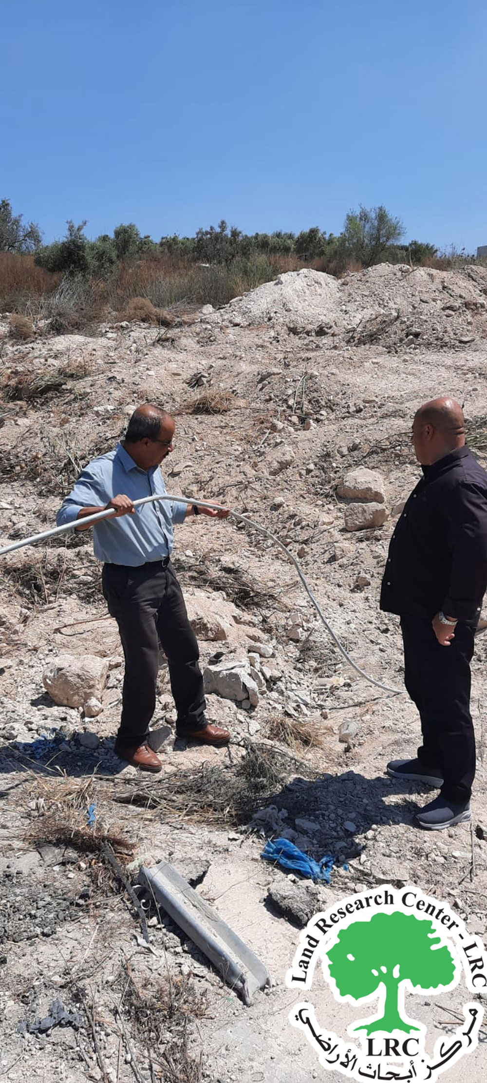 | 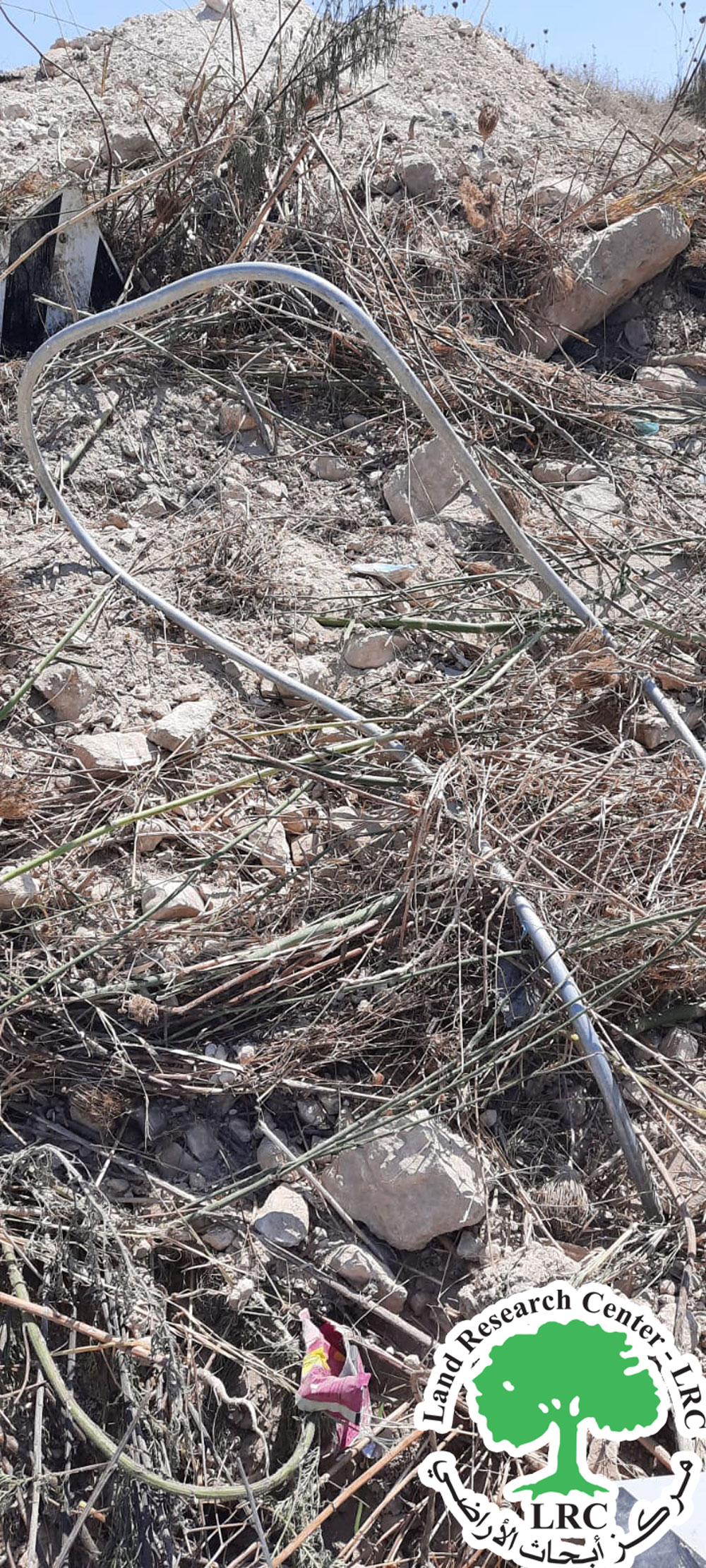 |
Damage to the road and water line
Statement by Mr. Mohamed Ahmed Azem, Head of Sabastiya Municipality:
"This road was constructed about a year and a half ago and serves as a vital access point to agricultural lands amid the closure of all secondary roads by the occupation. It is of great importance for the agricultural sector in the region. The municipality funded its construction, and it is a crucial access route for olive orchards. Despite this, the occupation forces demolished the entire road and damaged the nearby water network without any prior warning. Nonetheless, we will strive to construct an alternative road despite the occupation's actions."
Sabastiya Village: Sabastiya is located 12 km northwest of Nablus. It is bordered to the north by the village of Burqa, to the west by the village of Al-Masoudiya, to the east by Nisf-Jubeil, and to the south by the villages of Al-Naqura and Deir Sharaf. Its population was 3,205 as of 2017. The total area of the village is 16,225 dunams, of which 521 dunams are designated as built-up area. According to the Oslo Accords, the village's land is classified as:
- Area A: 8,942 dunams
- Area B: 4,980 dunams
- Area C: 2,303 dunams
Environmental Impact of the Occupation’s Actions: It is noteworthy that when the Israeli occupation destroys agricultural lands, it reduces green areas and removes plants and trees, leading to the disappearance of various plant species. Additionally, such destruction causes the loss of wildlife habitats, forcing animals to migrate and creating fragmented environmental conditions in Palestine, which harms biodiversity. The land’s degradation also increases soil erosion by removing trees and vegetation, leaving the land bare and exposed.
In this case, the occupation has committed two environmental crimes: the destruction of land and damage as described, and the impediment to farmers’ access to dozens of dunams of agricultural land, leading to the potential destruction of crops.
مشروع: حماية الحقوق البيئية الفلسطينية في مناطق "ج" SPERAC IV - GFFO
Disclaimer: The views and opinions expressed in this report are those of Land Research Center and do not necessarily reflect the views or positions of the project donor; the Norwegian Refugee Council.
إخلاء المسؤولية: الآراء ووجهات النظر الواردة في هذا التقرير هي آراء ووجهات نظر مركز أبحاث الأراضي ولا تعكس بالضرورة وجهات نظر أو مواقف الجهة المانحة للمشروع؛ المجلس النرويجي. للاجئين