2018-11-23
The Israeli occupation Halt opening a road in Nahhalin / Bethlehem governorate
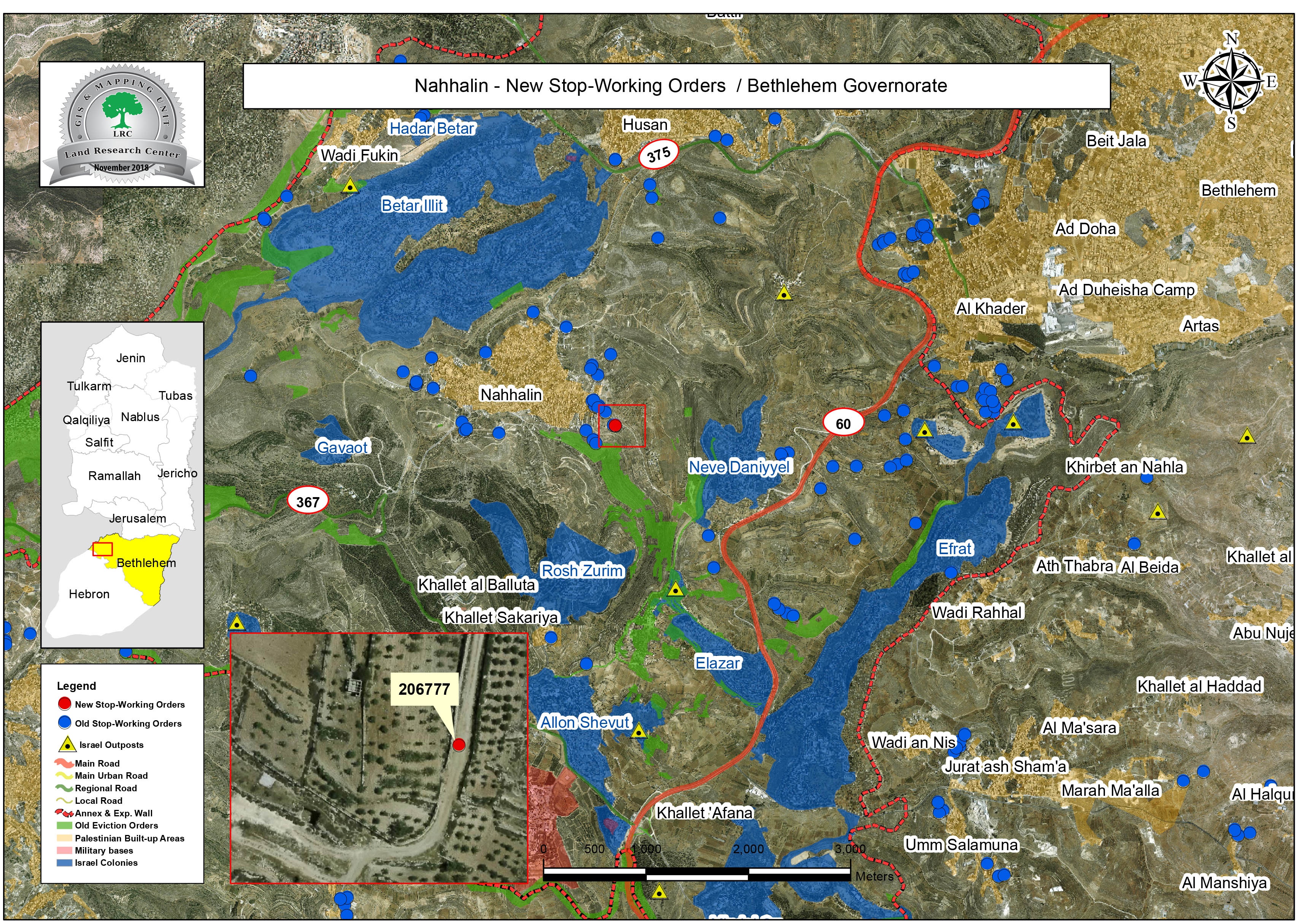
The notified road/ Nahhalin
Violation: Halting opening a vital road.
Location: Nahhalin - Bethlehem governorate.
Date: 23/11/2018.
Perpetrator: The Israeli occupation civil administration.
Victims: people of Nahhalin.
Description:
Vehicles from the Israeli occupation army and civil administration raided Umm Hadida area in Nahhalin town west Bethlehem , and served a halt of work order on an agricultural road , on the pretext that it was opened in area C before getting a license from the occupation.
Jihad Fanoun from Nahhalin told LRC reporter:
“Nahhalin municipality carried on paving a road (500*8 m) in Umm Al-Hadida area to facilitate the route to some houses and agricultural lands”
The Israeli occupation confiscated tools and machineries that were used in the project and forced workers to leave the location.
Fanoun asserted:
“We prepared the necessary documents hoping to carry on the construction of the road which will facilitate the lives of the area’s residents and farmers”
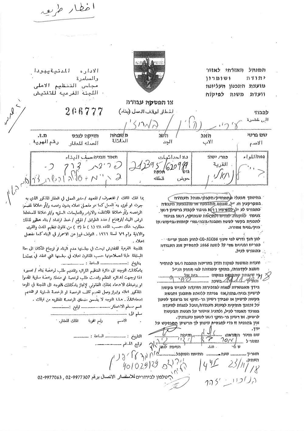
The Halt of Work order on the road
|
|


A view of the notified road
It is worth mentioning that the town of Nahhalin is heavily targeted by the Israeli occupation forces. The town is also subjected to settler attacks, as well as closures of agricultural roads to limit the movement of villagers and constrict their access to their lands.
Nahhalin[1]:
The village is located 10km to the south west of Bethlehem and 3.5 km to the east of the armistice line of 1949.
The village's total area is 18,858 dunums including 890 dunums of built-up area, inhabited by8805 people according to the PBS statistics of 2014.
Israel has confiscated 4,283 dunums from the village lands 3,583 dunums of which for colonial expansion purposes and 700 dunums for the favor of bypass roads. There are 8 colonies founded on the village land, namely (Beit Ein, Tsoref, Majdal Oz, Jabot, Kfar Etzion, Efrat, Illit, Rosen Tsurem and Allon Shevut).
[1] GIS - LRC

The contents of this document is the sole responsibility of LRC and can under no circumstances be regarded as reflecting the position of the European Union