2019-03-06
The occupation serves stop-work and demolition orders to 3 agricultural cisterns in Al-Khader / Bethlehem
Violation: serving stop –work and demolition orders to 3 agricultural cisterns.
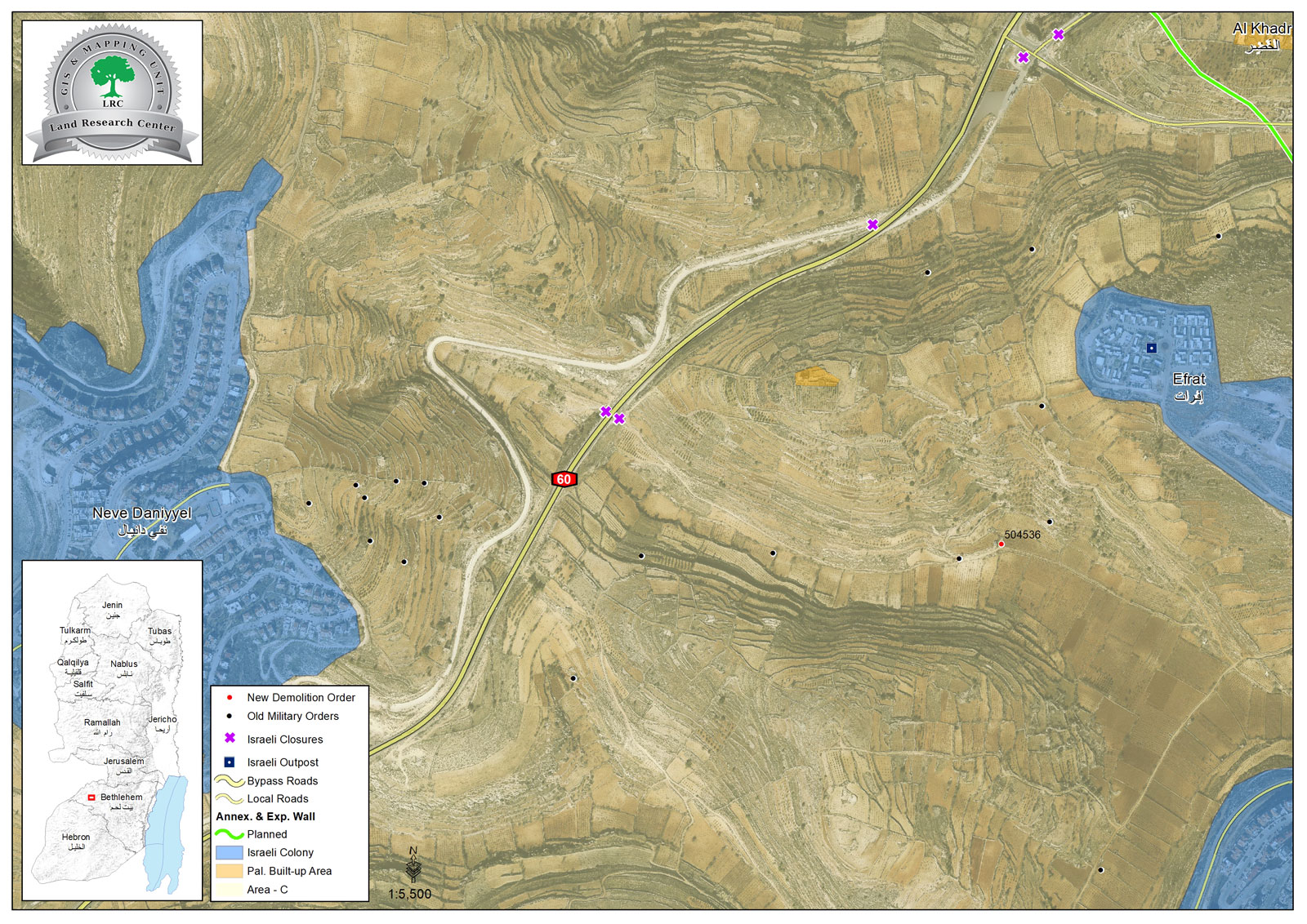
Location: Al-Khader / Bethlehem governorate.
Date: 06/3/2019.
Perpetrator: The Israeli occupation civil administration and army.
Victims: families of Ibrahim Musa , Imad Da’adou’ and Kawthar Issa.
Description:
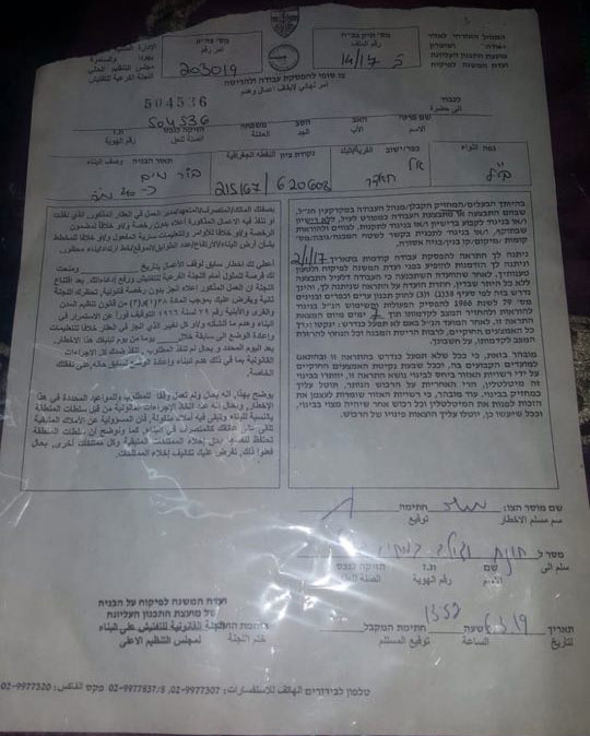
March 6th, the Israeli occupation army and civil administration served demolition orders to 3 agricultural cisterns; some of them were built more than ten years ago, under claims that they are unlicensed.
Eyad from Al-Khader municipality told LRC reporter:
“The area is very fertile; most farmers of Al-Khader use it in agriculture, the notified cisterns are there for more than tens of years, we have no idea how they threaten Israeli’s security. But the occupation’s intention is to destroy any Palestinian existence in the area”
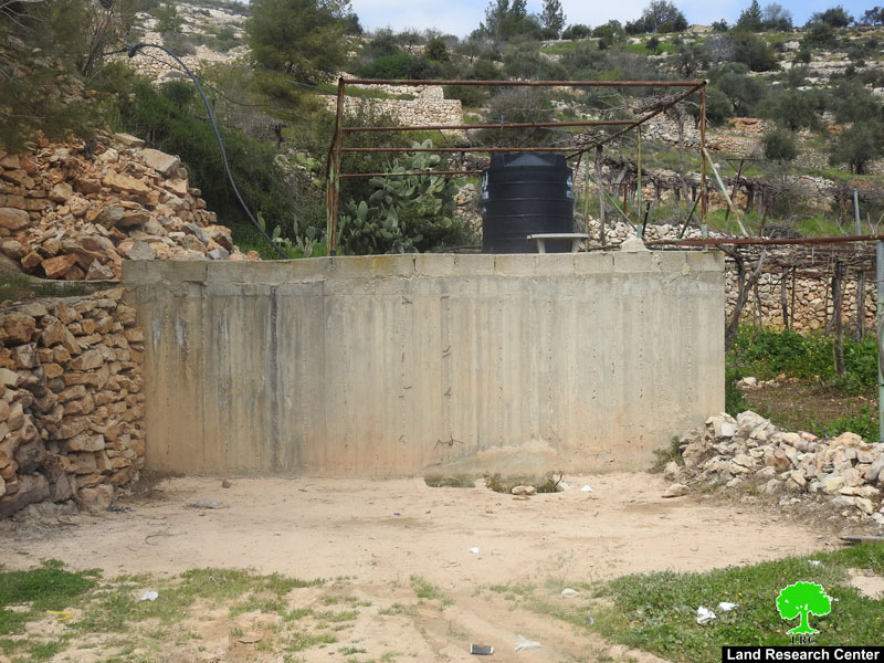
The targeted cisterns belong to Ibrahim Musa, Imad Da’adou’ and Kawthar Taher, each one has a capacity of 70 m3.
Noteworthy, the owners previously received stop work orders in 2/01/2017.
the cistern that belongs to Ibrahim Musa |
a military order that was served to Ibrahim Musa |
|
|

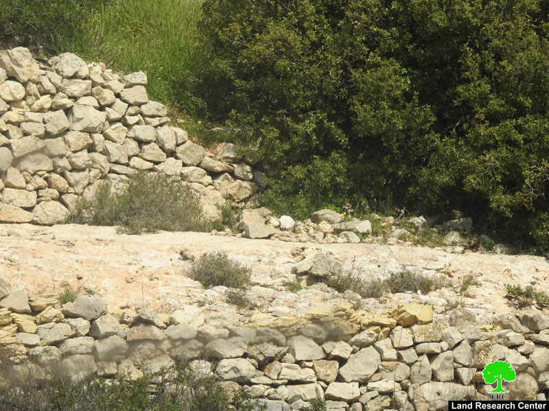
a cistern and an agricultural tent that belong to Kawthar Issa
About Al-Khader village:[1]
Al-Khader village is located 4 km from the western side of Bethlehem, it is bordered by Beit Jala and Batir from the north, Hussan and Nahaleen villages from the west, Aldoha, Wadi Rahhal, Beit Jala villages from the east, and Wadi Al-Nees from the south. Its population is 9774 people in 2007. Its gross area is 8,279 donums; 184 of them are the construction area.
The Israeli colonies have despoils 29 donums from the village's lands; two are colonies existed upon a part of the lands. The first one " Efrat" was constructed in 1979 A.D; they have usurped 5.8 donums, and its population 7037 colonists. The second one " Nafy Danial" eas constructed on 1982A.D; they have usurped 23 donums, and its population is 1073 colonists. A part of which is established upon the village's lands.
The bypass roads number 60 and 375 also despoiled more than 487 donums. In addition to establishing the apartheid upon its lands which causes the demolishing of 280 donums and isolating of 5638 donums behind it. The length of this apartheid existing upon the village's land is 2,805 meters.
The village's lands are classified in accordance with Oslo concord into areas( A,B ,C). Area A composes 10% , Area B 6%, Area C is the greatest area and it is under the total occupation domination, and it composes 84% from the total area. The areas are clarified in donums as following:
Area A (808) donums.
AreaB (475) donums.
Area C(6,996) donums .
[1] GIS-LRC

This document has been produced with the assistance of the European Union
The contents of this document are the sole responsibility of LRC and can under no circumstances be regarded as reflecting the position of the European Union