2019-11-28
مستعمرون متطرفون يقطعون أشجار العنب في أرض عائلة صبيح في بلدة الخضر / محافظة بيت لحم
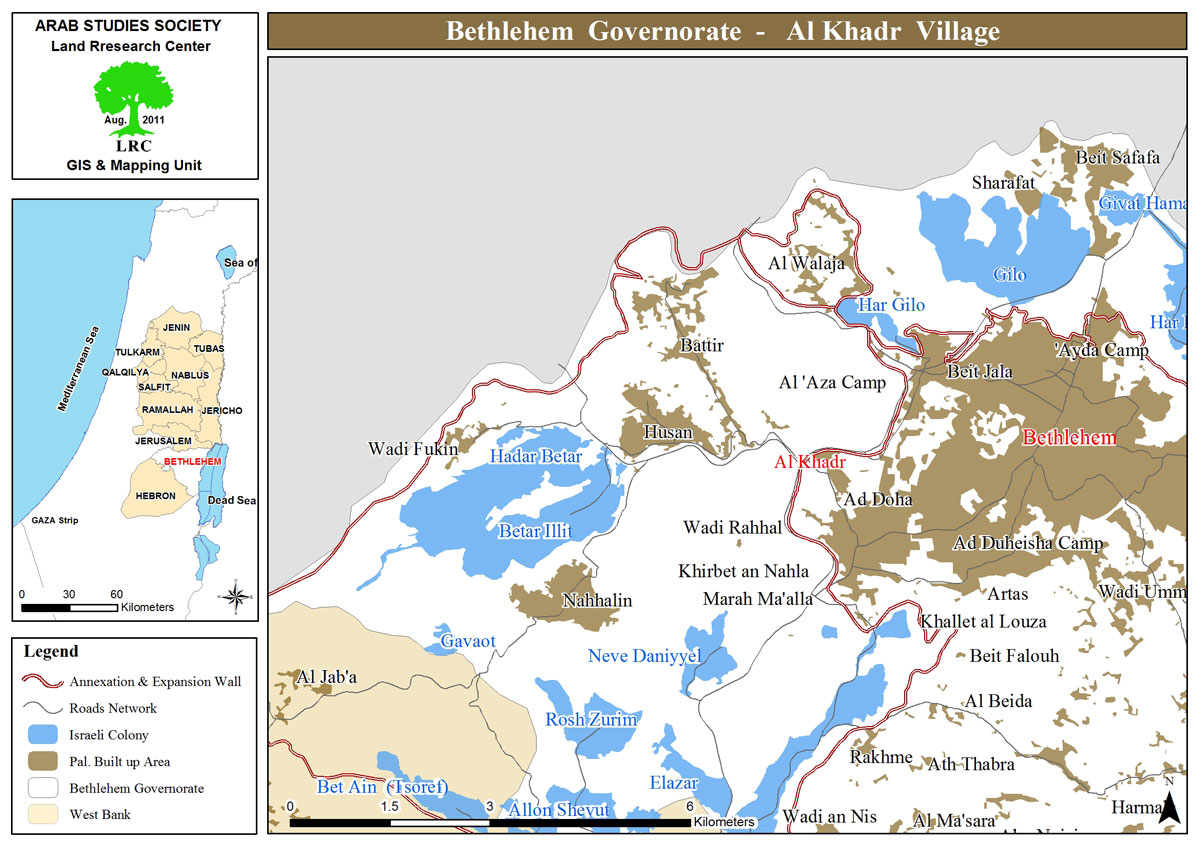
الموقع: عين العصافير- بلدة الخضر/ محافظة بيت لحم.
التاريخ: 28/11/2019م.
الجهة المعتدية: مستعمرو مستعمرتي " أفرات واليعازر".
الجهة المتضررة: يحيى صبيح.
تفاصيل الانتهاك:
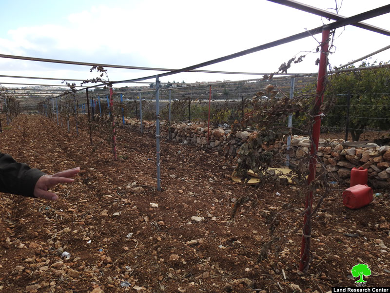
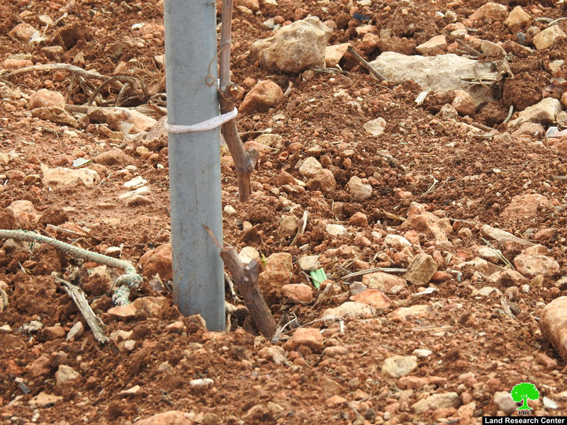
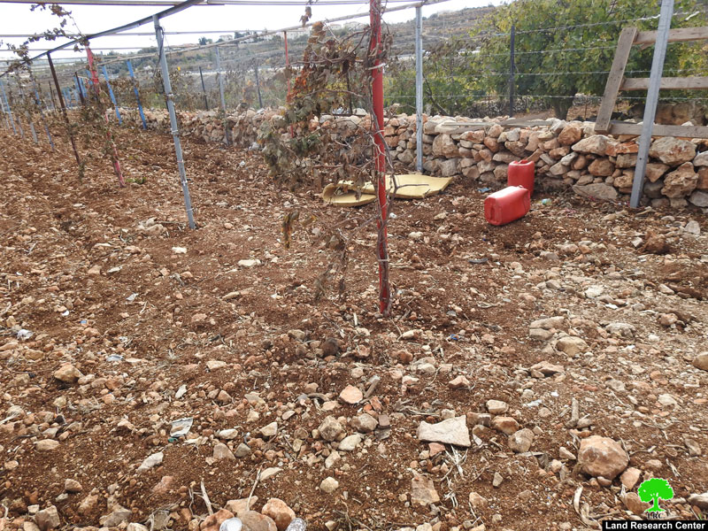
أقدم مستعمرو مستعمرتي "أفرات" و"اليعازر" يوم الخميس الموافق 28 تشرين الثاني 2019 على تقطيع ما يقارب 100 شجرة عنب مزروعة في أرض المواطن يحيى صبيح في منطقة عين العصافير التابعة لمنطقة الخضر.
هذا وأفاد صاحب الأرض المواطن يحيى لباحث مركز أبحاث الأراضي بالتالي:
" هذه الأشجار تتعدى العشرين عام، اعتني بها وبالأرض كل يوم، هي موطني وبيتي الآمن، اعتني بالأشجار كالابن لأشاهدها تنمو أمامي، لكن الاحتلال لا يسمح حتى للشجر بالنمو؟!!".
كما أفاد إياد صبيح من بلدية الخضر لباحث مركز أبحاث الأراضي بالتالي:
" المستعمرون يستهدفون منطقة الخضر بشكل متواصل، ويعتدون على الأراضي والمزروعات و الاحتلال يدعمهم بهدم وتهديد المنازل ، كل ذلك لصالح مخططاتهم الاستيطانية الاحتلالية التي تستهدف بلدة الخضر والأراضي الفلسطينية بالكامل، ليحولها لمناطق استعمارية".
جدير بالذكر بأن المواطن يحيى هو مزارع يعتمد في دخله على بيعه للمزروعات في موسمها، وما أحدثه المستعمرون اثر سلباً على دخله إذ يحتاج إلى إعادة زراعة أشجار العنب حتى يثمر بعد ثلاث سنوات، أي يحتاج إلى بذل جهد مضاعف حتى يعود إلى نقطة البداية.
والقطاع الزراعي يعتبر حجر الزاوية في التنمية الاقتصادية لمنطقة الخضر فهي أراضي زراعية واسعة وأغلبية المواطنين يعتمدون على الزراعة في دخلهم.
كما يمكن إضافة أن المواطن قدم شكوى إلى الشرطة الإسرائيلية للاعتراض، وعلى الرغم من وجود الكاميرات الإسرائيلية في كل مكان إلا أنهم تحججوا بان تلك الكاميرات لا تستطيع إظهار الأشخاص بدقة، لذلك من الصعب معرفة من قام بقطع الأشجار من المستعمرين.
المستعمرون يسعون إلى السيطرة على أراضي زراعية من الفلسطينيين لتوسيع مستعمراتهم وبناء منازل لهم، وذلك سعياً إلى زيادة أعداد المستعمرين في الأراضي الفلسطينية، كما أن الاحتلال الإسرائيلي وما يناصره من دول العالم يشجع المستعمرون على تلك السياسة لإقامة وطن قومي لهم.
تعريف ببلدة الخضر المستهدفة[1]:
تقع بلدة الخضر على بعد 4كم من الجهة الغربية من مدينة بيت لحم، ويحدها من الشمال مدينة بيت جالا وبلدة بتير، ومن الغرب قرية حوسان وبلدة نحالين، ومن الشرق: مدينة الدوحة، وقرية ادي رحال، ومدينة بيت جالا، ومن الجنوب قرية واد النيص.
يبلغ عدد سكانها 11,960 نسمة حتى عام 2017م. وتبلغ مساحة البلدة الإجمالية 8,279 دونماً منها 184 دونم عبارة عن مسطح بناء للبلدة.
نهبت المستعمرات الإسرائيلية من أراضي البلدة 29 دونماً، حيث تقع على جزء من أراضي البلدة مستعمرتين، الأولى "إفرات" والتي تأسست عام 1979م وصادرت من أراضي البلدة 5.8 دونماً ويقطنها 7037 مستعمراً، والثانية " مستعمرة نفي دانيال" والتي تأسست عام 1982م ومقام جزء منها على أراضي البلدة ونهبت منها 23 دونماً ويقطنها 1073 مستعمراً.
كما نهبت الطرق الالتفافية رقم 60 ورقم 375 أكثر من (487) دونماً. هذا بالإضافة إلى إقامة الجدار العنصري على أراضيها والذي دمر تحت مساره 280 دونماً، وسيعزل خلفه 5,638 دونماً، ويبلغ طول الجدار العنصري القائم على أراضي البلدة 2,805 متراً.
هذا وتصنف أراضي البلدة حسب اتفاق أوسلو إلى مناطق A,B,Cحيث تشكل مناطق A ما نسبته (10%) ومناطق B تشكل (6%) بينما المناطق المصنفة C تشكل المساحة الأكبر وهي خاضعة للسيطرة الكاملة للاحتلال الإسرائيلية تشكل نسبة 84% ونوضح هنا المساحات بالدونم:
- مناطق مصنفة A ( 808) دونم.
- مناطق مصنفة B (475) دونم.
- مناطق مصنفة C ( 6,996) دونم.
[1] المصدر: وحدة نظم المعلومات الجغرافية - مركز أبحاث الأراضي.


