2018-04-01
Demolition order for a cistern in Al-Khader/ Bethlehem
Violation: An order to stop working on a cistern that serves agricultural lands in Al-Khader
Date: 1 April 2018.
Perpetrators: The occupation's civil administration and IOF.
Victim: Citizen Khader Ali.
Details:
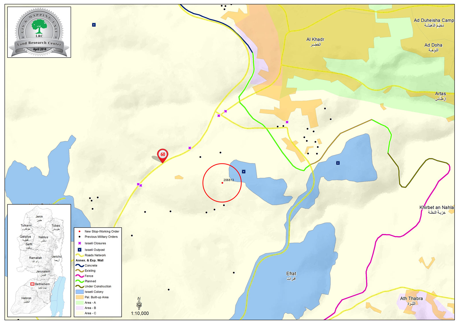
In the first day of April 2018, members of the Israeli civil administration broke into Al-Khader town and delivered orders to stop working on a cistern on the pretext of unauthorized constructions in area "C" , This 120m3 cistern serves agricultural lands of the area. The order informs that in court session 16 April , subcommittee will discuss destroying the cistern.
Al-Khader is a victim of an attack by the occupation, Other than confiscating lands , they carry out shoveling in order to add on illegal colonies in the area.
Citizen Eyad told LRC observer:
"We follow up Israeli violations in Al-Khader especially on lands, we help owners to file the necessary documents to apply them to human-rights institutions, in order to protect subjected lands, especially around illegal colonies."
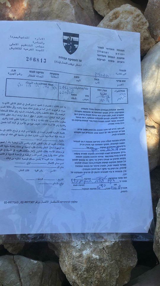
Order number 266813 on a cistern / Al-Khader
About Al-Khader village:
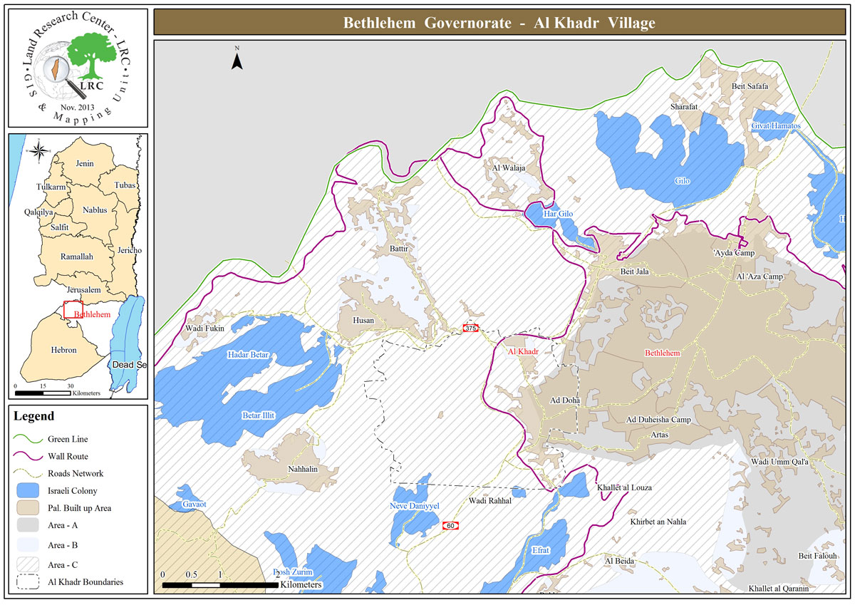
Al-Khader village is located 4 km from the western side of Bethlehem, it is bordered by Beit Jala and Batir from the north, Hussan and Nahaleen villages from the west, Aldoha, Wadi Rahhal, Beit Jala villages from the east, and Wadi Al-Nees from the south. Its population is 11960 people in 2017. Its gross area is 8,279 donums; 184 of them are the construction area.
The Israeli colonies have despoils 29 donums from the village's lands; two are colonies existed upon a part of the lands. The first one " Efrat" was constructed in 1979 A.D; they have usurped 5.8 donums, and its population 7037 colonists. The second one " Nafy Danial" eas constructed on 1982A.D; they have usurped 23 donums, and its population is 1073 colonists. A part of which is established upon the village's lands.
The bypass roads number 60 and 375 also despoiled more than 487 donums. In addition to establishing the apartheid upon its lands which causes the demolishing of 280 donums and isolating of 5638 donums behind it. The length of this apartheid existing upon the village's land is 2,805 meters.
The village's lands are classified in accordance with Oslo concord into areas( A,B ,C). Area A composes 10% , Area B 6%, Area C is the greatest area and it is under the total occupation domination, and it composes 84% from the total area. The areas are clarified in donums as following:
Area A (808) donums
AreaB (475) donums
Area C(6,996) donums

This document has been produced with the financial assistance of the European Union
The contents of this document is the sole responsibility of LRC and can under no circumstances be regarded as reflecting the position of the European Union