2024-07-09
Occupation Authorities Threaten to Demolish Agricultural Structures Owned by the Al-Swai'ti Family in Beit ‘Awwa Town / Hebron
- Violation: Threat of demolition of agricultural structures
- Date of Violation: July 9, 2024
- Location: Beit Awwa Town / Hebron Governorate
- Perpetrator: Israeli Civil Administration
- Affected Party: Citizen Jihad Al-Swaiti
Details of the Violation:
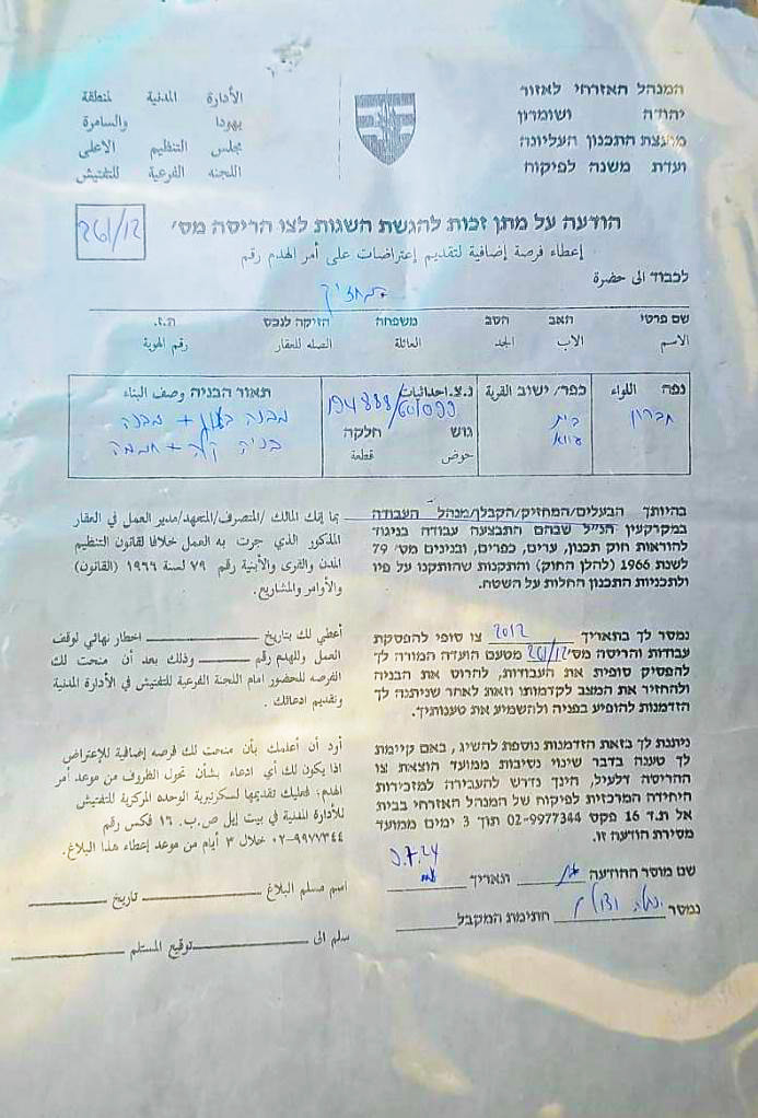
Israeli occupation authorities have threatened to demolish agricultural structures and a residential agricultural unit owned by citizen Jihad Rassem Mustafa Al-Swai'ti, citing their construction without a permit in Beit Awwa, west of Hebron.
The citizen discovered a notice posted on one of his structures, issued by the "Civil Administration" of the occupation on July 9, 2024, bearing the number (261/12) titled "Additional Opportunity to Object to the Demolition Order." The notice indicates that the occupation authorities had issued a demolition order for the targeted structures in 2012 and are now giving the citizen a "chance" to file an objection to the demolition order within 3 days.
Structures at Risk of Demolition:
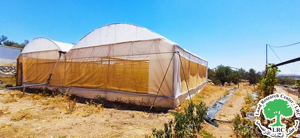
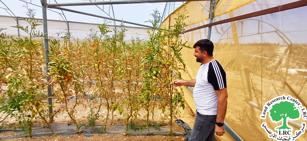
- Agricultural Greenhouse: A greenhouse with an area of 150 square meters, planted with vegetables, established since 2015.
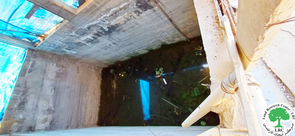
- Water Reservoir: A water collection tank with a capacity of 160 cubic meters, used for agricultural purposes and irrigating 2 dunums of grapes and vegetables, including the greenhouse.
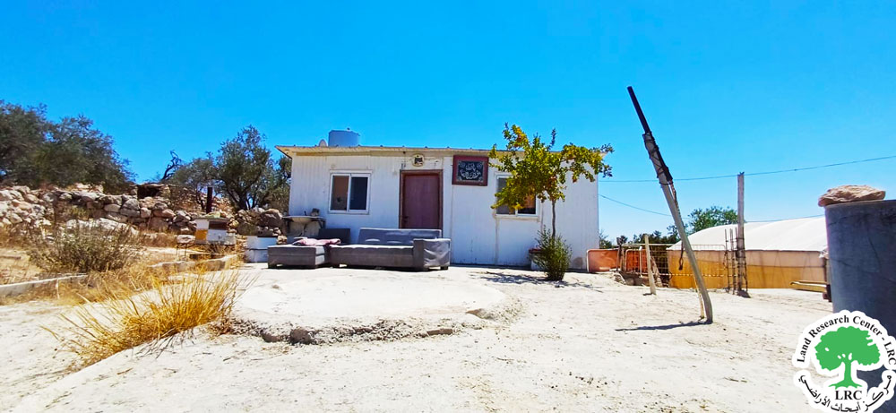
- Agricultural Residence: A tin-sheet residential unit, measuring 100 square meters, used by the citizen for accommodation while working on his land and during the summer with his family.
- Concrete Yard: A concrete area in front of the agricultural residence, measuring 80 square meters..
Agricultural structures threatened with demolition
In 2023, the occupation authorities targeted Al-Swai'ti's structures, demolishing a tin-sheet structure near the land where the threatened structures are located, as well as the water reservoir. Al-Swai'ti managed to rehabilitate the reservoir to save his crops, but the authorities pursued him again and threatened further demolition.
Citizen Jihad Al-Swai'ti (42 years old) told the researcher from the Land Research Center:
"I own a 3-dunum plot of land and have established an agricultural greenhouse to grow vegetables for my family's needs. I support a family of 9, including 6 children and 5 females, including two wives. I found the notice attached to the corner of the water reservoir, and I fear that the occupation authorities will proceed with the demolition, destroying all my agricultural structures and property on the plot."
About Beit Awwa Town[1]:
Beit Awwa is located 17 km west of Hebron city, bordered by Deir Samet to the north, the 1948-occupied territories to the west, Dora town to the east, and the villages of Tawwas and Sikka to the south. As of 2017, its population was 10,436. The total area of the town is 22,428 dunums, including 1,048 dunums designated for town development.
Israeli settlements have confiscated 152 dunums of the town's land. The "Nigevot" settlement, established in 1982, occupies 112 dunums of the town’s land and houses 134 settlers. The "Mershalim" settlement occupies 40 dunums.
The path of the apartheid wall in the area is 4,061 meters long, destroying 406 dunums of land and isolating 380 dunums.
According to Oslo Accords classifications, the town's lands are divided into Areas B (53%) and C (47%). Area C, under full Israeli control, covers 10,582 dunums, while Area B covers 11,846 dunums.
[1] LRC-GIS.
مشروع: حماية الحقوق البيئية الفلسطينية في مناطق "ج" SPERAC IV - GFFO
Disclaimer: The views and opinions expressed in this report are those of Land Research Center and do not necessarily reflect the views or positions of the project donor; the Norwegian Refugee Council.
إخلاء المسؤولية: الآراء ووجهات النظر الواردة في هذا التقرير هي آراء ووجهات نظر مركز أبحاث الأراضي ولا تعكس بالضرورة وجهات نظر أو مواقف الجهة المانحة للمشروع؛ المجلس النرويجي. للاجئين
