2026-04-14
Israeli Occupation Uproots 170 Ancient Olive Trees in Deir Istiya, North of Salfit
Violation: Uprooting and destruction of ancient olive trees.
Location: Deir Istiya, north of Salfit city.
Date: Early April 2026.
Perpetrator: Israeli occupation forces.
Victims: Six families from the Abu Zeid family.
Details:
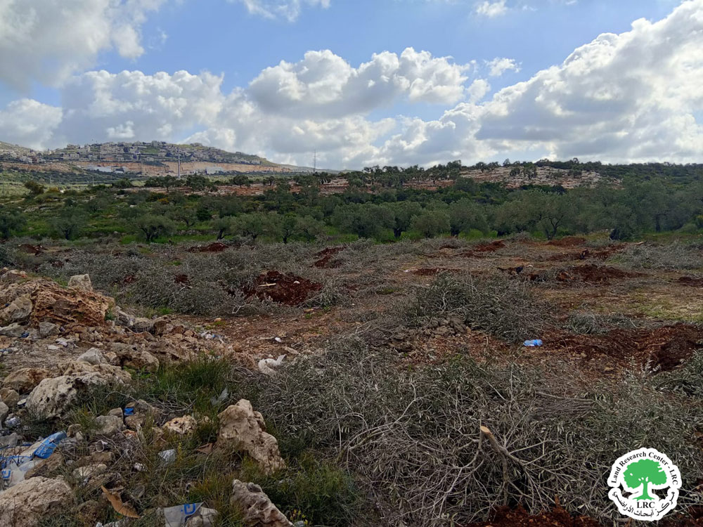
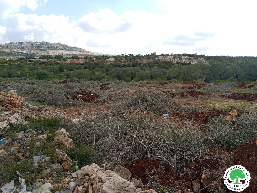
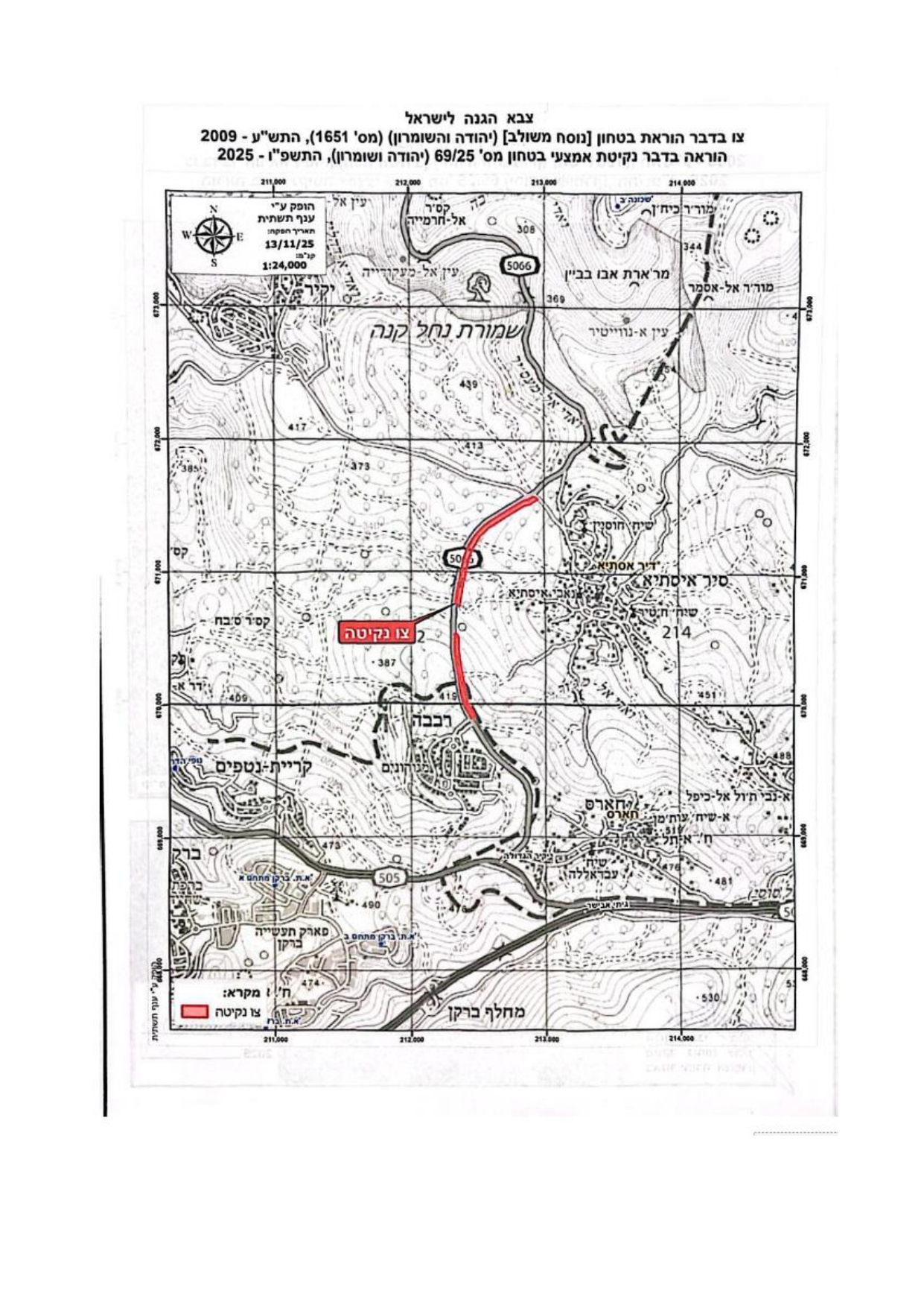
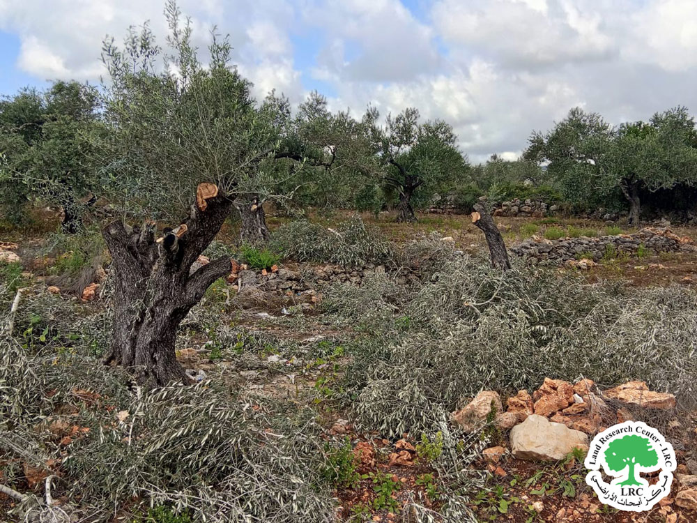
At the beginning of April 2026, the Israeli occupation forces, using three civilian bulldozers, carried out extensive leveling operations on agricultural lands planted with ancient Roman olive trees, at the western entrance of Deir Istiya along the bypass road No. 5066, which crosses the lands of Wadi Qana and Deir Istiya, north of Salfit Governorate.
These destructive actions led to the leveling of no less than 15 dunums of agricultural land and the complete uprooting and destruction of 170 ancient olive trees over a stretch of approximately 600 meters, starting from the main western entrance of the town and extending north along the bypass road.
It is noteworthy that the targeted lands are officially owned by local farmers. The leveling was concentrated in the following areas:
- Natural Basin No. 6: Qattan Al-Baydar and Karm Al-Muhmas
- Natural Basin No. 28: Sheikh Hussein and Al-Mughraqa
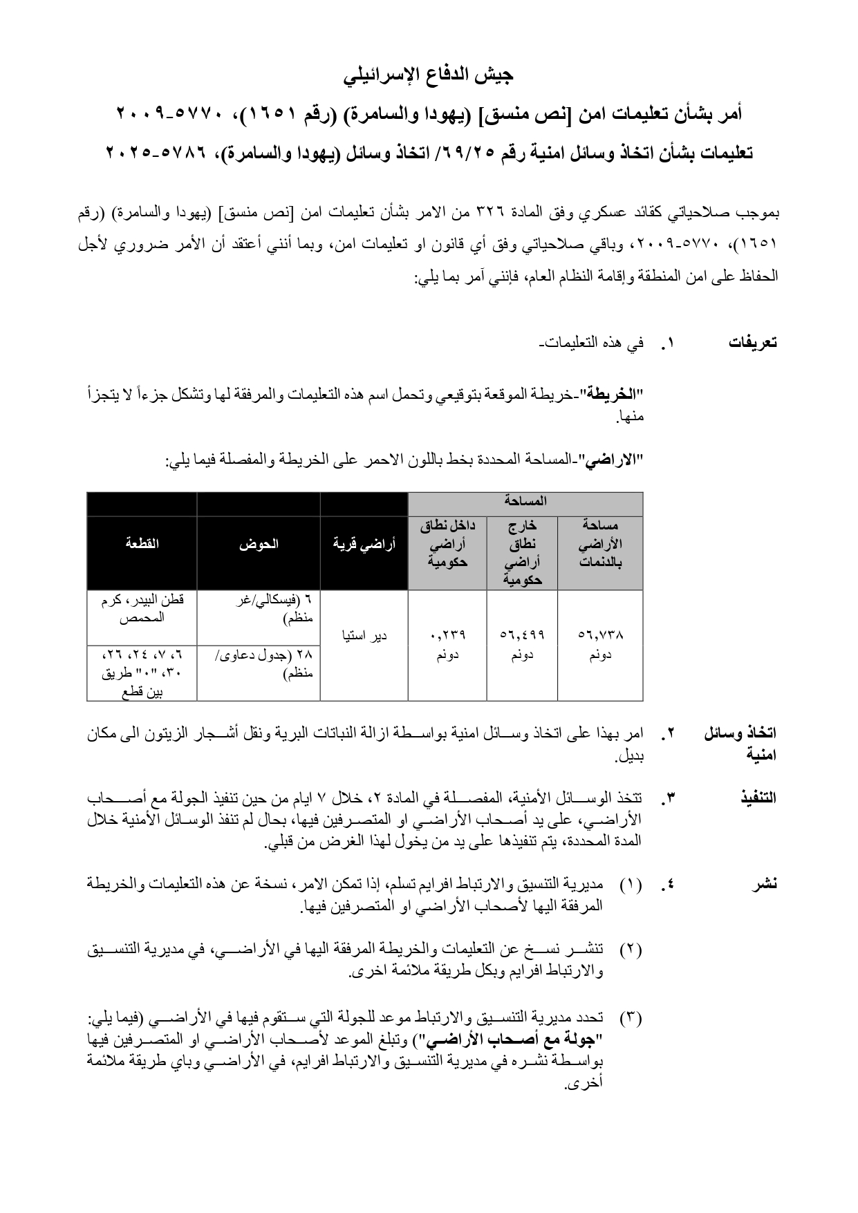
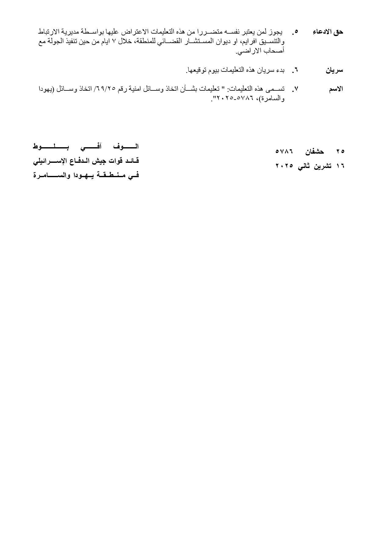
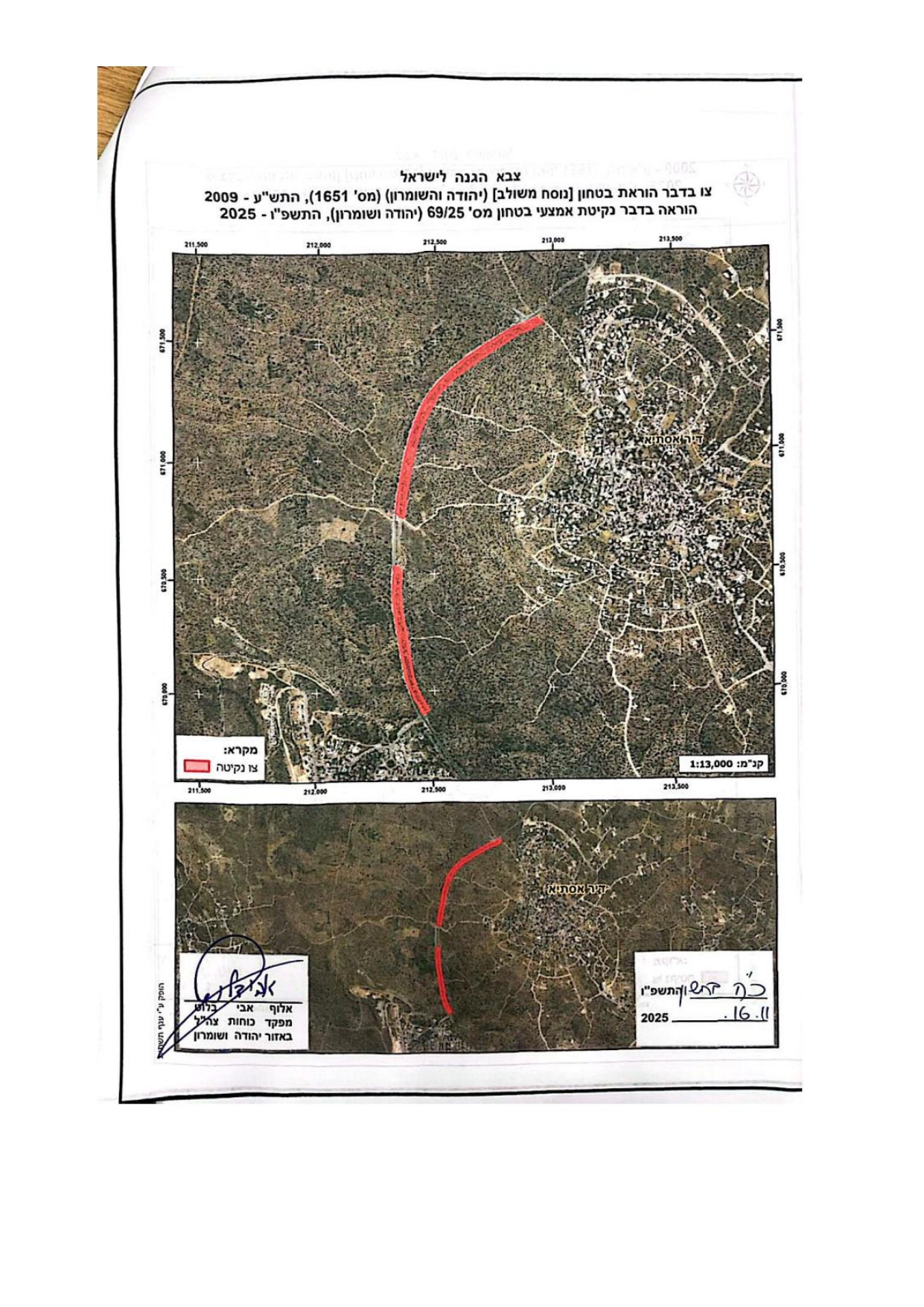
The targeted area is close to lands previously affected by the occupation in December 2025, when it uprooted 600 olive trees under Military Order No. 25/69 issued on November 16, 2025, by the commander of the Israeli army in the West Bank, named “Ophir Blot.” The order included the removal of trees from an area estimated at 56 dunums, but in April 2026, an additional 15 dunums were leveled.
Damage to Farmers:
Farmer | Number of Trees Damaged | Type of Damage |
Nasr Hatem Mustafa Abu Zeid | 34 | Complete Damage |
Latifa Abdul Latif Abdul Rahman Abu Zeid | 10 | Complete Damage |
Abdul Aziz Muhammad Abdul Qader Abu Zeid and siblings | 46 | Complete Damage |
Abdul Rahim Hamdallah Issa Abu Zeid and siblings | 39 | Complete Damage |
Amin Abdul Qader Muhammad Abu Zeid | 17 | Complete Damage |
Khaled Rateb Mustafa Abu Hajla | 24 | Complete Damage |
Total | 170 |
Abdul Rahim Ali Zaidan, head of the Agricultural Committee in Deir Istiya, stated:
"Deir Istiya is known for its unique agricultural character and abundance of ancient trees, mainly concentrated west of the town in Wadi Qana. At the end of last year (2025), we received through the Civil Liaison Office a military order from the Israeli army commander requesting the removal of trees from a 56-dunum area along the bypass road, claiming security reasons. At the beginning of April, at 6 AM, we were surprised to find three civilian bulldozers accompanied by heavy military presence, carrying out leveling and uprooting of trees and then destroying them to prevent reuse, contrary to the military order, which mentioned relocating the trees elsewhere. Farmers were prevented from accessing the area, which had previously faced restrictions during the olive harvest season."
He added that these actions represent a serious crime against olive trees, which usually yield about 15 kilograms of olive oil per tree, a vital income source for local farmers.
Deir Istiya Village:[1]
DeirIstiya village is located 10 km to the north of Salfit city. It is bordered to the north by Imatin, Jinsafot, and Kofr Laqif; to the west by Azoun and Kofr Thulth; to the east by Zita Jamma'in and Kifl Haris; and to the south by Haris and Qarawat Bani Hassan.
The village had a population of 3,696 residents as of 2017.
Its total area is 34,125 dunams, of which 640 dunams are designated for construction purposes.
The Israeli occupation has confiscated 4,257 dunams of its land, as detailed below:
- Israeli colonies’ have stolen 4,024 dunams from the village’s land. These are:
Colony Name | Established year | Area of Confiscated Land / dunams | Colonists Number | The extent of settler seizure of village lands |
Rfafa | 1991 | 167 | 2664 |
|
Yakeer | 1981 | 757 | 2341 | Entire colonies’’ |
Jenat Shamron( | 1985 | 944 | NA |
|
Karni Shamron( | 1978 | 540 | 8388 |
|
Nofem | 1986 | 663 | 867 | Entire colonies |
Amanouel | 1981 | 879 | 4220 |
|
Maaleh Shamron | 1980 | 52 | 1002 |
|
Almattan | 1981 | 22 | NA | Entire Colonies’ |
2- The bypass roads numbered 55 and 5066 have confiscated 118 dunams.
3- The existing apartheid wall has confiscated (115) dunams along its path, with a total length of (1,148) meters. If the wall is completed, it will isolate (8,408) dunams and destroy (160) dunams.
According to the Oslo Agreement, the village's lands are classified as follows:
- Area classified as B: 6,132 dunams.
- Area classified as C: 27,993 dunams.
Environmental and Biodiversity Impact:
- Changing the land topography and removing the fertile topsoil.
- Elimination of plants, herbs, insects, reptiles, and small wildlife.
- Soil erosion and deterioration of quality, especially as olive trees stabilize the soil.
- Increased carbon emissions, as olive trees absorb CO₂ and mitigate climate change.
- Disruption of the water cycle, as vegetation helps absorb rainfall and recharge groundwater.
- Olive trees are a critical part of vegetation; their removal destabilizes the environment and increases desertification risks.
- Negative impact on local biodiversity and agricultural identity.
Legal Accountability of the Occupation:
Israeli actions violate international humanitarian law and environmental protection conventions:
- Fourth Geneva Convention (1977), Additional Protocols (Articles 35 & 55):
- Prohibits methods or means of warfare expected to cause widespread, long-term, or severe environmental damage.
- Requires protection of the natural environment during conflict and forbids retaliatory attacks on it.
- UN General Assembly Resolution 71/247 (2016):
- Calls on Israel to comply with international humanitarian law and cease environmentally harmful practices in occupied Palestinian territories, including land leveling and colonies establishment.
- Rome Statute of the International Criminal Court (1998, effective 2002):
- Recognizes severe environmental damage during armed conflict as a war crime (Article 8, paragraph 2(b)(4)).
- Convention on the Prohibition of Military or Any Hostile Use of Environmental Modification Techniques (ENMOD, 1976/1978):
- Prohibits using environmental modification for military or hostile purposes intended to cause destruction or damage to another state.
- International Union for Conservation of Nature (IUCN):
- Sets standards for protecting species and preventing environmental harm.
مشروع: حماية الحقوق البيئية الفلسطينية في مناطق "ج" SPERAC IV - GFFO
Disclaimer: The views and opinions expressed in this report are those of Land Research Center and do not necessarily reflect the views or positions of the project donor; the Norwegian Refugee Council.
إخلاء المسؤولية: الآراء ووجهات النظر الواردة في هذا التقرير هي آراء ووجهات نظر مركز أبحاث الأراضي ولا تعكس بالضرورة وجهات نظر أو مواقف الجهة المانحة للمشروع؛ المجلس النرويجي. للاجئين