2018-01-29
Israeli Occupation Forces notify structures of demolition in Nablus city
Violation: serving final demolition orders
Location: Beit Dajan village
Date: January 29, 2018
Perpetrators: Planning and Construction Committee- Israel Civil Administration
Victims: three Palestinian families
Details:
The so-called Planning and Construction Committee- Israel Civil Administration issued on January 29, 2018 demolition orders on structures in Beit Dajan village on the claim of "unlicensed construction" within area classified as "C" according to Oslo Accords, which are under Israeli control. Noteworthy, the orders targeted two residences and an agricultural barrack that are owned by three citizens from the village.
According to the military orders, the affected people were given one week deadline to complete all licensing procedures.
The following table shows information about the affected people and their properties:
Affected citizen | Location | Family | Minors | Aream2 | Nature of structure | No. of military order |
Worood Abu Thabit | Al-Hammara | 4 | 2 | 180 | One story residence | |
Ohood Abu Thabit | Al-Hammara | 7 | 5 | 440 | Two story residence | |
Saed Abu Jeish | Jib Al-Nimr | 9 | 7 | 100 | Sheep barrack | |
Total | 20 | 14 | 720 | |||
Source : Field observation- Department of Monitoring Israeli Violations- Land Research Center-2018
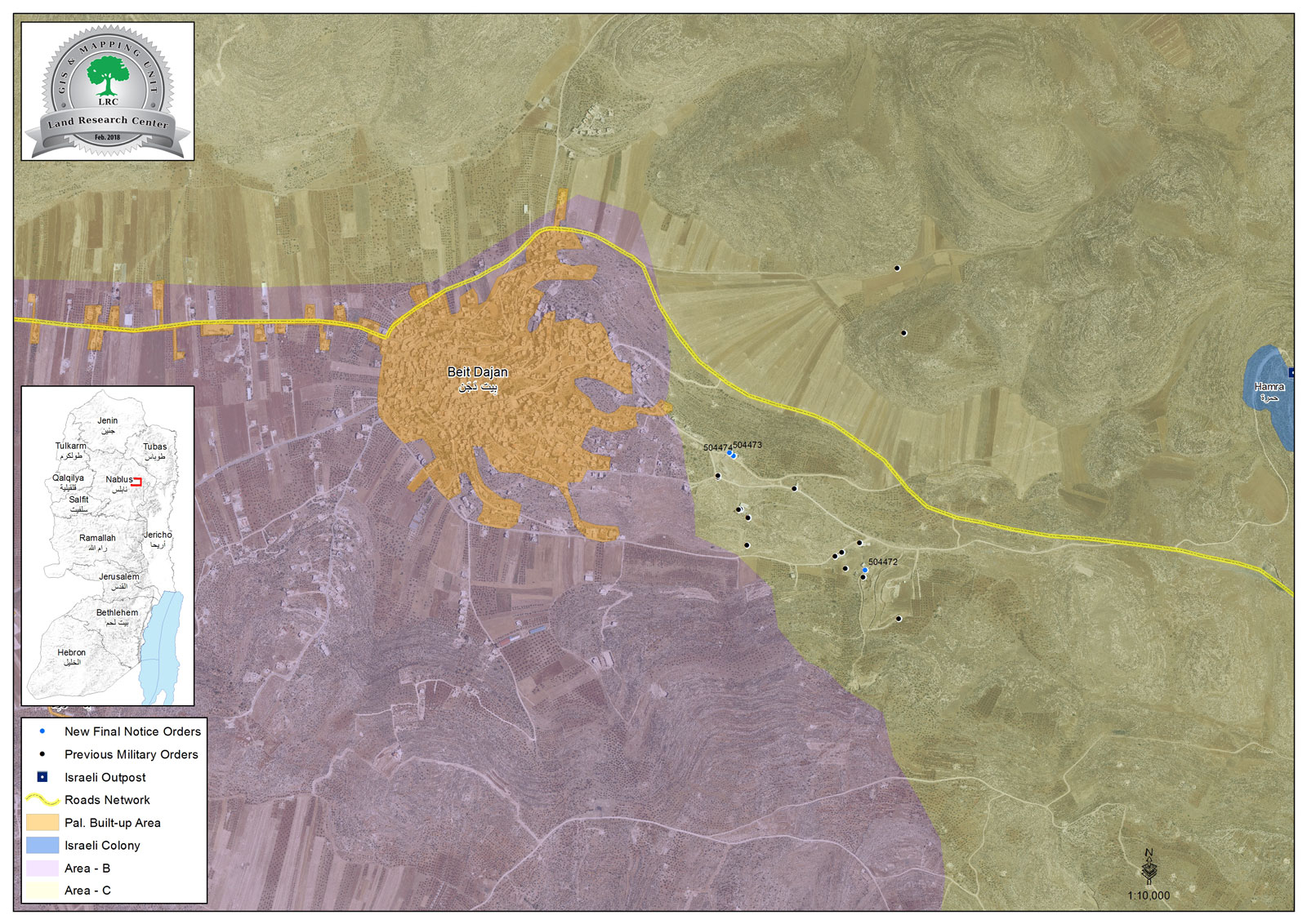
The head of Beit Dajan village council told Land Research Center the following:
" There are thirteen houses and seven barracks in the village that are notified of stop-work by the occupation. The old master plan of the village doesn’t meet with demographic increase. This is why residents of the area build on lands classified "C" according to the occupation and risk to get their structures demolished. Lately, the occupation chased farmers, denied them access to lands, confiscated agricultural tools, arrested some of them and even imposed high fines on them. The occupation does all it takes to harass Palestinian and force them out"
Affected citizen, Worood Abu Thabit told Land Research Center the following:
"We received a demolition order on April 25, 2017 and prepared a legal file to complete all licensing procedures in Israeli courts. At time, we completed the construction. On January 29, 2018, we were served a demolition order with one week deadline. We immediately informed Jerusalem Center for Legal Aid , which adopted our case and informed us that the file was submitted to the objection committee in the court"
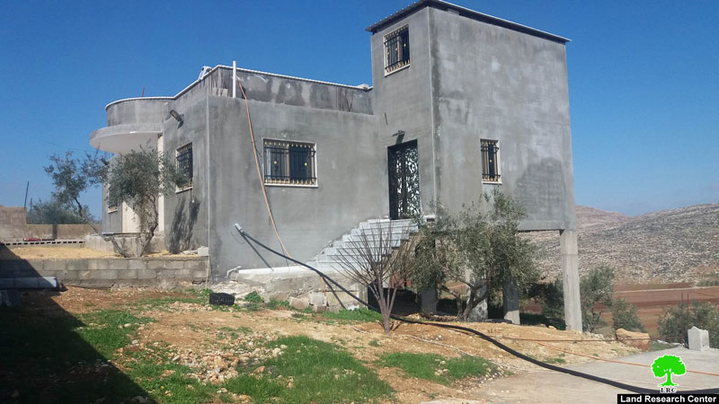
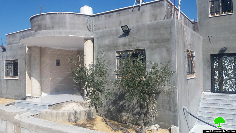
Photos 1-2: residence of citizen Worood
Citizen Ohood Abu Thabit told Land Research Center the following:
" Same thing that happened to my sister Worood happened to us. We did all procedures but we did not complete the construction of the house, waiting for the court to halt the demolition order"
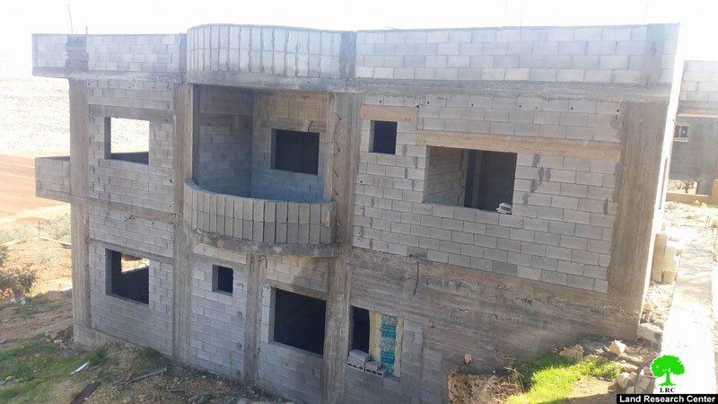
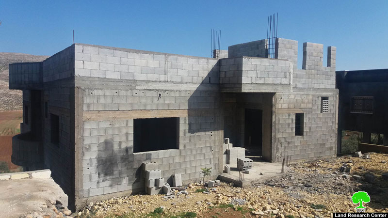
Photos 3-4: residence of citizen Ohood
Farmer Saed Abu Jeish told Land Research Center the following:
" We received a final demolition order on my 100m2 barrack. The order gave us one week deadline to prepare a license file, which I did with the help of the village council through the legal information desk that Land Research Center established. The file was given to Jerusalem Center for Legal Aid before the deadline ends. Despite all effort, the structure was demolished"
The affected citizen also asserted that he got a previous barrack demolished by the occupation on March 10, 2017. The barrack was 120m2 in area and cost 50,000 NIS.
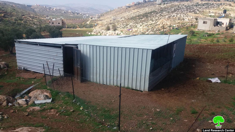
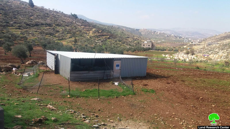
Photos 5-6: residence of citizen Saed
Remark:
It is noteworthy that the Israeli Occupation Authorities use the claim of lands classified as "C" according to Oslo Accords to ban Palestinian urban expansion and demolish existing structures. Areas "C" form about 62% of the West Bank and are under Israeli administrative and military control. Despite that Palestinians have ownership documents on such lands, yet they are not allowed to use them due to the Accords. Since there are no place to build on, some build structures there but end with demolition. Israel has, since the Accords, used such lands as reserve for colonial expansion and other military activities.
About Beit Dajan:
Beit Dajan is located 12km to the east of Nablus; its total area is 44100 dunums including 360 dunums of built up area inhabited by 4229 people (2016 census) in addition to 12500 dunums that are related to al-Ghoor area . A large part of the village lands were confiscated for the construction of the colony of Mehola in 1973.
Beit Dajan is surrounded by a number of villages namely (Salem, Deir al-Hatab, Talluza, Beit Furik, Ghoor el-Far'a ) and depends on grains plantation and fruitful trees such like olive, figs and almond.
This document has been produced with the financial assistance of the European Union.

The contents of this document is the sole responsibility of LRC and can under no circumstances be regarded as reflecting the position of the European Union.
