2018-12-12
Settlers place a siege around agricultural lands in Al-Khader / Bethlehem
Violation: placing a siege around an agricultural land in Al-Khader leveling to take over it.
Location: Rajem As-Sabet- Al-Khader town / Bethlehem governorate.
Date: 12/12/2018.
Perpetrator: “Gush Etzion” settlement cluster.
Victims: people of Al-Khader.
Description:
In 12 December, settlers of Efrat and under the protection of Israeli troops placed barbed wires siege around an agricultural land, leveling to confiscate it. The wires are supplied with sensors to make sure that farmers will be able to access to the area.
The siege will isolate 60 dunums of almond groves and Vine yards. The targeted area is surrounded by “Efrat” illegal settlement , and bypass 60.
Eiad from legal consultant office in LRC: “the siege will hinder farmer’s access to their lands”
|
|
|
|
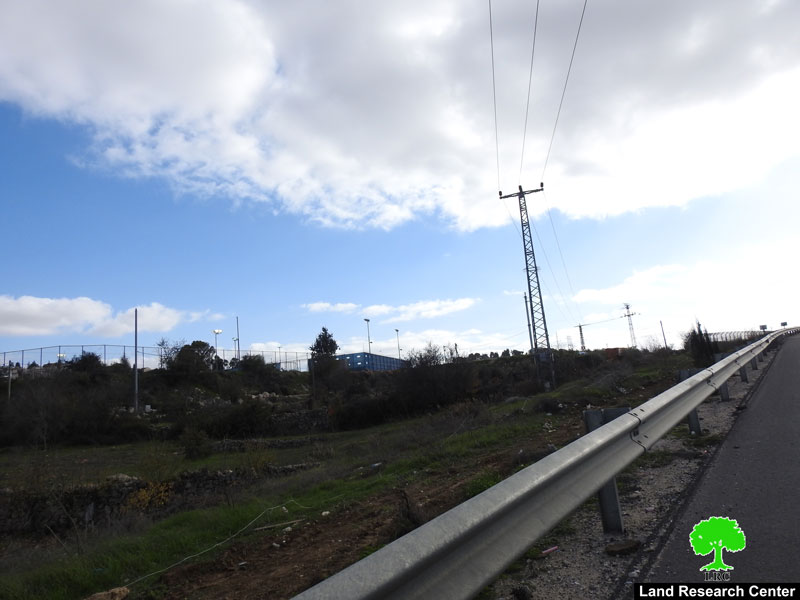
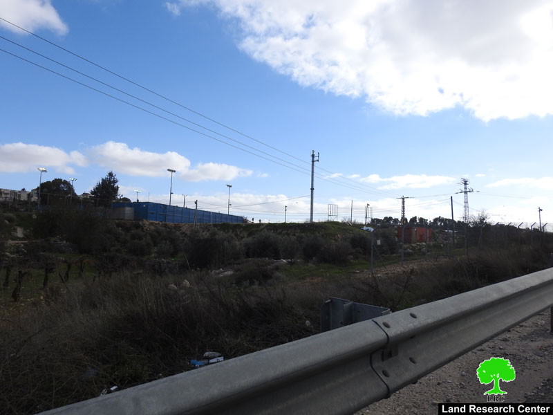
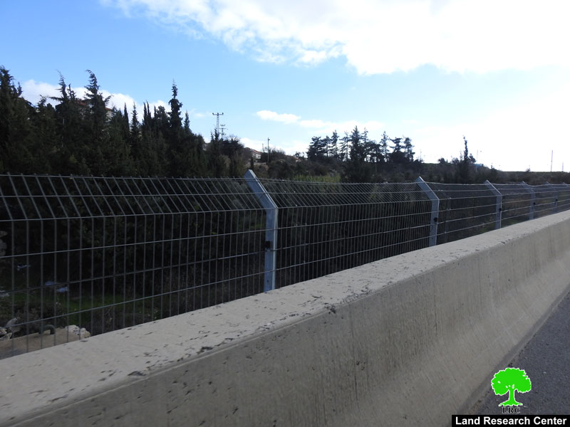
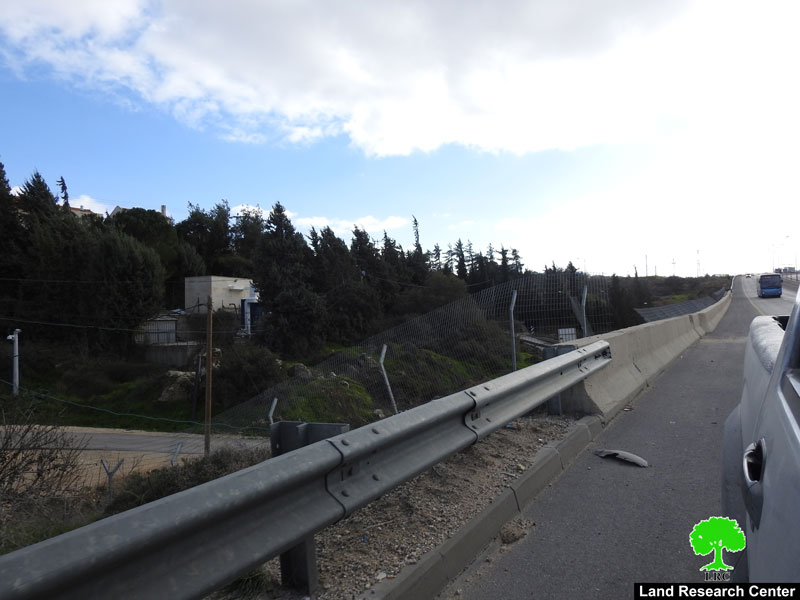
Photo: a segment from the siege placed on Al-Khader lands
Noteworthy, the occupation’s government believes that such measures will protect Israeli illegal settlers who live in surrounded confiscated lands. Consequently, they take away Palestinian farmers’ right of accessing to their land.
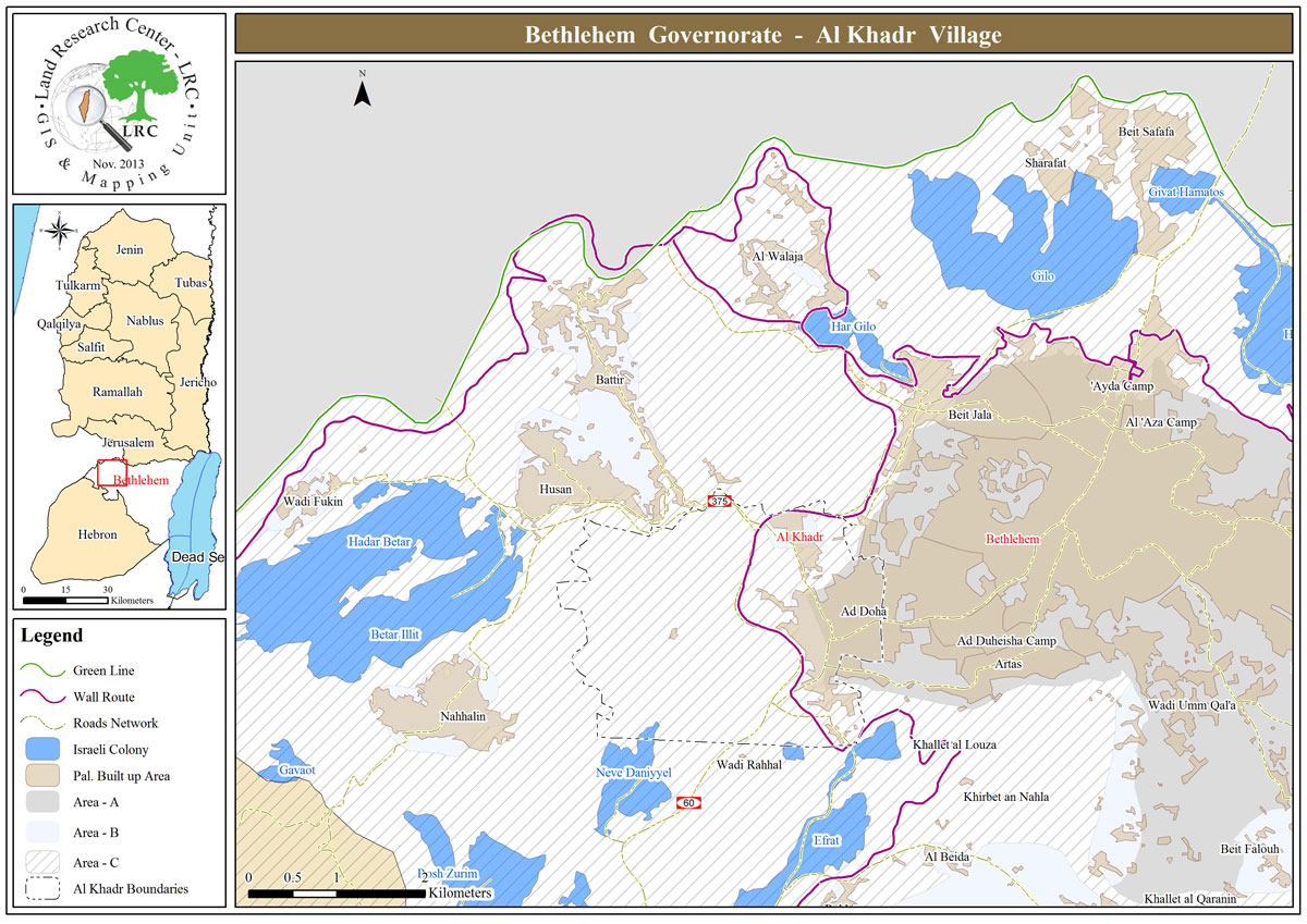
About Al-Khader village:[1]
Al-Khader village is located 4 km from the western side of Bethlehem, it is bordered by Beit Jala and Batir from the north, Hussan and Nahaleen villages from the west, Aldoha, Wadi Rahhal, Beit Jala villages from the east, and Wadi Al-Nees from the south. Its population is 9774 people in 2007. Its gross area is 8,279 donums; 184 of them are the construction area.
The Israeli colonies have despoils 29 donums from the village's lands; two are colonies existed upon a part of the lands. The first one " Efrat" was constructed in 1979 A.D; they have usurped 5.8 donums, and its population 7037 colonists. The second one " Nafy Danial" eas constructed on 1982A.D; they have usurped 23 donums, and its population is 1073 colonists. A part of which is established upon the village's lands.
The bypass roads number 60 and 375 also despoiled more than 487 donums. In addition to establishing the apartheid upon its lands which causes the demolishing of 280 donums and isolating of 5638 donums behind it. The length of this apartheid existing upon the village's land is 2,805 meters.
The village's lands are classified in accordance with Oslo concord into areas( A,B ,C). Area A composes 10% , Area B 6%, Area C is the greatest area and it is under the total occupation domination, and it composes 84% from the total area. The areas are clarified in donums as following:
Area A (808) donums.
AreaB (475) donums.
Area C(6,996) donums .
[1] GIS-LRC

The contents of this document is the sole responsibility of LRC and can under no circumstances be regarded as reflecting the position of the European Union