2019-02-15
Bulldozing a plot in ‘Urif / Nablus governorate
Violation: Land ravaging.
Location: ‘Urif town / Nablus governorate.
Date: 15/02/2019.
Perpetrator: The Israeli occupation army.
Victims: People of ‘Urif.
Description:
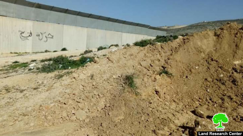
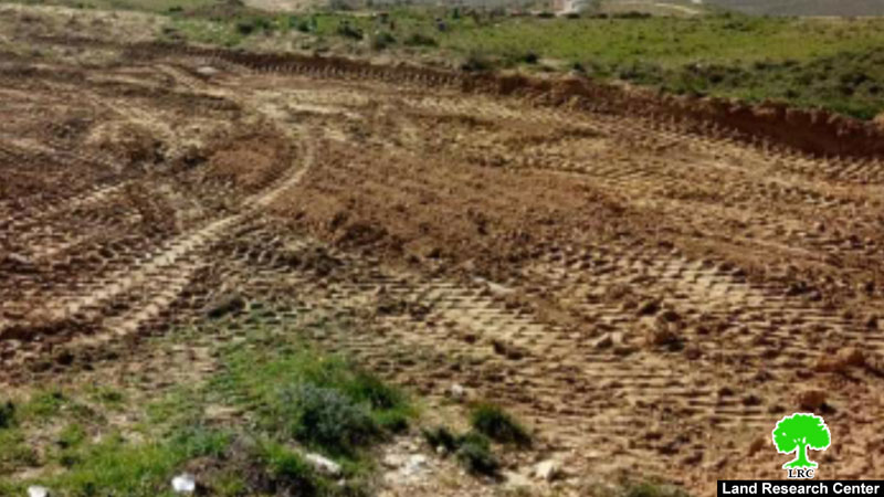
In the early morning hours of Friday 15th February 2019, An army force supported by a bulldozer raided ‘Urif , and ravaged a plot in Al-Marah location at the eastern area.
Colonization activist Adel Amer told LRC reporter:
“The occupation’s bulldozers ravaged half a dunum belong to Akram Sabah (52), the plot provides a sub-side source of income for Sabah’s family of 5. In addition, the fanatic troops also placed earth mounds that blocked 200 dunums of olive groves in the area”.
Amer says that all signs indicate that the occupation troops are planning to establish a military point in the targeted location, which is in area “B”.
|
|
|
Noteworthy the ravaging followed protests by “Yitzhar” illegal settlers on opening a road in the location by the Village council.
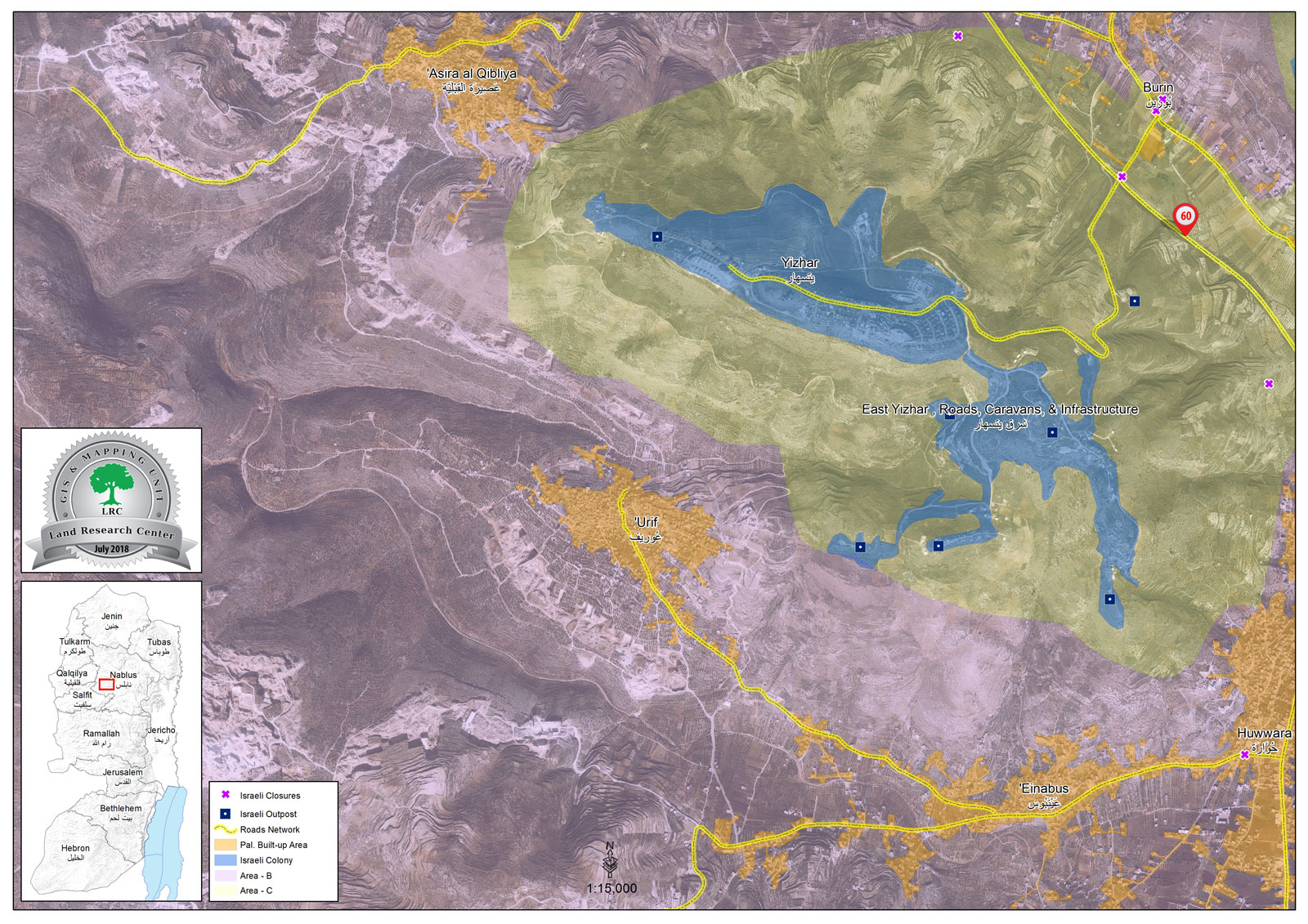
‘Urif[1]:
About 12 km south west Nablus, ‘Urif is inhabited by 3624 people in 2017 census. The village has an area of 4069 dunums , 319 of them are a built up area. ‘Urif is surrounded by ‘Asira al Qibliya (north) , Jamma’in (west) , Huwwara (east) , Yizhar settlement is built over parts of Huwwara lands, Jamma’in and Einabus (south).
“Yizhar” illegal colony devoured 64 dunums of the town’s land, the colony was established in 1981 and inhabited by 440 colonists.
Oslo Accords divided the lands of Urif as follows:
3,083 dunums are classified as area B
981 dunums are classified as area C
[1] GIS-LRC