Colonial Wall Construction: The Occupation Issues an Order to Seize Land from Um Al-Khair Village in Yatta/ Hebron Governorate
Violation: Military Order for Seizure of Land.
Date of Violation: 01/09/2024.
Location: Um Al-Khair – Yatta Town, Hebron Governorate.
Perpetrator: Israeli Occupation Army.
Affected Party: Citizens of Um Al-Khair Village.
Description:
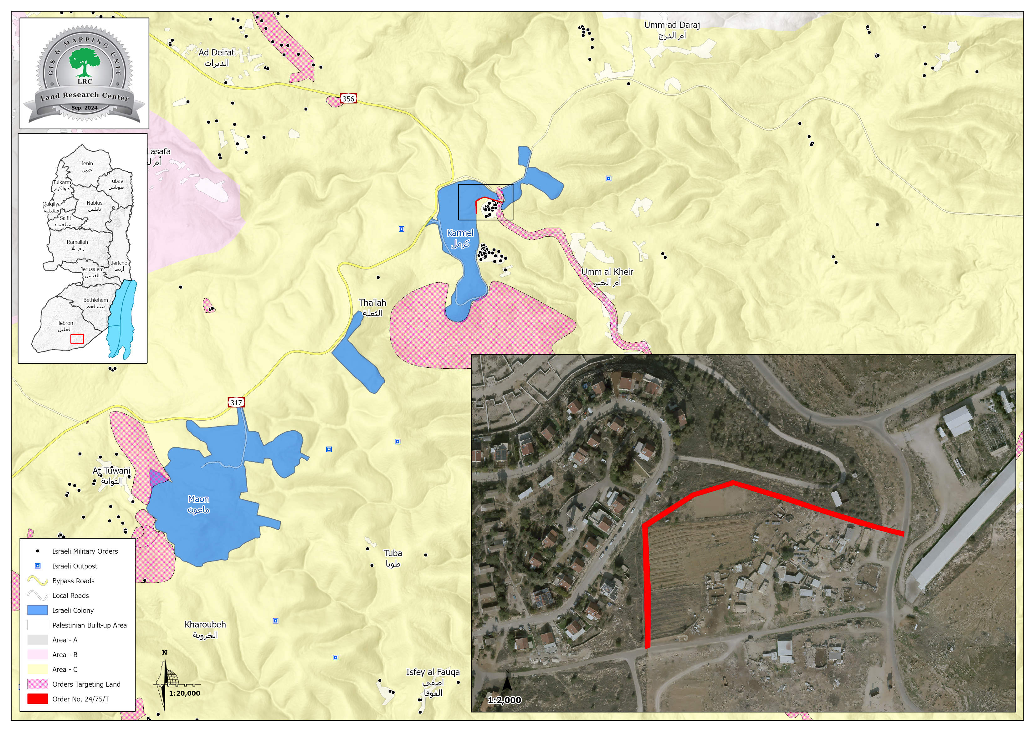
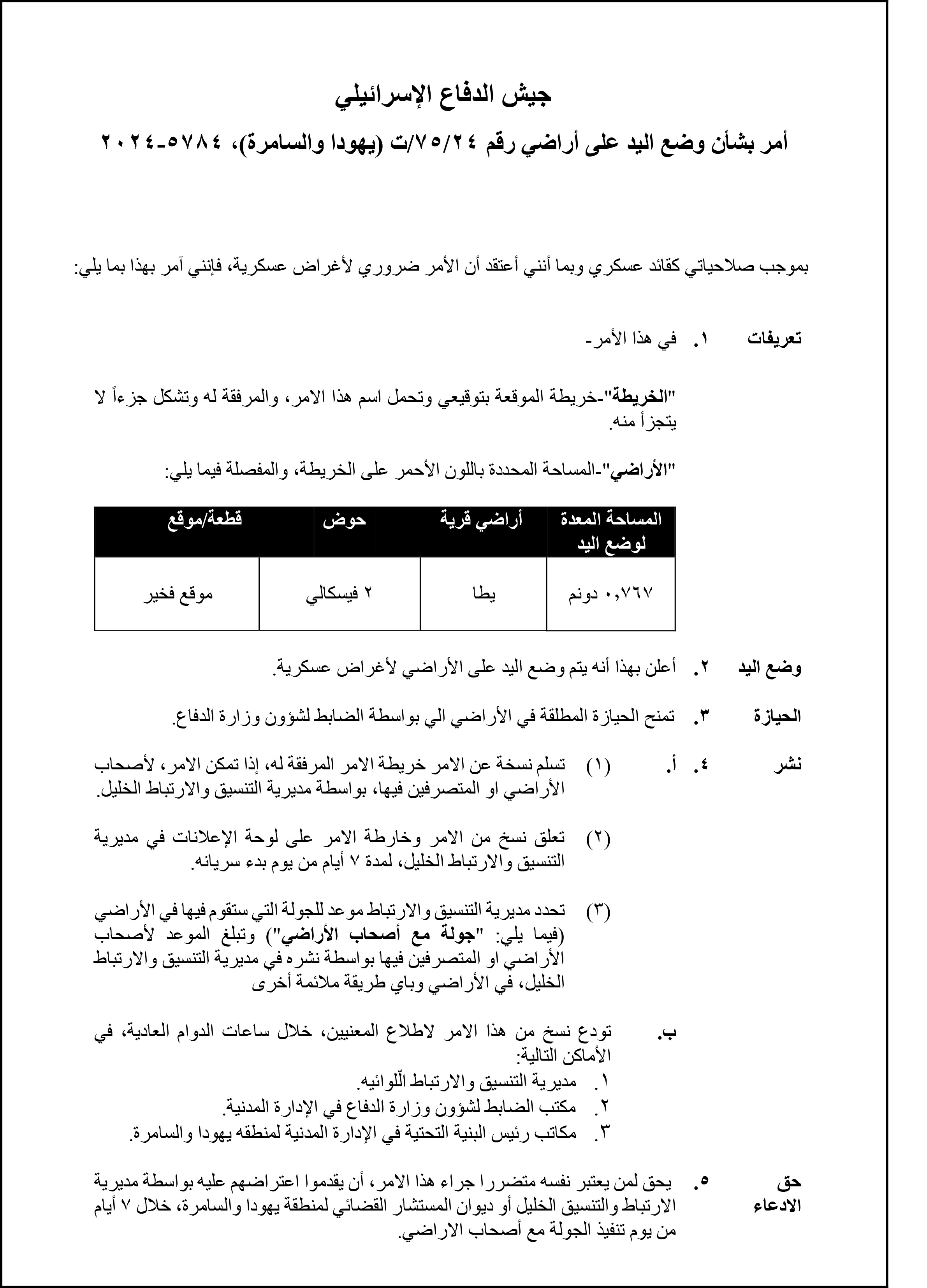
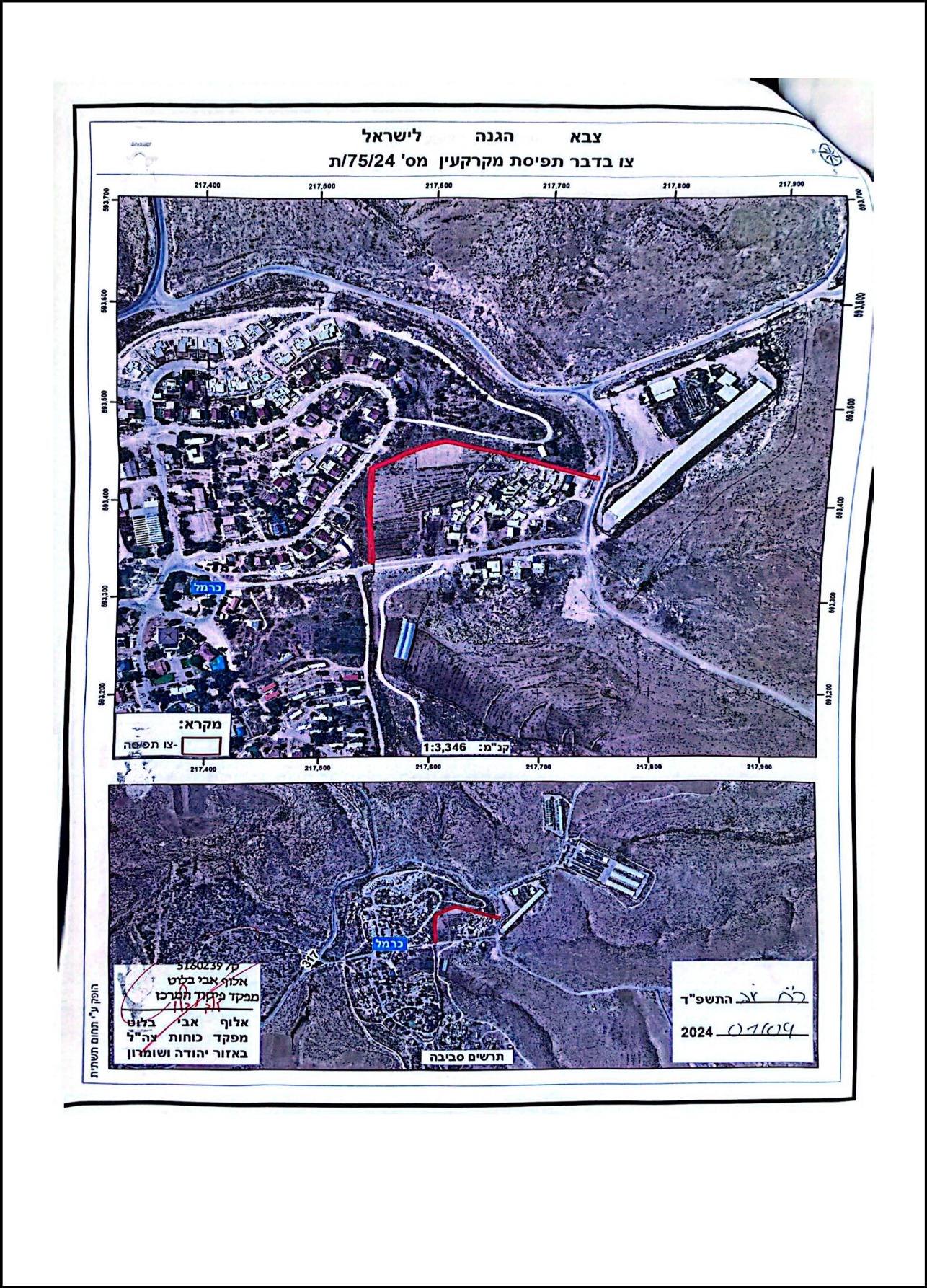
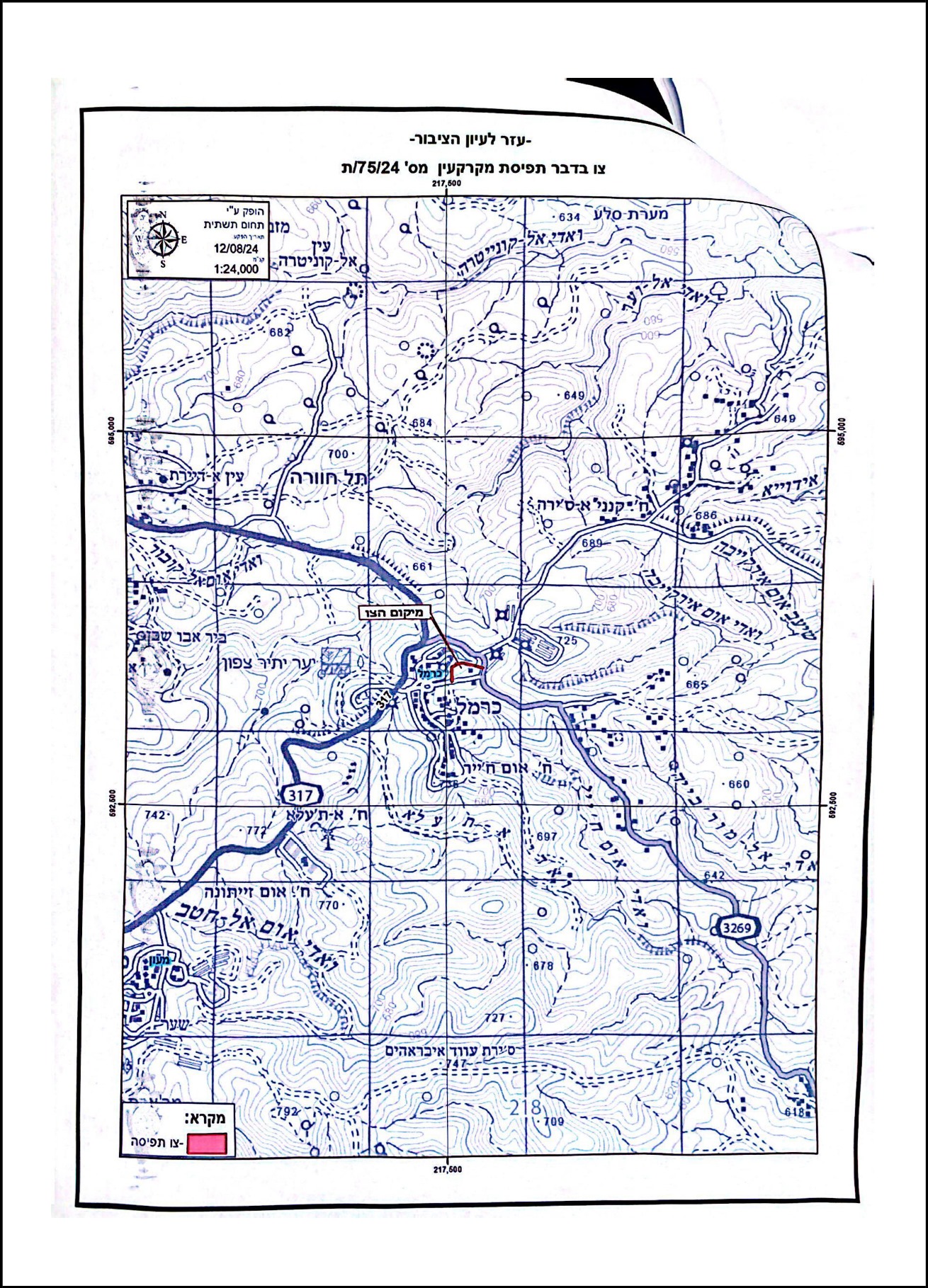
On September 1, 2024, the so-called Commander of the Israeli Occupation Army issued a military order to seize a plot of land measuring (767) square meters in Um Al-Khair village, located to the east of Yatta town, south of Hebron.
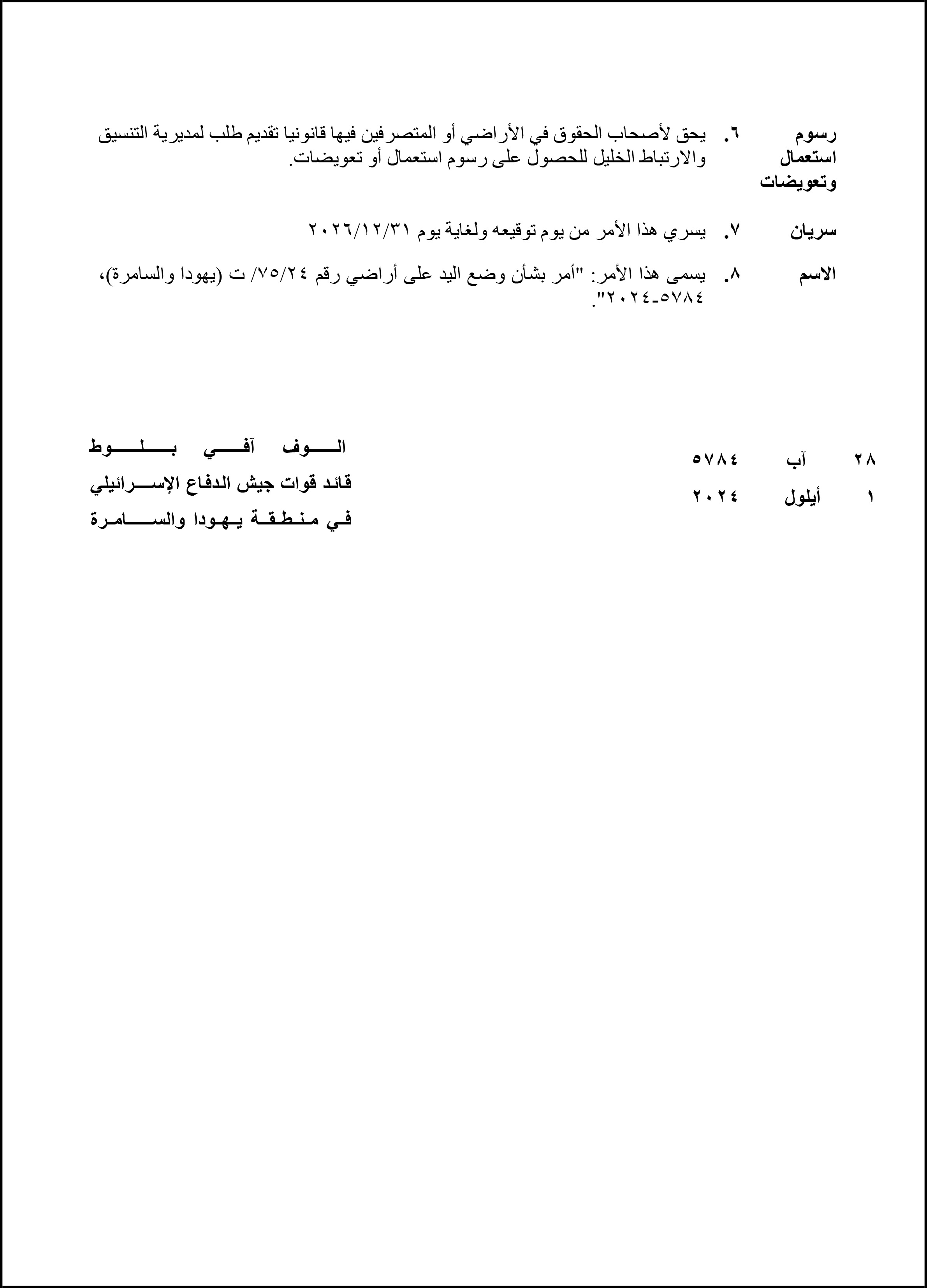
The military order, numbered (T/75/24), was titled "Order Regarding the Seizure of Land," and it included a map and an aerial image showing the land that will be taken over by the occupation army under the pretext of "military needs." The control over this land will last from the date of the order until December 31, 2026.
The seized land is located in the natural basin No. 2, in the "Fkhir" area. It is privately owned by the Al-Hathaleen family and lies in the northern section of the village (Harat Al-Hajj Shaib).
According to the head of the Um Al-Khair Village Council, Mr. Khalil Al-Hathaleen, the Israeli army intends to build a concrete wall, approximately 6 meters high, to separate the residential area of the village from part of the "Karmeel" settlement, which has been built on the lands of the village’s residents.
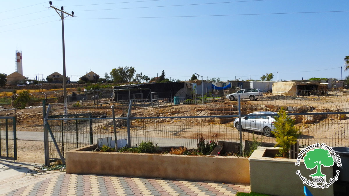
A Section of the Citizens' Homes and Settler Houses Where the Wall Will Pass Between Them
Mr. Al-Hathaleen pointed out that the occupation authorities had previously installed a metal fence in the area several years ago and now intend to replace it with a concrete wall. Additionally, they plan to construct a road adjacent to the new wall. He clarified that the area to be seized by the wall will be much larger than initially announced, considering the path of the wall and the adjacent road.
The lands that will be affected by the wall belong to:
- Khalil Mohammed Khalil Al-Hathaleen.
- Aziz Mohammed Al-Haleen.
- Mahmoud Shaib Al-Hathaleen.
- Awda Mohammed Al-Hathaleen.
The area designated for the wall is planted with olive trees, approximately 7 years old. The head of the village council noted that the new wall's path and the adjacent road would result in the uprooting and removal of around 100 olive trees.
In addition to the direct damage to citizens' property, the head of the village council mentioned that the excavation, leveling, and wall construction near the residents' homes would stir up dust and dirt, polluting the air and harming children, the elderly, and the general population.
It is important to note that Um Al-Khair village is one of the villages where all buildings and structures are under threat of demolition by the occupation authorities. Several demolition operations have already been carried out there.
Furthermore, the "Karmeel" settlement is located near the village, with luxurious settler homes only a few meters away from the makeshift or tin homes of the residents. The occupation authorities prohibit the villagers from building on their land to force them to leave, enabling the seizure of their land to expand the settlement. Settlers view the village as an obstacle to the settlement's expansion eastward.
مشروع: حماية الحقوق البيئية الفلسطينية في مناطق "ج" SPERAC V - FCDO
Disclaimer: The views and opinions expressed in this report are those of Land Research Center and do not necessarily reflect the views or positions of the project donor; the Norwegian Refugee Council.
إخلاء المسؤولية: الآراء ووجهات النظر الواردة في هذا التقرير هي آراء ووجهات نظر مركز أبحاث الأراضي ولا تعكس بالضرورة وجهات نظر أو مواقف الجهة المانحة للمشروع؛ المجلس النرويجي. للاجئين
